
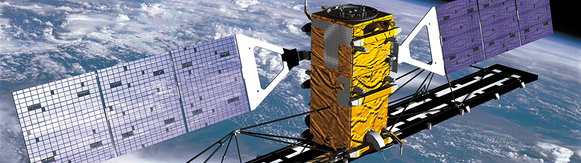
What is RADARSAT-2
Launch:
Status: Active
RADARSAT-2 is one of the world's most advanced commercially available Earth observation radar image providers and offers users around the world an expanded range of high-quality data products for hundreds of applications.
Technical characteristics
- Mass: 2,300 kg
- Distance travelled: 2.35 billion km in 10 years (-)
- Technical comparison
Mission overview
The RADARSAT-2 satellite mission offers powerful technical advancements that enhances marine surveillance, ice monitoring, disaster management, environmental monitoring, resource management and mapping in Canada and around the world. Scientific and commercial users in agriculture, cartography, hydrology, forestry, oceanography, and ice studies will greatly benefit from more readily accessible radar data.
This project represents a unique collaboration between government and industry. MacDonald, Dettwiler and Associates Ltd. (MDA) owns and operates the satellite and ground segment. The Canadian Space Agency (CSA) helps fund the construction and launch of the satellite and recovers this investment through the supply of RADARSAT-2 data to the Government of Canada during the lifetime of the mission. RADARSAT-2 demonstrates the Canadian space community's leadership in developing remote sensing technology and applications.

Text version - RADARSAT-2: Canada's eye in the sky
This infographic presents a few interesting facts about the satellite to celebrate its anniversary. (Credit: CSA)
What is it used for?
The primary mission objective is the supply and distribution of data and products to meet the needs of present and future markets using a commercially viable approach. This is achieved by leveraging the knowledge and experience gained through the long and successful RADARSAT-1 mission while taking advantage of new technologies. The RADARSAT-2 mission design and construction incorporates new capabilities that ensure Canada's continued leadership in the global marketplace for radar image data.
RADARSAT products also provide valuable information for major application areas in coastal and marine surveillance, and security and foreign policy.
Capable of scanning the Earth at all times, day or night through any weather conditions, RADARSAT-2 has typically acquired more than 30,000 images a year since its launch in . (Credit: CSA)
Commercially viable
The Canadian Space Program (CSP) is committed to ensuring Canada's Earth observation community develops into a leading, profitable and sustainable business through the continued development of remote sensing technology and applications. RADARSAT-2 is proof positive of Canada's commitment to a vigorous knowledge economy through support for leading-edge research, the development of innovative technologies, and the establishment of public-private sector partnerships.
The ground segment
The many systems that form the RADARSAT-2 ground segment are housed in CSA facilities in Longueuil, Quebec, and Saskatoon, Saskatchewan; in Canada Centre for Mapping and Earth Observation (CCMEO) facilities in Gatineau, Quebec, and Prince Albert, Saskatchewan, and MDA headquarters in Richmond, British Columbia.