
Agriculture in the satellite age

Food is vital to our survival. It's hardly surprising, therefore, that agriculture plays such an important role in Canadian society and in our economy: half a million Canadians work on our 640,000 km² or so of farmland.
Satellite data are a unique resource farmers can use to help them keep watch over this vast acreage. Such data are the only way of observing huge tracts of land while providing information otherwise invisible to the naked eye—such as soil humidity—with uncommon accuracy. Satellite data also make it possible to monitor changes in the land on a continuous basis.
Canadian Space Agency astronaut Joshua Kutryk shares how agriculture shapes the way we live, work and eat, but also how satellite supports agriculture and how food production for space benefits people on Earth. (Credit: Canadian Space Agency)
Satellite data fosters the development of sustainable agriculture and helps farmers better manage resources such as water, pesticides and fertilizer. (Credit: Canadian Space Agency, NASA, Agriculture and Agri-Food Canada)
What satellites provide data for farming operations?
- RADARSAT Constellation Mission and RADARSAT-2: To facilitate the management of resources (including farmland), ecosystem monitoring, disaster management and mapping in Canada and around the world.
- SMAP: To map soil moisture and freeze/thaw status.
- SMOS: To map sea surface salinity and monitor soil moisture on a global scale, thus contributing to a better understanding of the Earth's water cycle.
How do data from space help farmers?
By making it possible to grow crops to their full potential

In the cab of her tractor, a farmer uses digital tools as she works the land in Three Hills, Alberta. (Credit: Canadian Space Agency)
Agricultural practices are constantly evolving. Numerous innovations are pointing the way to farming methods and technologies that maximize yields while remaining:
- cost-effective;
- environmentally friendly;
- safe; and
- adapted to climate change.
Farmers use satellite data to:
- identify soil and crop characteristics and condition;
- monitor shoot growth;
- assess soil moisture and irrigation requirements;
- better forecast precipitation and insect pest infestations;
- spread fertilizer to better effect;
- estimate total farm output.
Helping farmers increase crop yields

Credit: Tony Balkwill
Tony Balkwill is a farmer and a farming consultant in Southern Ontario. He uses RADARSAT data to manage his crops and to help his clients do the same. RADARSAT data allows farmers to be more productive, as they can assess field conditions without having to conduct manual inspections that are really time-consuming. By monitoring moisture levels in the top few centimetres of soil, RADARSAT data helps farmers like Tony evaluate soil and crop properties. This enables them to grow more crops, while using less energy and potential pollutants. Read Tony's full story.
RADARSAT satellites
What do they do?
Each RADARSAT satellite has a radar that can accurately detect crop characteristics over thousands of square metres, regardless of weather conditions.
What purpose do they serve?
RADARSAT-2 images are extremely useful in monitoring moisture levels in the top few centimetres of soil, assessing soil and crop health, and avoiding waste of fertilizer, pesticides and water.
The highly accurate data collected by RADARSAT Constellation Mission satellites enables farmers to maximize crop yields while reducing energy consumption and the use of potential pollutants.
SMAP
What does it do?
From space, the SMAP satellite accurately measures soil conditions to a depth of 5 cm.
What purpose does it serve?
It maps soil moisture and freeze/thaw status, providing data that are very useful in determining when irrigation is needed, or when is the best time to seed the land.
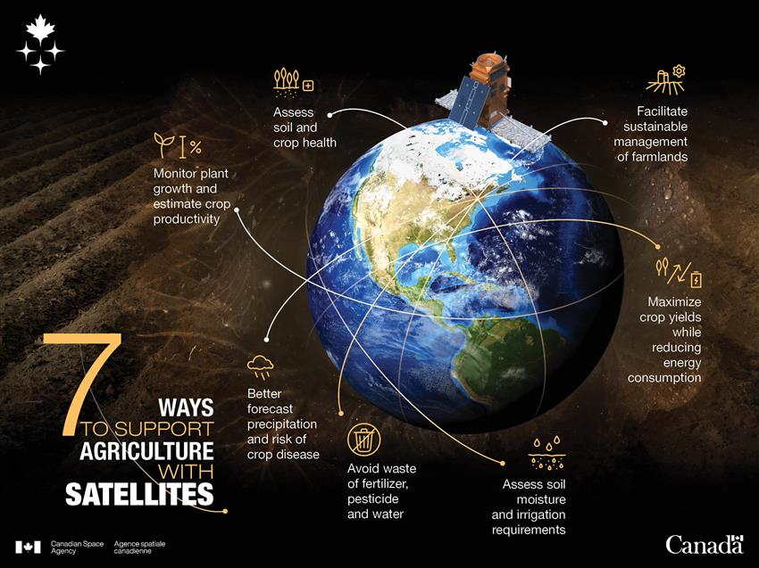
Text version - Space in service of agriculture - Infographic
Satellite data fosters the development of sustainable agriculture and helps farmers better manage resources such as water, pesticides and fertilizer. This way, they can maximize the use of their lands, which in turn benefits all Canadians. (Credit: Canadian Space Agency)
Testing tomorrow's crops on board the International Space Station

US astronaut Kjell Lindgren harvests the very first crop of Outredgeous space lettuce, the first vegetable to be cultivated and consumed in space. (Credit: NASA)
Satellites are not alone in supporting progress in agriculture. On board the International Space Station, astronauts are exploring a most promising line of research: space agriculture. Can you imagine what human life will be like 100 years from now? What sort of conditions people will be living under? How astronauts will get the nutrition they need during long space voyages? All of these kinds of research can lead to findings that could also apply to people living in remote areas.
Researchers have a number of projects to draw on. Some examples:
- Tomatosphere™: Every year, more than 15,000 classrooms across Canada from kindergarten to Grade 12 take part in Tomatosphere™, an educational project in which they study the effects of space on the germination of tomato seeds. The program allows students to learn more about agriculture and scientific method. Tomatosphere™ is an award-winning initiative launched in 2001 by the Canadian Space Agency, and managed since 2014 by Let's Talk Science.
- Veggie: Astronauts are growing herbs and vegetables in orbit. The experiment is providing data on the effects of the space environment on growing edible plants.
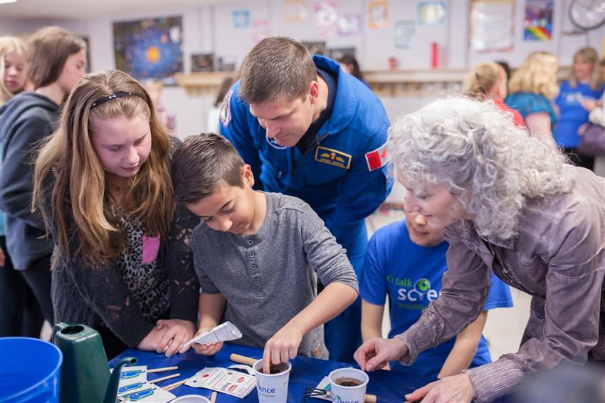
Grade 6 students from Byron Northview Elementary School in London, Ontario, plant Tomatosphere™ seeds with Canadian astronaut Jeremy Hansen and Bonnie Schmidt, President and Founder of Let's Talk Science. (Credit: Canadian Space Agency)
Our satellites at your service
- SMAP – Measuring soil moisture from space
- [Video] Food for thought: Let's talk Tomatosphere™ with astronaut Thomas Pesquet
- Agriculture and Agri-Food Canada's Annual Crop Inventory (satellite maps)