
RADARSAT-2 reaches milestone of one million images
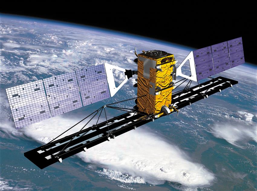
Launched in , RADARSAT-2 weighs 2300 kg and orbits Earth 14 times a day at an altitude of 800 km. It just took its millionth image.

The millionth RADARSAT-2 image was acquired on , and shows Sermilik fjord in eastern Greenland. (Credit: RADARSAT-2 data and products © MDA Geospatial Services Inc. – All rights reserved. RADARSAT is an official mark of the Canadian Space Agency.)
RADARSAT-2 works tirelessly to meet the needs of various users in Canada and around the world. In orbit for almost 15 years, it has far surpassed its expected lifespan of seven years. The fact that RADARSAT-2 has acquired one million images goes to show how reliable and durable it is.
From space, RADARSAT-2 provides valuable data to governments, the space industry, academia and international partners.
RADARSAT-2 data and products © MacDonald, Dettwiler and Associates Ltd. (2005) – All rights reserved. RADARSAT is an official mark of the Canadian Space Agency. (Credit: Maxar Technologies Ltd.)
RADARSAT satellites use synthetic aperture radar technology to scan Earth day and night, through any weather conditions. With the same technology as RADARSAT-1, RADARSAT-2 acquires imagery that is much more precise. It is more powerful than its predecessor, and is still today one of the world's most advanced Earth observation satellites.
RADARSAT-2 is owned by MacDonald, Dettwiler and Associates Ltd. (MDA). The mission was developed in partnership with the Canadian Space Agency (CSA) to meet the satellite data needs of the Government of Canada. About a dozen federal departments and agencies regularly used RADARSAT-2 data. They can now turn to data from its successor, the RADARSAT Constellation Mission (RCM), which launched in . Satellite data helps provide Canadians with important services, like ice monitoring, maritime surveillance, hydrology, cartography, geology, oceanography and agriculture.
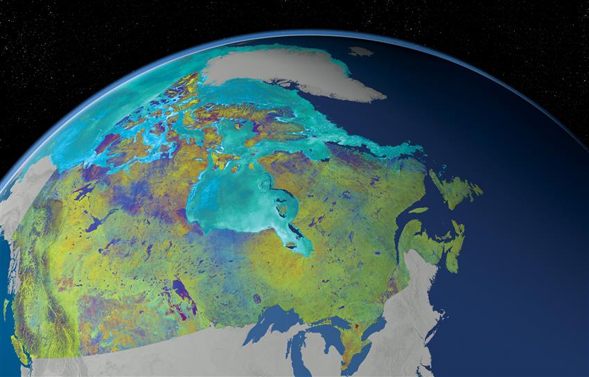
Mosaic of Canada made from 121 images captured by Canadian satellite RADARSAT-2. These images were acquired from to . The colour variation represents the changes in soil texture, roughness and the level of soil moisture. (Credit: RADARSAT-2 data and products © MDA Geospatial Services Inc. – All rights reserved. RADARSAT is an official mark of the Canadian Space Agency.)
Radar satellites like those in the RADARSAT series are also key resources for managing various types of disasters, such as earthquakes, tsunamis, floods, landslides and forest fires. The ability to deliver data in near real time is essential for relief operations to map and monitor damage and for assessing the impact on the future.

Red indicates the flooded areas of Houston following Hurricane Harvey in , as shown by RADARSAT-2. (Credit: RADARSAT-2 data and products © MDA Geospatial Services Inc. – All rights reserved. RADARSAT is an official mark of the Canadian Space Agency.)
The CSA regularly provides RCM and RADARSAT-2 data as part of the International Charter "Space and Major Disasters," an international initiative of which Canada is a founding member. This data plays an essential role in the work of first responders and search and rescue teams in the affected areas.
Federal departments have had access to its data, which is essential for monitoring and protecting our environment, managing our resources, and ensuring the safety of Canadians. The satellite images, and Canadian satellite expertise, are enabling us to take action on climate change while supporting global humanitarian efforts and sustainable development.

First high-resolution mosaic of the Antarctic continent produced by RADARSAT-2 during the International Polar Year (). Data available through the Polar Data Catalogue. (Credit: RADARSAT-2 data and products © MacDonald, Dettwiler and Associates Ltd. () All rights reserved. RADARSAT is an official mark of the Canadian Space Agency.)
RADARSAT-2's millionth image is a testament to Canada's great expertise in space technology, which led to the RCM. By itself, the new generation of Canadian satellites provides over 250,000 images per year! With this strong track record, Canada is now preparing to write the next chapter of Canadian Earth observation history by planning for what will follow the RCM, to meet the ever-increasing need for satellite imagery.