
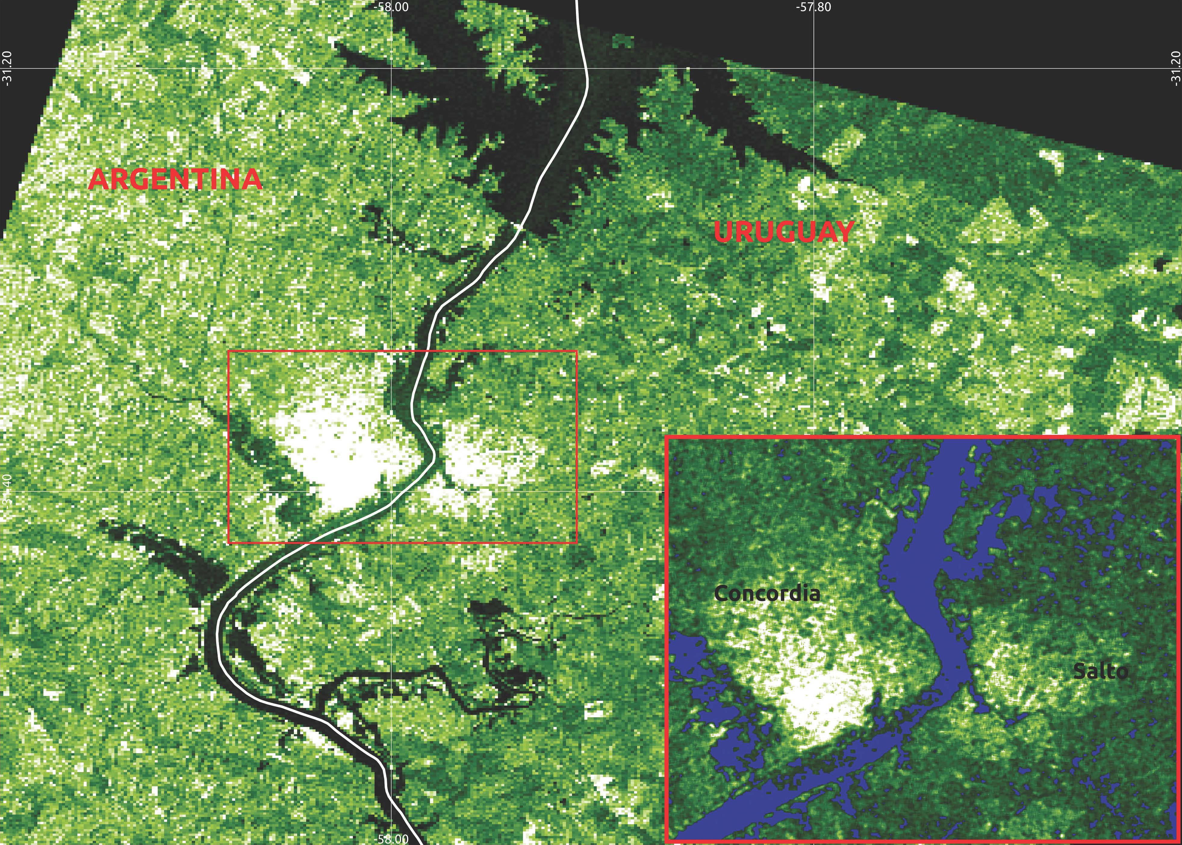
Flooding in Uruguay – June 2017

2017-06-08 - RADARSAT-2 images acquired on June 8, 2017, were used to produce this map to help analyze the extent of flooding in northwestern Uruguay. The water detected is shown in blue.
The images were provided by the CSA following an activation of the International Charter "Space and Major Disasters."
Map prepared by the Argentinian Space Agency (CONAE). (Credit: RADARSAT-2 Data and products © MacDonald, Dettwiler and Associates Ltd. (2017) - All rights reserved. RADARSAT is an official mark of the Canadian Space Agency)
File size: 8.05 MB
Image size: 3926 x 2806 pixels
Resolution: 72 dpi
Photo taken on June 8, 2017
Useful link(s)
- Date modified: