
About WildFireSat
- Launch:
- Mission duration:
- five years with possibility to extend
- Mission status:
- in development
WildFireSat is the first government-owned satellite mission set to monitor all active wildfires across Canada on a daily basis. This Canadian mission will consist of a constellation of seven microsatellites that will provide timely, essential data to track fire activity and support fire management efforts.
A growing threat
Canada's forests are vast and host some of the world's largest and most intense wildfires. Canada is home to over 367 million hectares of forest. This represents about 9% of all the world's forests and a quarter of the world's boreal forests.
Climate change has a big impact on wildfires. It is creating longer wildfire seasons, more extreme weather, and more dry conditions – our forests could burn twice as much in the coming decades.
During wildfire season, hundreds of wildfires can burn at the same time in any province or territory. Since there are not enough resources to fight them all, firefighters must prioritize and focus on the most dangerous and critical ones.
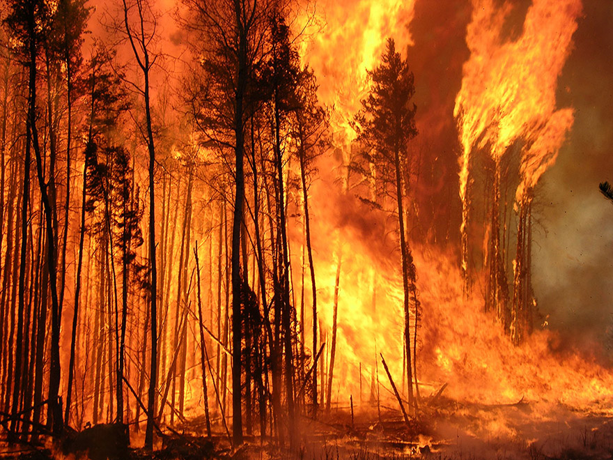
Wildfires are a serious challenge in Canada. (Credit: Canadian Forest Service (CFS))
Mission goals
WildFireSat will:
- provide wildfire managers and researchers near-real-time updates twice a day with accurate information about fires
- enable wildfire managers to determine which wildfires have the potential to burn out of control
- combine satellite data with information such as wind direction, land shape, vegetation type and level of dryness
- help prioritize high-risk fires to reduce economic losses, protect ecosystems, and secure critical infrastructure
- contribute to air quality forecasting during wildfires
- help scientists create better tools to predict how fires will spread and grow under different conditions
The data collected will be integrated into other existing fire management tools to accelerate decision-making and respond more quickly to wildfires.

Infographic showcasing the objectives of the WildFireSat mission and its benefits for Canadians. (Credit: CSA)
Benefits to Canadians
The WildFireSat mission will bring many benefits to Canadians. The mission is expected to:
- Help reduce wildfire damage by tracking fires more precisely. This will improve community protection and help prevent unnecessary evacuations.
- Keep resources, infrastructure, and the environment safer. WildFireSat will provide a more accurate and detailed view of fire locations, particularly in areas close to communities.
- Reduce the number of high-risk reconnaissance flights by aircraft used to identify and monitor wildfires.
- Contribute to information on harmful wildfire smoke, which can be used by Canadians to reduce exposure and wildfire-related health impacts.
- Position Canada as a world leader in wildfire research using advanced space-based technology.
Processed and calibrated WildFireSat data collected over Canada will be accessible to the public.
Impact on Canada's North
In Canada, wildfires are usually managed based on the risk they present to people, buildings, or important infrastructure. In Canada's North, where fewer people live, wildfires sometimes occur naturally and are usually left to burn. However, they still need to be watched to make sure they do not reach communities or vulnerable wildlife habitats. WildFireSat will help track those remote fires more effectively by using satellites instead of aircraft.

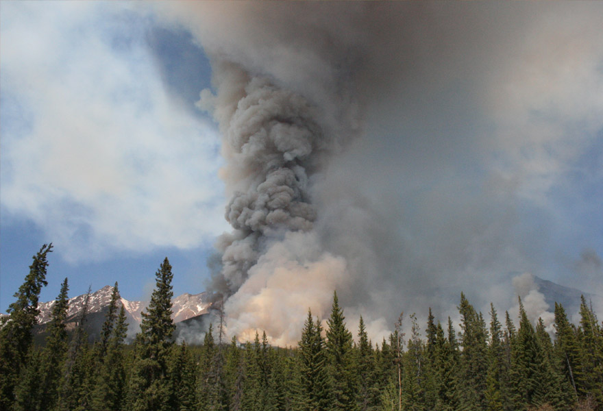
Wildfires release large amounts of carbon into the atmosphere. (Credit: Chris Marchand, Ontario Ministry of Natural Resources)
WildFireSat measurements
WildFireSat's microsatellites will be equipped with infrared sensors that measure the quantity of heat emitted from wildfires, also known as Fire Radiative Power (FRP). This type of measurement helps us track fire intensity and how quickly it is spreading.
The mission's FRP measurements will also contribute to Canada's smoke and air quality forecasting. WildFireSat data will benefit several existing services, including the Canadian Air Quality Health Index program, environmental emergency response modelling services, visibility products for air navigation, wildfire smoke forecasts to aid local and regional public emergency responses, and air quality health impact modelling studies.
Learn more about the WildFireSat's prototype and its components on the data sheet page.
Did you know?
Smoke from wildfires can travel long distances and cause serious air quality issues. In 2023, smoke from wildfires in Canada caused very poor air quality in many cities in eastern Canada and the United States. WildFireSat will provide more accurate data on the smoke coming from wildfires and contribute to smoke forecasts for organizations and citizens.
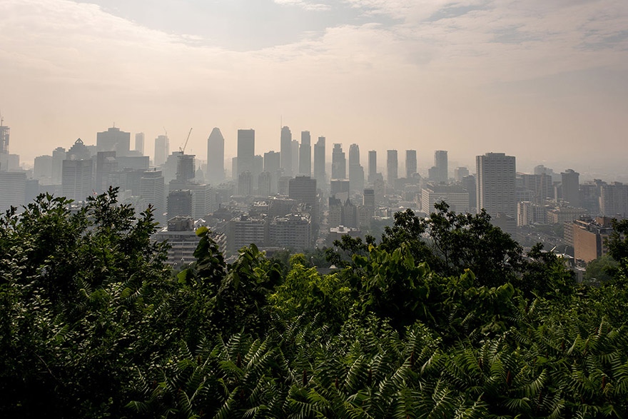
Downtown Montreal in the smoke of Canadian wildfires in .
Addressing a gap in wildfire observations from space
Existing satellites with infrared sensors can observe wildfires. However, for a period of several hours in the afternoon and early evening, no public satellites provide data when needed most. This gap happens during the most critical time for wildfires, known as the late afternoon "peak burn period." During that period, higher daily temperatures and strong winds often result in a rapid propagation of wildfires. WildFireSat aims to fill that crucial gap by taking measurements during the daily peak burn period.
WildFireSat will provide Canadians with more precise information on smoke and air quality. (Credit: CFS)
Mission collaborators
WildFireSat is a Government of Canada collaboration between the Canadian Space Agency (CSA), Natural Resources Canada's Canadian Forest Service (CFS) and Canada Centre for Mapping and Earth Observation (CCMEO), and Environment and Climate Change Canada (ECCC).
- The CSA is responsible for the development of the satellites, and operating them from the Satellite Operations Control Centre in Longueuil, Quebec.
- The CFS is responsible for generating and distributing wildfire information products from WildFireSat data, and ensuring that they are made available to end-users (wildfire managers and scientists).
- The CCMEO is responsible for configuring and operating the ground stations that communicate with the satellites, and for data archiving.
- ECCC is responsible for integrating WildFireSat data into its existing systems and applications to contribute to its daily air quality and smoke forecasts.
Watch WildFireSat, a mission tailored to the needs of wildland fire management in Canada to learn more about how wildfires are managed in Canada.
Who's building WildFireSat?
WildFireSat will be built by Spire Global Canada, a subsidiary of Spire Global Inc., based in Cambridge, Ontario. Canada's investments in WildFireSat will directly lead to the construction of new facilities on Canadian soil for satellite fabrication and strengthen our country's ability to build, test, and assemble small satellites, and support the ongoing growth and diversification of the Canadian space sector.