
Canada and the ENVISAT Program
Credit: European Space Agency (ESA)
- Launch: March 1, 2002
- Status: Inactive
Maintaining Canada's Niche in Remote Sensing from Space
Much like Canada, the European Space Agency (ESA) has been using satellites to "keep an eye" on the Earth's environment for almost a decade.
Through the Co-operation Agreement between the Government of Canada and the ESA, Canada chose to participate in the ENVISAT environmental satellite program. Canada's co-operation with ESA provides an ideal platform for the sharing of knowledge and expertise and the promotion of the use of advanced specialized technologies developed by Canadian space companies. It also offers unique opportunities to participate directly in select ESA programs, activities and decision-making, like the ENVISAT program.
ENVISAT complemented RADARSAT-1 and assured data continuity between RADARSAT-1 and RADARSAT-2. The satellite has played an important role in the preparation for RADARSAT-2 but also for future Canadian missions, such as a hyperspectral sensor mission. ENVISAT data helped develop Canadian knowledge and expertise, keeping Canada at the forefront of remote sensing from space.
ENVISAT was a multidisciplinary mission continuing and extending the science and application objectives of the ERS-1 and 2 missions. The number and quality of instruments included with the Polar Platform allowed for an unprecedented wealth of data brought to European and Canadian users. As such ENVISAT was part of coherent European and Canadian Earth Observation (EO) programs ensuring the long-term provision of continuous data sets, essential for addressing environmental and climatological issues, as well as aiming at the growth of applications and commercial use of EO data.
Credit: ESA
Credit: ESA
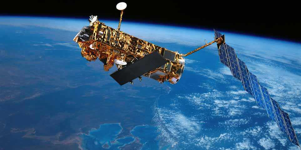
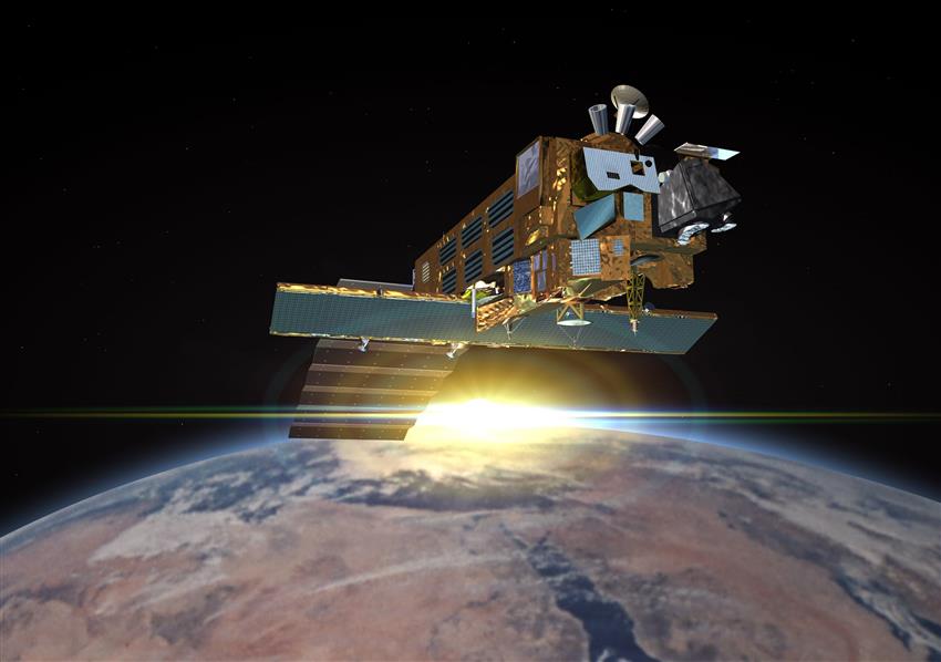
Overview of ENVISAT's mission
The earth's ocean, the land with its plant and animal life, the ice covered regions (cryosphere) and all levels of the atmosphere (troposphere, stratosphere and mesosphere) are all parts of an interconnected system – the Earth system. A change in any one part affects what happens elsewhere in the system.
ENVISAT carried instruments to collect information that helped scientists to understand each part of the Earth system and to predict how changes in one part affected others.
Many of ENVISAT's instruments were a development of those that flew on the ESA's Earth-observing missions of the 1990s (ERS-1 and -2). This means that scientists have observations stretching back over 10 years. It is possible, therefore, to make comparisons between conditions observed during ENVISAT's lifetime and those recorded during the past 10 years.
Why ENVISAT mattered?
- How fast are the ice caps melting?
- What is the state of the rain forests?
- What is the state of the El Niño current?
- What concentrations of "Greenhouse" gases are to be found in the atmosphere?
- Is the ozone hole growing?
ENVISAT helped to answer questions important for the future of all humanity. Scientists and policy makers needed the kind of data that ENVISAT and other Earth-observing satellites collected so that they can make informed decisions about how to protect earth's environment.
State-of-the-art research
As part of ESA's data policy to maximize the beneficial use of data from ENVISAT and to stimulate a balanced development of scientific, public and commercial use of data, ESA launched an Announcement of Opportunity (AO) for the use of ENVISAT data. Canada was well represented in the group of chosen projects within the ESA AO. Canadian universities, government departments and industries submitted a wide range of project subjects that were accepted. Projects ranged from coastal zones and oceans, ice monitoring, geology, disaster management and calibration and validation.
Through Canada's participation in the design, construction and deployment of ESA's ENVISAT, the Canadian Space Agency (CSA) built Canadian knowledge and expertise, rewarding Canadian innovation with opportunity and strengthening Canada's economy by leading the world in Earth Observation.
Payload and applications
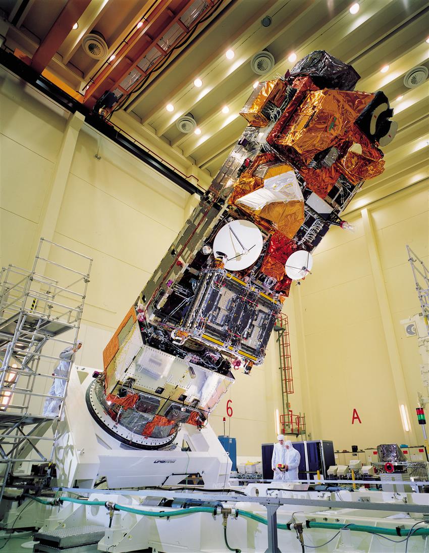
ENVISAT will be the largest free flying satellite built in Europe. Ten instruments, accommodated on the Polar Platform, compose its payload. The most demanding instrument in terms of mass, volume and power resources is the ASAR with an antenna of some 700 kg but 6 other large instruments also share the satellite resources with mass ranging between 100 kg and more than 300 kg.
ENVISAT's configuration concept provides a large, modular construction, with sufficient earth facing mounting surface for payload instruments and an anti-sun face, free of occultation by satellite subsystem equipment. In-flight, the spacecraft longitudinal axis (the X-axis) is normal to the orbit plane, the Y-axis is closely aligned to the velocity vector and the Z-axis is earth pointing.
The satellite comprises two major assemblies:
- The Service Module (SM) which provides the main satellite support functions
- The Payload Module (PLM) on which the payload instruments are mounted
The Payload Module itself is composed of three major subassemblies:
- The instruments either externally mounted or partly accommodated in the Polar Platform
- The Payload Equipment Bay (PEB) which accommodates payload support subsystems and some instrument electronics
- The Payload Carrier (PLC) which provides the main structural support for externally mounted instruments and antennas.
This split provides the basis for a convenient physical and functional separation between the Service Module subsystems and equipment which is needed for every mission and those in the Payload Module which are mission specific and therefore dedicated only to the needs of the particular payload complement being flown. In addition, the interface, decoupling at module level, facilitates parallel development and integration of Service and Payload Modules and allows for an efficient satellite AIT programme where only a minimum of system level activity is needed for final verification.