
Viresco (Meaning: I will flourish, I will grow)
Credit: KorrAI Technologies, RADARSAT Constellation Mission imagery © Government of Canada (). RADARSAT is an official mark of the CSA
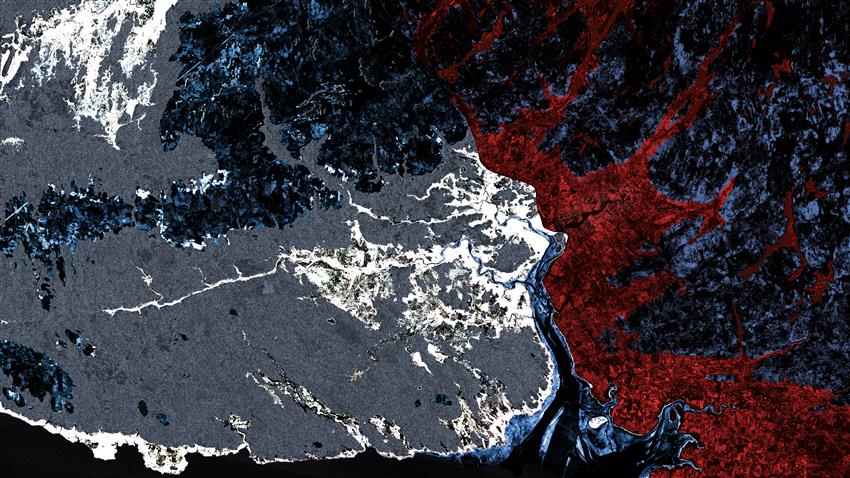
- Location: Bay of Fundy, Nova Scotia
- Company: KorrAI Technologies
The Bay of Fundy tributaries meander through ancient riverbeds, evaporated seas, and the remnants of kilometre-thick glaciers, forming one of the most unique places on Earth. Home to the highest tides and a sensitive, diverse ecosystem, this region reflects the need for balance amongst constant change.
As Canadians, we are passionate about the natural beauty that surrounds us and strive to build a future that will maintain the balance between prosperity and integrity. Our diversity gives us strength, but we must learn from the lessons of our past and form new growth from old wounds.
Human activity and its impacts on our planet are being better understood as new forms of data and analysis are made available to us all. Patterns in the low-lying topography reveal a partially fragmented flag of Canada, stretching through the Windsor Causeway down to the Annapolis Valley. When the causeway was built in the early s, its impacts on the tides and watershed were not fully understood.
Today, through the power of satellite-based imagery, we can see tidal channels and their fluctuations through the base of the watershed. With Canadian know-how and capabilities provided by the RADARSAT Constellation Mission, future development and implementation of such structures can be made in a manner that will allow us to grow and prosper, without fragmenting the symbols that define us.