
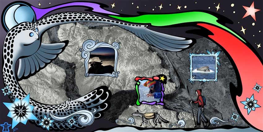
Qaamisimajuq – Blanket of Winter
Credits: Jamesie Itulu from Mittimatalik (formerly called Pond Inlet), in collaboration with the Sikumik Qaujimajjuti (tool to know how the ice is) team at SmartICE – Andrew Arreak, Leanne Beaulieu, Becky Segal, and Lynn Moorman. Photos: Andrew Arreak, Leanne Beaulieu, and Shelly Elverum. RADARSAT Constellation Mission imagery © Government of Canada (). RADARSAT is an official mark of the Canadian Space Agency
- Location: Mittimatalik, Nunavut
- Company: SmartICE
This RADARSAT Constellation Mission image from , illuminates the area travelled by Mittimatalikmiut, the people of Mittimatalik. Our community – indicated by a white star – is connected by a frozen ocean to hunting and harvesting grounds, traditions, and our friends and family members who live in nearby communities.
When winter comes to the quiet and open land,
the snow gently blankets the ground and ice with a cool touch,
quietly beckoning the land to rest and sleep
under the starry sky, the Moon and northern lights,
which watch over the animals and people on its rocky body.
The soft wind is created by the beating wings of the Ukpikjua spirit
to help the snow spread farther and farther,
preparing the tundra for a long, slow winter.
At SmartICE we are learning to interpret satellite imagery and bring that information together with our Inuit Qaujimajatuqangit knowledge system. For those of us who live and travel under a dark and beautiful blanket of winter, radar imagery helps unveil sea ice conditions – and knowledge about these conditions is critical to our safety. We are proud to share what we learn about our dynamic and changing ice conditions with our communities.