
Coastline where Land and Sea Meet
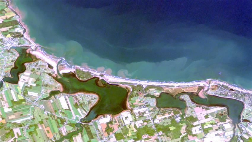
Between land and sea lie emerald lagoons. They are wetlands: some made up of freshwater, and others of seawater. These small ponds, separated from the sea by a sand bar, provide a mixed habitat for many species of plants, fish and birds. Prince Edward Island National Park is also known for its red sandstone cliffs. As they are eroded by the beating of the waves, their sediment creates pink swirls along the coastline.
Credit: Arctus Inc. Contains modified Copernicus Sentinel-2 data processed by ESA
About the visual art
- Location: Prince Edward Island National Park of Canada, Brackley section, Prince Edward Island
- Company: Arctus Inc.
The differences shown so colourfully in this image are a testament to the mixed beauty of Prince Edward Island National Park. To the south, geometrically shaped farmlands are interspersed with remnants of the Acadian Forest. To the north, dunes and beaches line the Gulf of St. Lawrence, which appears turquoise along the coast but gives way to a deep blue expanse.
Earth observation enables us not only to showcase these diverse splendours of nature in vivid colour, but also to track coastal change, coastal dynamics, coastlines and ecosystems. By improving our understanding of these processes, Earth observation can also support the management, conservation and restoration of natural environments.
In addition to revealing Earth's sweeping landscapes as captured from space, geographer Thomas Jaegler studies the coastal marine environment. As a remote sensing specialist, he uses images from Earth observation satellites to better understand and preserve that environment.