
Engagement paper: Space-Based Earth Observation -
Contents
1. Introduction
With its population scattered across almost 10 million square kilometers, Canada has a unique challenge in collecting the environmental intelligence it needs. Our country's dynamic environment requires systematic monitoring, but its vastness precludes doing so entirely from the ground.
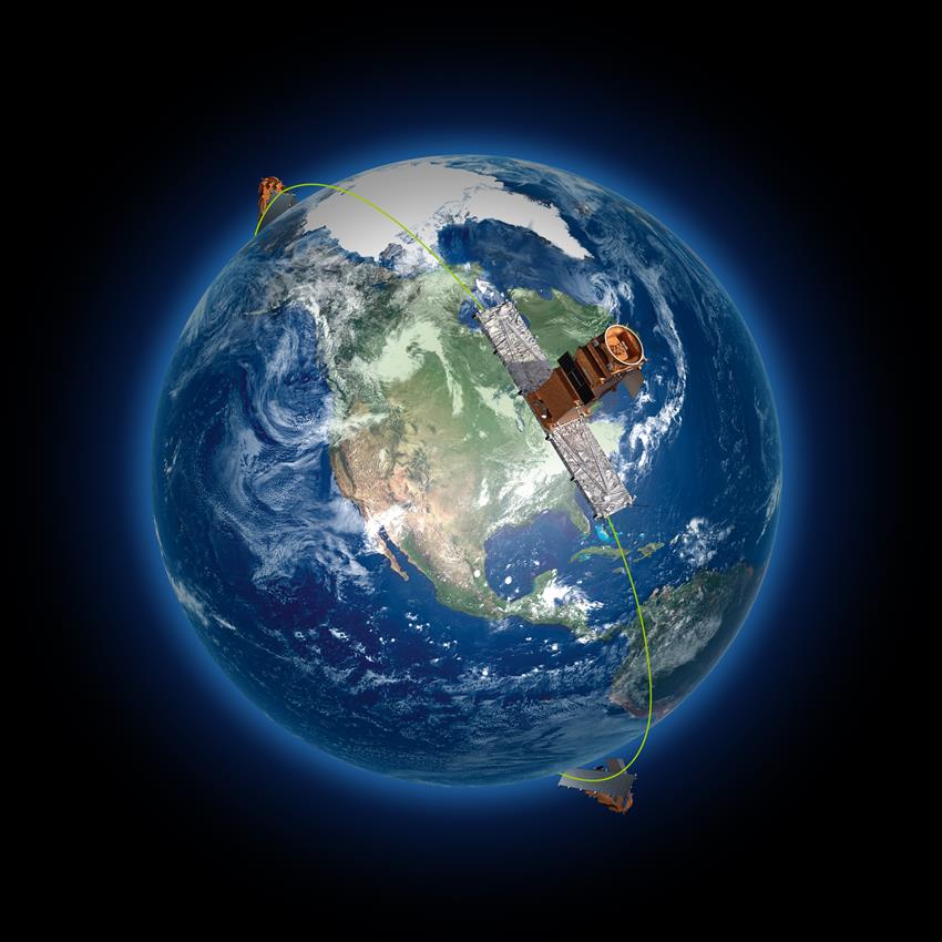
This reality spurred Canada's rapid adoption of space-based Earth Observation (SBEO). The use of satellites to monitor our environment began with weather and resource monitoring in the 's and 's. It was followed by systematic monitoring of coastal waters and the Arctic via the RADARSAT program beginning in the 1990s. Since then, satellites have proven to be the most efficient and effective way to observe our country and have become a cornerstone of multiple services to Canadians (e.g. weather forecasting, agricultural monitoring, ice mapping, atmospheric monitoring, and disaster response). Meanwhile, Canadian missions such as MOPITT, OSIRIS, SCISAT, RADARSAT-2, and CloudSat continue to generate valuable data.
Today, Canada's landscape, coasts, waters, and cities are changing rapidly as a result of accelerating climate change. Canada's future economic and environmental security, as well as the safety and well-being of its citizens, depend on our ability to keep up with, understand, and respond quickly to these changes.
Opportunity has presented itself. As SBEO technology advances, the benefits derived from it can provide for faster, more accurate, and more cost-effective ways to address Canada's challenges. Such an effort would positively affect the lives of every Canadian, allow Government of Canada (GC) departments to better meet their mandates and support Canadian industry and academia.
Over the past eighteen months the GC has been exploring the future of SBEO in Canada through an interdepartmental effort. As work continues internal to the GC to identify needs and potential forward strategies, it is vital to now engage the broader SBEO stakeholder community in Canada. SBEO benefits are whole-of-society, and therefore any long-term SBEO pathway must be the culmination of collaboration across governments and sectors for the benefits of of all Canadian business, researchers, students, decision makers, and citizens.
This document provides an overview of the potential of SBEO and how it can provide daily benefits to Canadians. The objective is to highlight the potential of SBEO technology, and present important questions for Canadian stakeholders in academia, industry, provinces, territories, municipalities, and indigenous governments regarding the future direction for advancing SBEO capabilities in Canada. Capacity in SBEO is not only about increasing what government can do in its services, but also providing a healthy landscape for Canadian companies and researchers when it comes to accessing and working with data in order to develop solutions and positive economic activity.
What is SBEO?
Credit: Canadian Space Agency
Space-Based Earth Observation (SBEO) is defined here as the gathering of data about the Earth's physical, chemical, and biological systems using satellites. SBEO also involves monitoring changes in natural and built environments. SBEO critically supports other observations conducted by aerial and ground systems. Together, all of these platforms (space, aerial, ground) make up the wider field of Earth observation (EO).
2. Canada's Challenges and SBEO
Canada faces a series of grand challenges at both the domestic and international scale. These include adapting to the impacts of climate change, producing food for Canadians and the world, modernizing infrastructure, and ensuring national security. While SBEO is not the sole solution to these challenges it has evolved to be able to play a vital role in addressing them.
In each of the challenges outlined in Figure 2.1, SBEO provides a unique capability. Common across all these examples is an increase in capabilities to a faster, more accurate, and more cost-effective way of observing our environment and maritime approaches for the benefit of all Canadians. It is recognized that this list of grand challenges is not exhaustive and that others exist in which SBOE can have a positive impact.

Credit: Canadian Space Agency
Figure 2.1 Six future challenges where SBEO will be critical - Text version
- Sustainable Agriculture and Food Security
- Healthy Canadians
- Security, Sovereignty, and Defence
- Competitive Resource Sectors
- Clean Water
- Climate Change Action and Resilience
The benefits of SBEO technology, both as it is applied today and in the future will also support the economic well-being of Canadians. The development of SBEO technology fuels upstream manufacturing firms. At the same time, Canadian value-added companies and researchers use satellite data to compete on the global stage. As the world of SBEO advances, we see small, medium, and large enterprises, as well as non-governmental organizations (NGOs) and academia, accessing and transforming satellite data into everyday applications for Canadians at an increasing pace.

2.1 A Vision of Future SBEO Benefits
The following figure identifies how the trajectory of SBEO technology is poised to contribute to addressing the major societal challenges facing Canada listed above. Annex 1 provides detailed examples of the future applications for SBEO in regards to these major challenges.

Credit: Canadian Space Agency
The Future of Canada and SBEO - Text version
The Future of Canada and SBEO
- Subtainable agriculture and food security
- Helping farmers grow more food with less impact
- Sustaining fish stocks in an unpredictable climate
- Healthy Canadians
- Forecasting disease spreading conditions
- Informing healthy community design
- Security, sovereignty and defence
- Precision real-time intelligence
- A view of our Arctic, northern territories, and maritime approaches
- Competitive resource sectors
- Monitoring resource infrastructure and risk
- Increasing opportunities for responsible forestry
- Clean water
- Improving ecosystem protection in our waters
- Accounting for Canada's fresh water
- Climate change action and resilience
- Tracking Greenhouse Gas Emissions
- Identifying impacts and reducing disasters
3. SBEO Best Practices
3.1 Long-Term Planning
For Canada, it is vital to begin long-term planning of SBEO investments for both scientific and operational needs. Internationally, long-term asset planning would increase Canada's ability to fit into the global network of satellites. At the same time it is industry who ultimately benefits from long-term planning, as GC signals can provide security for investment, start-up fundraising, and market projections in the private sector. Long-term planning is not limited only to satellite assets, but also applies to ground infrastructure, including reception stations, and computing infrastructure. The SBEO system includes technological and scientific development for new instruments and satellite mission technology, as well as enhanced data integration systems for combining satellite data with those from the ground and air. Finally, long-term investment into skilled labour and capacity is as critical as investments in hardware, as requisite skills and expertise provide the working environment in academia, government, and industry that underpins all SBEO use.
3.2 End-to-End Perspective: Investing Across the Value Chain
The process by which data is collected by satellites and then turned into information to support decisions can be effectively visualized as a value chain (Figure 3.2). Each segment of the value chain (upstream, midstream, downstream) brings the information held within the data closer to its end user. A value chain perspective is valuable in recognizing the interconnectivity of different parts of the SBEO system. Each investment in SBEO must be considered for its impact on, and alignment with, other streams of the value chain. Every process in the value chain is underpinned by a cycle of science as well as research and development (R&D), including: investigating new sensors, developing new methods to process data, and building algorithms to analyze these data. The underpinning nature of science across the value stream further reflects the interconnectedness of the streams.

Credit: Canadian Space Agency
Figure 3.2 – The EO Value Chain - Text version
The EO Value Chain
The EO Value Chain infographic shows how satellite data flows from space to the end users. The infographic is made up of five columns. The first column shows the drivers of data needs. Those drivers are government priorities, the mandates of individual departments and agencies, and scientific research. The second column shows that data capture is an upstream activity. Data capture involves space infrastructure and international partnerships for data access. The third column shows that data handling is a midstream activity. Two examples are given: the reception of data by the ground segment; and the storage, pre-processing, cataloguing and archiving of data. The fourth column shows that data exploitation is a downstream activity. Three examples are given: the first is big data and analytics; the second is platform services; and the third is applications, products and services, and dissemination. Lastly, the fifth column shows the end users of the data: government, academia, industry and the general public.
3.3 Commitment to Open Data
Today, Canada, like all countries, relies on SBEO data from international partners to meet its operational and scientific needs. Fortunately, there is a long global tradition of governments sharing satellite data to support public good activities such as weather forecasting, agricultural science, and disaster response. While open data has historically been promoted by the World Meteorological Organization (WMO) and the United Nations Environment Program (UNEP), the European Commissions' Copernicus program has made significant contributions over the past decade. Along with GC departments, Canadian governments at all levels, universities, and companies benefit greatly from open data. Continuing our participation in this international trend, while respecting national security requirements, is critical to providing Canadian researchers, scientists and companies the data they need, as well as maintaining good standing on the global stage.
3.4 Data Complementarity
Data complimentary refers to a commitment to assure that SBEO data collection and data formatting are designed in a manner that supports integration from other data sources, such as instruments on the ground. In-situ sensors (e.g. weather instruments, marine buoys) and aerial sensors (e.g. drones, aircraft) play a key role in the environmental monitoring of our planet and when combined with SBEO, improve our understanding of the complex behaviour of the Earth system. Together, modernized terrestrial networks and satellites complement each other in a symbiotic fashion. In the near future, information from sensors on the ground will be transmitted directly to satellites in orbit to calibrate their data in real time (avoiding time-intensive geo-tagging by technicians). At the same time, the miniaturization of professional in-situ observation devices and the exponential growth in public observation devices (e.g. phones, citizen science), is creating a dense network of ground observations for advanced systems to pull from. Moving forward, improved integration of modern ground technology with satellites will be key to moving Canada's SBEO capabilities forward.
3.5 Whole-of-Government Approach
The GC has already begun to take an integrated approach to the planning and operations of its SBEO systems. A coordinated internal commitment to SBEO will continue the tradition of partnerships between SBEO experts in industry and academia with those across government departments. At which ever point external stakeholders interact with GC SBEO systems, it is imperative that a sense of collective commitment and coordination is the user experience for all Canadians.
3.6 Partnership Approach
While the GC hosts significant portions of the Earth observation expertise in Canada, knowledge and experience from academics, private companies, and provincial/territorial/local/Indigenous governments will play an important role. Along with GC scientists, academia and industry are often at the cutting edge of new technologies and applications. Additionally, provinces, territories, Indigenous communities, and local governments know their jurisdictions and issues best. Experts from these regions will be critical in identifying case-specific and novel applications for SBEO technology. Internationally, SBEO capabilities in Canada currently benefit from collaboration with American and European partners. These partners are looking to Canada to co-invest and bring their expertise to new collaborative missions, especially in global priorities such as climate change. Canada also benefits immensely from its participation in fora such as the WMO, Group on Earth Observations (GEO), and International Charter on Space and Major Disasters, commitments that need to remain a core of our SBEO pathway.
4. Why Now? A Changing Planet and the Evolving Nature of SBEO
Canada's Arctic is warming at twice the global rate, amplifying challenges around biodiversity loss and positive feedback loops. Other changes facing Canada include disruptions in previously stable precipitation patterns, an increase in extreme weather events, changes in freshwater availability, and sea level rise. At the same time, monitoring Canada's territory amidst geopolitical change remains at the forefront of federal priorities in the 21st century.
Within the GC, multiple departments today use Canadian and international satellites for regular operations. For example, the GC's online Weather Office receives 50 million visits per month from Canadians, with the information provided primarily underpinned by SBEO technology. Canada's RADARSAT Constellation Mission (RCM), launched in , will provide data critical to at least 61 government operations across 11 departments.
The mainstreaming of SBEO across GC departments has not only provided novel capabilities but also reduced costs drastically compared to alternative data collection methods, especially in remote regions. SBEO is a vital portion of modern government operations, but increasing climate change impacts will require an even deeper understanding of the environment.
Along with environmental applications, SBEO capabilities are highly valued by Canada's armed forces in its efforts to assure the security of Canadians.
Figure 4.1 - Thirteen aspirational goals for Canada from the - Federal Sustainable Development Strategy. These goals overlap significantly with SBEO's benefit areas (ECCC, )
- Effective action on climate change
-

A low-carbon economy contributes to limiting global average temperature rise to well below 2 degrees Celsius and supports efforts to limit the increase to 1.5 degrees Celsius
- Greening government
-

The Government of Canada will transition to low-carbon, climate-resilient, and green operations
- Clean growth
-

A growing clean technology industry in Canada contributes to clean growth and the transition to a low-carbon economy
- Modern and resilient infrastructure
-

Modern, sustainable, and resilient infrastructure supports clean economic growth and social inclusion
- Clean energy
-

All Canadians have access to affordable, reliable and sustainable energy
- Healthy coasts and oceans
-

Coasts and oceans support healthy, resilient and productive ecosystems
- Pristine lakes and rivers
-

Clean and healthy lakes and rivers support economic prosperity and the well-being of Canadians
- Sustainably managed lands and forests
-

Lands and forests support biodiversity and provide a variety of ecosystem services for generations to come
- Healthy wildlife populations
-

All species have healthy and viable populations
- Clean drinking water
-

All Canadians have access to safe drinking water and, in particular, the significant challenges Indigenous communities face are addressed
- Sustainable food
-

Innovation and ingenuity contribute to a world-leading agricultural sector and food economy for the benefit of all Canadians
- Connecting Canadians with nature
-

Canadians are informed about the value of nature, experience nature first hand, and actively engage in its stewardship
- Safe and healthy communities
-

All Canadians live in clean, sustainable communities that contribute to their health and well-being
Around the world, international partners are advancing their SBEO capabilities at a significant pace. In particular, the European Commission (EC) has made significant strides in advancing SBEO capacity across Europe through their Copernicus program which offers free data and services to all its members (services include data products such as maps, statistics, and models). Through this investment, the EC has amplified generation, distribution, and use of their satellite data. European governments and companies now have unrivalled access to satellite data, as well as analytics tools and pre-made data services. In the private sector, the competitive advantage provided by Copernicus to European firms is expected to generate billions of dollars in revenues on the European content over the next two decades.
The SBEO landscape is also changing as a result of the entry of private companies. Due to cheaper launch access, smaller satellites (cubesats), and new sensor technologies, private firms are now active in capturing, storing, and analysing data for customers around the world. These changes in the SBEO landscape support important industrial capacity and economic well-being in Canada. The availability of data for these downstream firms is in someway the resource on which the companies thrive. While upstream, major manufacturing and high-tech jobs are supported by the construction of technologies, satellites, reception stations, and computing infrastructure. As mentioned, this capacity is not only about increasing what government can do in its services, but also providing a healthy landscape for Canadian companies and researchers when it comes to accessing and working with data in order to develop solutions and positive economic activity.
Figure 4.1 - Alignment between the benefits of advancing SBEO capabilities in Canada and major government commitments.
- Canada's Agenda National Strategy
-
The Agenda National Strategy seeks to create a vision of GC's contribution to the global Sustainable Development Goals . The principles of the strategy overlap considerably with SBEO. Leveraging industry and academic expertise is vital to both the vision of this paper and of the Agenda National Strategy.
- Canada's Space Strategy
-
The GC's Space Strategy for Canada sets space as a strategic national asset, requiring a WoG effort to ensure that Canada can continue to rely on space to help meet national needs.
- Strong, Secure, & Engaged: Canada's Defence Policy
-

A 20 year vision for Canada's defence capabilities. The strategy highlights the need for Canada's Armed Forces to be able to adapt quickly to an environment in which geopolitical change is met with rapid climate change.
- The Federal Sustainable Development Strategy
-

As mandated by the Federal Sustainable Development Act, the GC recently developed its new Federal Sustainable Development Strategy to follow its successful - strategy. The strategy calls for Canada's environmental monitoring to be more closely linked to the United Nations' SDGs.
- Emergency Management Strategy of Canada
-
The Emergency Management Strategy builds on the foundational principles articulated in the GC Emergency Management Framework and the international Sendai Framework for Disaster Risk Reduction in order to establish federal-provincial-territorial priorities to strengthen the resilience of Canadian society by .
- Government of Canada Data Strategy Roadmap
-
The Data Strategy Roadmap aims to support a modern digital and data-enabled government that develops and follows world-leading standards governing transparency, archiving, management, usability, interoperability, and privacy. GC departments using SBEO data face all of the challenges identified by the roadmap.
- Pan-Canadian Framework on Clean Growth and Climate Change
-
The Pan-Canadian Framework is a federated approach to addressing climate change and its impacts in Canada. The framework has four main pillars: pricing carbon pollution, emissions reduction, climate change adaptation, and support for clean technology and jobs.
- Government of Canada: Arctic and Northern Policy Framework
-

The GC has committed to improving infrastructure, access to education and health care in Canada's northern and remote communities. Among other benefits, Earth observation capabilities allow GC departments to assure safer transport to the north and provide rapid weather warnings.
5. Your Feedback: How Do We Get There?
The GC is committed to charting a new course for SBEO that strengthens our own federal services and at the same time providing the data and landscape necessary for industry, academia, and governments across Canada to thrive while fostering a generation of world class experts in all the technologies and sciences related to the field.
We are seeking input from interested stakeholders on the pathways and measures of interest to advancing SBEO and addressing the challenges set out in this paper. To facilitate this process we have developed six key questions in which we are most interested in your specific feedback. Whether you have interest in one or more questions, we want to hear from you.
- From your stakeholder perspective, what are the priority actions for advancing SBEO capabilities in Canada?
- How can Canada maximize the potential of SBEO data to solve everyday problems for Canadians?
- What would allow Canada's commercial SBEO sector (upstream, midstream, or downstream) to reach its full potential in strengthening the economy and creating jobs?
- What can be done to facilitate a strong role for SBEO in maintaining Canada's leadership in scientific and research excellence?
- Are the SBEO best practices identified in this document aligned with your perspective as a stakeholder in the SBEO landscape?
- Given your position as a SBEO stakeholder, how do you see yourself contributing to, or benefiting from, addressing the challenges outlined in this paper?
The government of Canada welcomes input from all SBEO stakeholders regarding these questions. Responses can be provided to the following email address:
earth.observation.terre@asc-csa.gc.ca
Annex 1 - A Vision for Future SBEO Benefits
A1.1 Sustainable Agriculture and Food Security
Future Capability: Helping Farmers Grow More Food with Less Environmental Impact
Satellite data will allow farmers to have daily high-resolution maps of their crops, indicating soil moisture, leaf health, and projected yield for each acre. Combined with smart farm equipment and weather models, they will be able to use less water, fuel, and fertilizer while producing more food.
Benefit: Canadians will have improved access to healthier and more affordable food while our agricultural sector will reduce its environmental impact and increase its competitiveness on the global market.

Future Capability: Sustaining Canada's Fish Stocks in an Unpredictable Climate
Systematic hyperspectral imaging from orbit will allow for the identification of early signs of ecosystem-disrupting algal blooms, disease conditions, or invasive species. This will provide the information necessary for officials to intervene before fish stocks are affected.
Benefits: Water managers will know about risks before impacts happen, protecting ecosystems, food security, and livelihoods in communities that rely on aquatic resources.

A1.2 Healthy Canadians
Future Capability: Forecasting and Preparing for Disease Spreading Conditions
Predictive models enhanced by artificial intelligence (AI) will routinely merge ground and satellite data sets to provide months of lead time on conditions favourable to West Nile, Lyme disease, and other illnesses. An agile monitoring system will be able to rapidly shift from monitoring to response when peak conditions arrive, adjusting to deliver information in real time.
Benefits: Public health authorities will be able to operationalize custom management strategies as they identify transmission risk long before transmitting species have time to spread or environmental conditions arise.

Future Capability: Informing Community Development and Designing Cities to Help Canadians Live Healthier Lives
Routine satellite imaging will provide precision evidence for vulnerability assessments, public heath indices, urban climate models, emissions profiles, and urban mobility calculations. SBEO integrated 3D models will provide simulations to depict problem areas related to wind corridors, air quality, and heat traps. Satellites will provide large-scale coverage and consistent capability to quantify air chemistry on spatial scales from the national down to the facility level, and provide for long-term monitoring of air pollutants.
Benefits: In cities, evidence-based decisions about building heights, materials, and greenspace, will reduce urban health issues. Communities will be efficient, healthier, and sustainable, making them more attractive to Canadians.

Future Capability: Delivering Rapid Information to Support Traditional Livelihoods
As Canada's northern and Arctic territories change rapidly, routine satellite monitoring will provide daily forecasts of ice and ground conditions. Forecasts for ice breakup, along with maps of unstable snowpack and river ice thickness, will provide safer intercommunity travel and support traditional activities such as hunting and fishing.
Benefits: Northern Indigenous communities will be increasingly connected with one another and the rest of Canada. Local travel and traditional livelihoods will be made safer and more reliable in an ever changing Canadian environment.

Credit: DND
A1.3 Security, Sovereignty, and Defence
Future Capability: Precision Real-time Intelligence for Canada's Armed Forces Operations
The Canadian Armed Forces (CAF) and its partners will be enabled with near-real-time, very high resolution, satellite reconnaissance supporting operations at home and abroad, able to resolve objects only tens of centimeters in size.
Benefits: Layering civil space-based EO data with defence-specific Intelligence, Surveillance and Reconnaissance (ISR), SBEO data will enable the CAF to perform global precision and wide area surveillance that is fast, cost-effective, and limits risk to forward-deployed personnel.

Credit: DND
Future Capability: A 24/7 View of our Arctic Waters and Northern Territory
Through surveillance from orbit, Canada will increase its Arctic and northern awareness and rapid response in support of regional safety and security. Alert and warning services that are reliant on robust weather, water, ice, and climate information will improve navigation, search and rescue, border enforcement, vessel tracking, and coast and landmass surveillance.
Benefits: SBEO, integrated with ground capabilities, will provide cost effective wide area surveillance in Canada's vast northern territories, strengthening Arctic situational awareness.

Credit: DND
A1.4 Competitive and Sustainable Resource Sectors
Future Capability: Monitoring Resource Infrastructure and Risk
Infrastructure managers and regulators will be able to routinely access satellite imagery and terrain models to foresee risk of, or quickly detect, infrastructure failure (e.g. pipelines, tailings ponds). This detailed satellite imagery will be integrated with other data to form the basis of faster, more complete, assessments of the cumulative effects of mining and energy extraction.
Benefits: Canada's energy and mineral industry will reduce its environmental impact, becoming more competitive in the future low-carbon economy.

Credit: Natural Resources Canada
Future Capability: Increasing Opportunities for Responsible and Safe Forestry
Equipped with detailed, high-resolution, up-to-date satellite maps of biomass, pest damage and burn extent, foresters will better understand and tactically manage the harvesting and protection of forests. This intelligence will help manage harvestable areas increasingly vulnerable to the impacts of climate change.
Benefits: Rooted in sustainable forestry and state-of-the-art monitoring technology, Canada's forest sector will be more efficient and embrace global market advantages.

A1.5 Clean Water
Future Capability: Improving Navigation for Ecosystem Protection in Canada's Water Ways
Constant mapping of ice floes, flood debris, and depth changes will inform shipping activity in real time. Navigators will have the capacity to instantly model alternative routes or travel times from cloud-connected on-board computers, avoiding collisions and protecting sensitive ecosystems.
Benefits: Travel through Canada's pristine waterways will be safe, clean, and efficient, guarding Canada's water from spills and other damage. Increased protection for iconic species such as Salmon, Right whales, Blue whales, and Orcas will be a source of both ecological benefit and national pride.

Future Capability: Accounting for the Quality and Quantity of Canada's Freshwater
Satellite observations of hydrological systems will be combined with ground data to identify the impacts of climate change on freshwater resources. These data will provide information on hundreds of variables across large areas for both quantity (e.g. precipitation, soil saturation, snowpack) and quality (e.g. chlorophyll a, suspended solids, dissolved organic carbons, and algae). Easy to use simulators will recreate historical and current usage, providing projections of water availability from the country to neighbourhood level.
Benefits: The design of water diversion and extraction projects will be based on precision models. Tools will be at decision makers' fingertips to protect our most precious resource and work with partners to develop adaptation strategies that decrease vulnerability to climate change.

A1.6 Climate Change Action and Resilience
Future Capability: Detailed Tracking of Greenhouse Gas Emissions Across the Country
Collecting high frequency and high density data of the air above our environment, satellite and ground sensor networks will provide a national census of atmospheric greenhouse gases. From regional to point source emissions, Canada's Greenhouse Gas (GHG) budget will inform national and local emissions reduction policies.
Benefits: The GC will have the precise information it needs to assess, adjust, and report on emissions reduction policies. Canada will be seen as a world leader for its ability to implement successful, and effective, climate change mitigation and adaptation policies.

Credit: NASA
Future Capability: Preparing for Climate Impacts and Reducing Disaster Risk
Tapping into decades of satellite data, planners will know better how to build resilient communities. Real time data will inform projections of flood events, sea-level rise, and wildfire risk at the scale of people's homes. Decisions makers will have access to customizable 3D models of their environment able to pre-visualize how events, such as a flood, will unfold.
Benefits: First responders will have access to satellite maps in minutes instead of hours. Canadians will live in more resilient communities, better able to withstand the impacts of climate change and other hazards.

Future Capability: Identifying Road and Bridge Damage before they Impact Users
Routine scanning of satellite images, combined with data from the ground, will allow automated programs to detect and flag damage at, and near, bridges, single access roads, seasonal roads, railways, and other vital transport points.
Benefits: Transport dispatchers will know about potential washouts, rock falls, landslides, and sinkholes before deploying staff, thereby avoiding costly rerouting. Remote and northern communities will have more reliable delivery schedules and longer lead time on planning alternatives in the event of ground transport delays.

Future Capability: Monitoring Change in the Arctic Climate and Northern Ecosystem
Critical changes in the Arctic climate will be monitored from the global to the chemical level. Observations of the dynamic and complex process will be translated into analysis ready data and information on processes such as sea ice extent and permafrost thawing will inform critical global climate models.
Benefits: Arctic knowledge will reduce the risk to new and existing homes, railways, roads, and mines. Canada's northern and remote communities will have the best information to adapt and keep their assets safe in a changing climate. Critically, Canadian observations will inform global models to help understand climate change.

Credit: Natural Resources Canada