
Data Compendium - Radar imaging over the polar regions

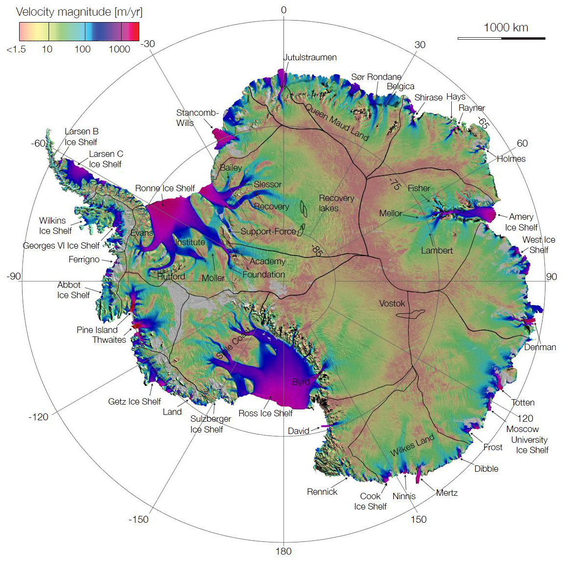
2016-04-21 - Canadian satellites RADARSAT- 1 and 2 have significantly contributed to completing the first radar-generated map showing the speed and direction of ice flow in Antarctica. Data: NASA/JPL, UCI, ESA, CSA, JAXA. (Credit: Rignot, Mouginot & Scheuchl 2011, Science 333 (6048))
File size: 0.89 MB
Image size: 1160 x 1144 pixels
Resolution: 96 dpi
- Date modified: