RADARSAT-2: Canada’s eye in the sky

Description
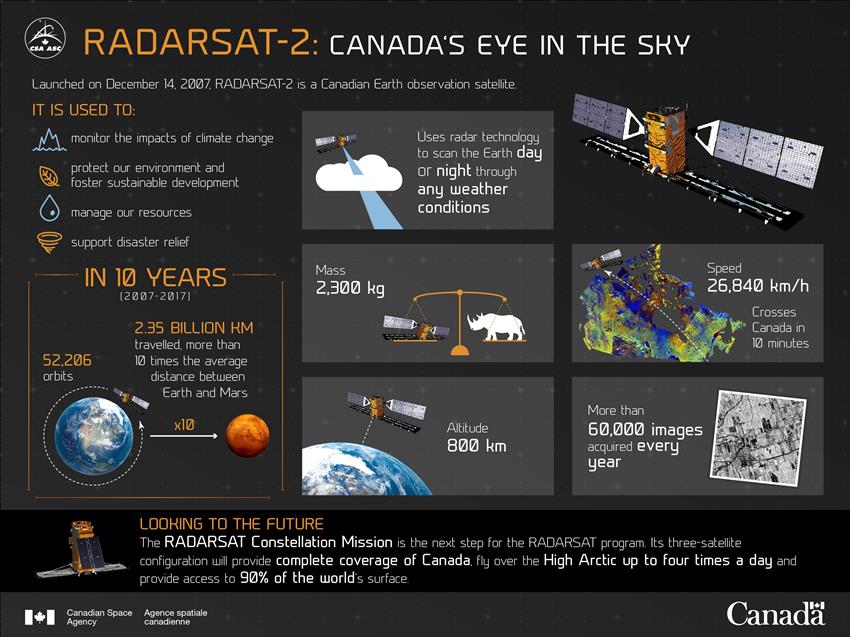
2017-12-14 - Launched in December 2007, Canada's RADARSAT-2 is an Earth observation satellite that enhances marine surveillance, ice and environmental monitoring, disaster and resource management and mapping in Canada and around the world.
MacDonald, Dettwiler and Associates Ltd. owns and operates the satellite and ground segment. The Canadian Space Agency helped fund the construction and launch of the satellite and recovers this investment through the supply of RADARSAT-2 data to the Government of Canada during the lifetime of the mission. (Credit: Canadian Space Agency)
Text version
Launched on December 14, 2007, RADARSAT-2 is a Canadian Earth observation satellite.
It is used to:
- monitor the impacts of climate change
- protect our environment and foster sustainable development
- manage our resources
- support disaster relief
In 10 years (2007-2017)
- 52,206 orbits
- 2.35 billion km travelled, more than 10 times the average distance between Earth and Mars
Description
- Uses radar technology to scan the Earth day or night through any weather conditions
- Mass 2,300 kg
- Speed 26,840 km/h
- Crosses Canada in 10 minutes
- Altitude 800 km
- More than 60,000 images acquired every year
Looking to the future
The RADARSAT Constellation Mission is the next step for the RADARSAT program. Its three-satellite configuration will provide complete coverage of Canada, fly over the High Arctic up to four times a day and provide access to 90% of the world's surface.
File size: 0.65 MB
Image size: 2400 x 1800 pixels
Resolution: 96 dpi
Image date: December 14, 2017
Useful link(s)
Copyright / Permission to reproduce
- Date modified: