
Shuikeng, Guangdong Province, China
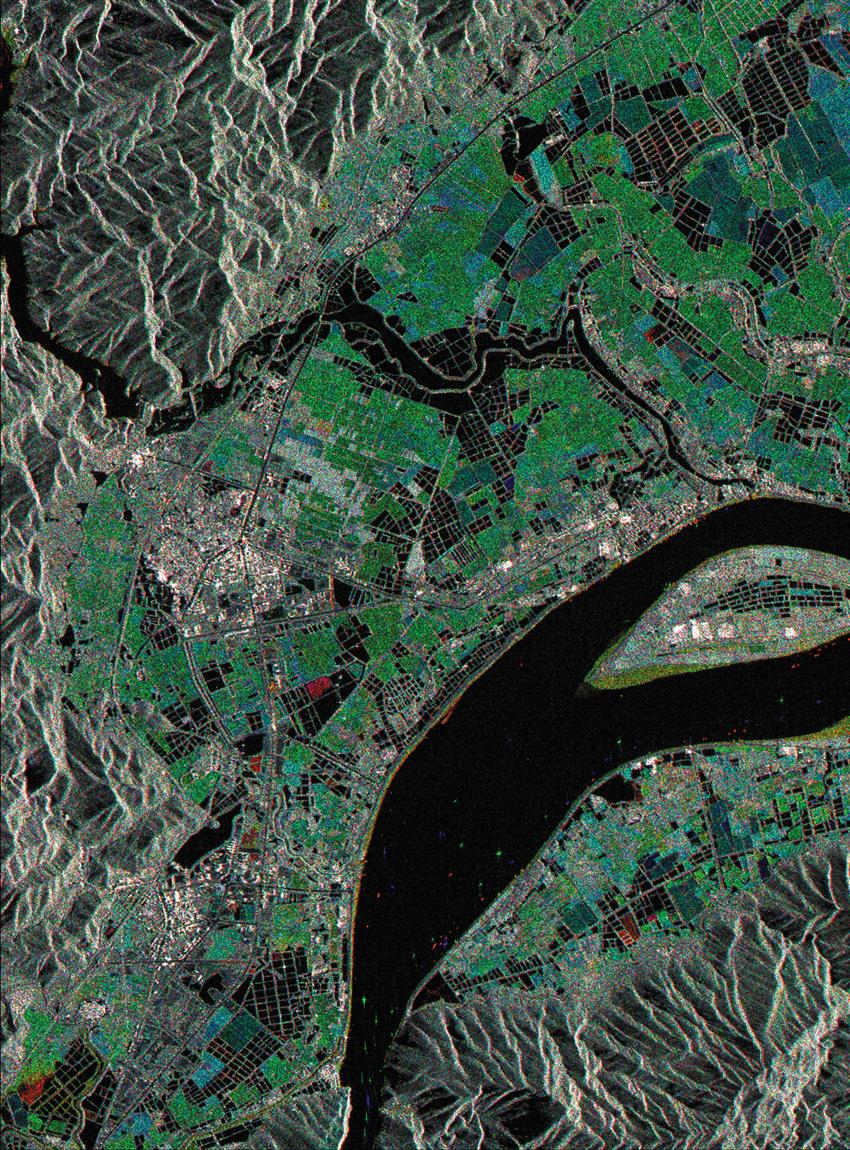
It is estimated that almost two thirds of the world's people depend on rice as their primary food source. In this colour composite of three images aquired over Guangdong Province, China, on April 6, June 17, August 4, 1996, the developmental stages of the rice crop can be seen. Rice is near peak growth in June (green), and produces the most backscatter in the radar image, if compared to April (red) when has been planted, or August (blue) when it is harvested. Water surfaces such as the Xijeng River, irrigation canals, and aquaculture ponds, appear quite dark. Other colours in the floodplain are caused by variations in the stage of rice growth, or are due to other crop types such as bananas and sugar cane. (Credit: Canadian Space Agency)
File size: 4.54 MB
Image size: 1622 x 2196 pixels
Resolution: 250 dpi
Photo taken on August 4, 1996
Useful link(s)
Copyright / Permission to reproduce
- Date modified: