
WildFireSat : Monitor, Prevent, Protect – infographic
Description
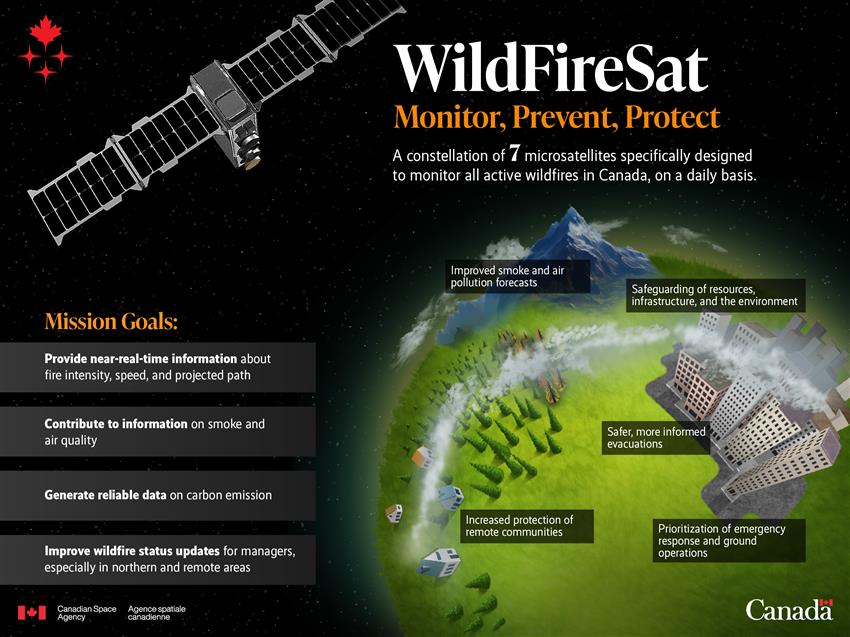
Infographic showcasing the objectives of the WildFireSat mission and its benefits for Canadians. (Credit: Canadian Space Agency)
Text version
Isometric infographic showing a stylized Earth with space in the background and one satellite from the WildFireSat mission in orbit. The infographic includes the following details:
A constellation of 7 microsatellites specifically designed to monitor all active wildfires in Canada, on a daily basis.
Mission goals:
- Provide near-real-time information about fire intensity, speed, and projected path
- Contribute to information on smoke and air quality
- Generate reliable data on carbon emission
- Improve wildfire status updates for managers, especially in northern and remote areas
Benefits for Canadians:
- Prioritization of emergency response and ground operations
- Increased protection of remote communities
- Safeguarding of resources, infrastructure, and the environment
- Improved smoke and air pollution forecasts
- Safer, more informed evacuations
File size: 1.71 MB
Image size: 2400 x 1800 pixels
Resolution: 72 dpi
Image date: February 7, 2025
Copyright / Permission to reproduce
- Date modified: