
Kluane National Park and Reserve
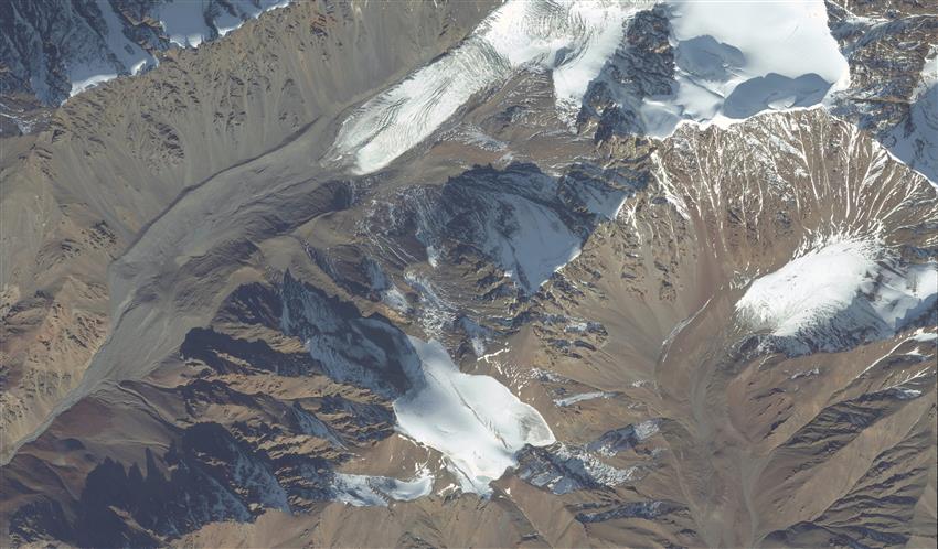
Imaged by Maxar's WorldView-2 satellite, the summit area of Mount Hoge (2790 m) encapsulates the mountainous terrain and the effects of glaciation up close in great spatial detail. (Credit: WorldView-2 satellite image ©2022 Maxar Technologies)
File size: 7.23 MB
Image size: 9999 x 5862 pixels
Resolution: 96 dpi
Useful link(s)
- Date modified: