
Bathurst Island Northwest Territories, Canada
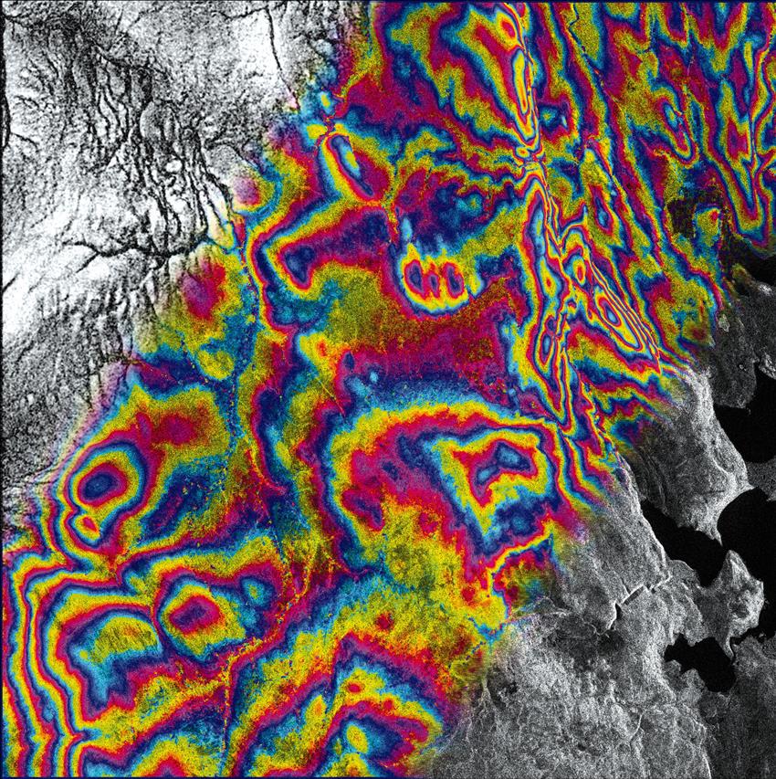
This composite of images taken March 4 and 28, 1996, is an interferogram. It represents the precise topography of the area and can be used to generate an accurate digital elevation model of the terrain. An interferogram is composed of scene coherence (upper left corner), an interferometric phase (centre), and the interferogram intensity (lower right) that corresponds to the radar image. Bathurst Island is an ideal test site for RADARSAT interferometry since it is dry and barren and there is little chance of significant change during the 24-day interval of a complete satellite revisit cycle. (Credit: Canadian Space Agency)
File size: 4.37 MB
Image size: 2032 x 2040 pixels
Resolution: 250 dpi
Image date: March 4, 1996
Copyright / Permission to reproduce
- Date modified: