
Exploring Earth: Map of our planet
Legend
When you click on one of the icons below, the content for that category is removed from the map. You can restore the content by clicking on the icon a second time.
| Image | Topic | Date | Category | Information |
|---|---|---|---|---|
 |
Meteorite impact craters! |
2019-01-08 | Landforms |
See the description |
 |
Islands and archipelagos: sunny and icy! |
2019-01-08 | Landforms |
See the description |
 |
Water as far as you can “sea!” |
2019-01-08 | Water bodies |
See the description |
 |
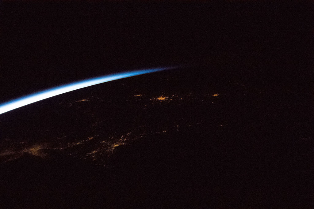
Air pollution and global warming |
2019-01-15 | Human footprint |
See the description |
 |
A tall glass of iceberg, please! |
2019-01-15 | Cryosphere |
See the description |
 |
Canyons - the result of weathering and erosion! |
2019-01-15 | Landforms |
See the description |
 |
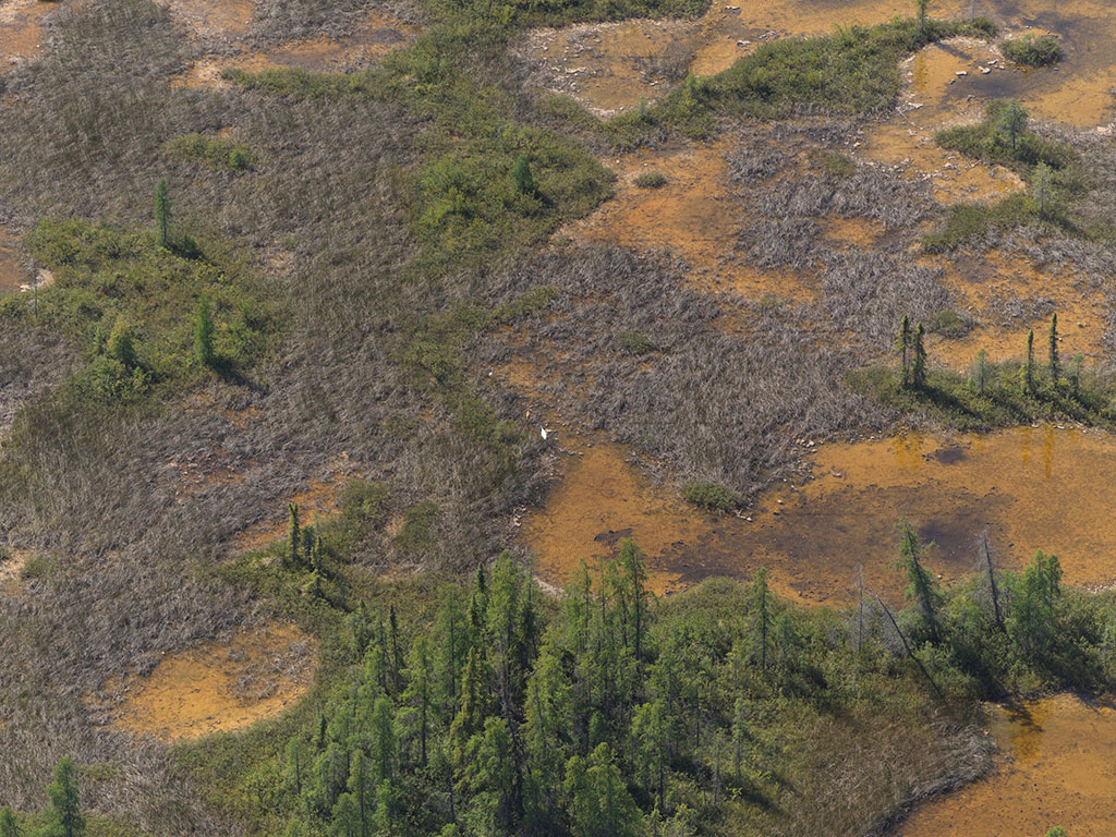
Coastal wetlands: migratory bird lifelines |
2019-01-22 | Bird migration |
See the description |
 |
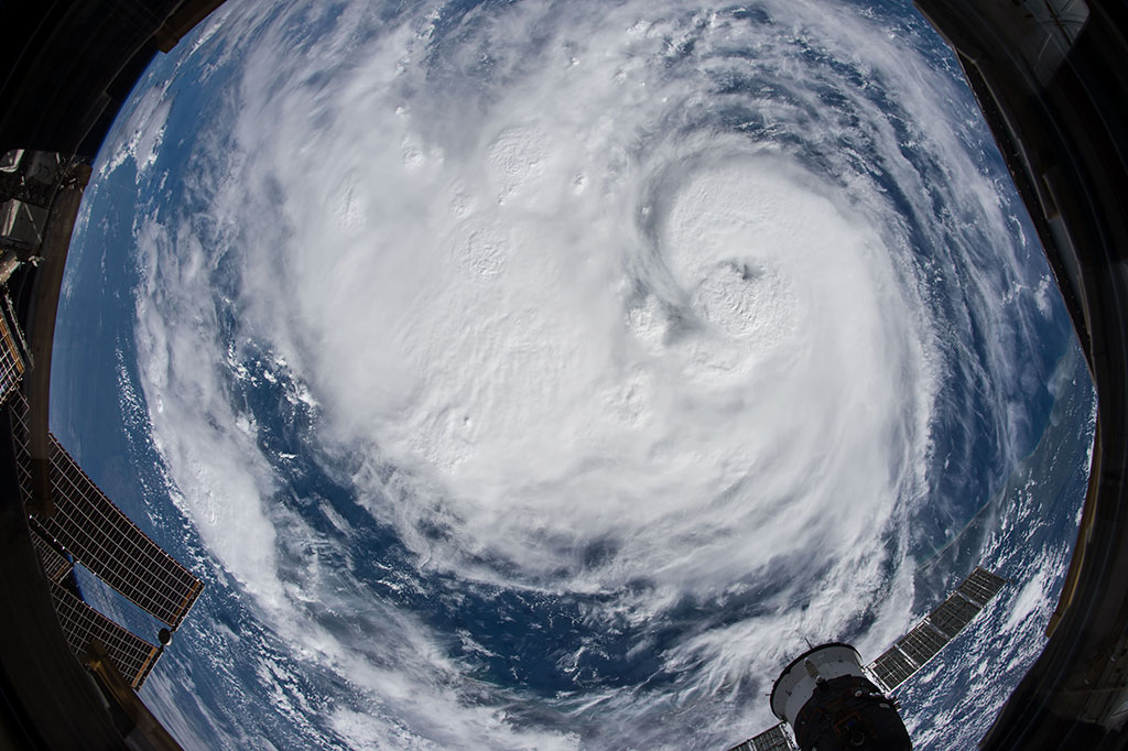
The one-eyed monster |
2019-01-22 | Natural hazards, weather |
See the description |
 |
Aurora borealis – dancing polar lights |
2019-01-22 | Miscellaneous |
See the description |
 |
Sand dunes are truly unique! |
2019-01-30 | Landforms |
See the description |
 |
I hope you packed your rain gear! |
2019-01-30 | Natural hazards, weather |
See the description |
 |
From the Rockies to the Alps |
2019-01-30 | Landforms |
See the description |
 |
Cruising above the clouds |
2019-02-05 | Human footprint |
See the description |
 |
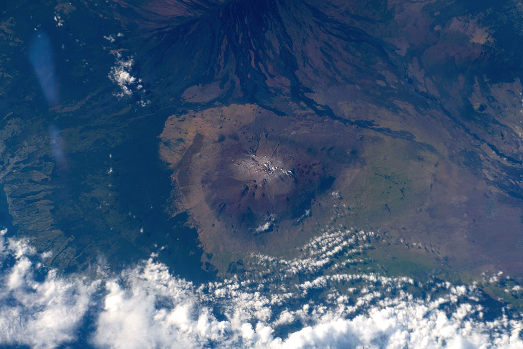
The mountains of fire |
2019-02-05 | Landforms |
See the description |
 |
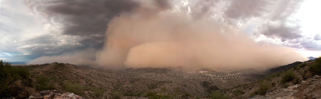
Dust storms - a meteorological mess! |
2019-02-05 | Natural hazards, weather |
See the description |
 |
Down by the bay, where the watermelons grow… |
2019-02-12 | Water bodies |
See the description |
 |
Water in deserts |
2019-02-12 | Terrestrial biomes |
See the description |
 |
Deltas: where rivers meet the sea |
2019-02-12 | Landforms |
See the description |
 |
Interior wetlands: shrinking footholds |
2019-02-19 | Bird migration |
See the description |
 |
Growing crops in the desert |
2019-02-19 | Human footprint |
See the description |
 |
Preserving dark skies for stargazing |
2019-02-19 | Human footprint |
See the description |
 |
Ice on the Great Lakes |
2019-02-26 | Cryosphere |
See the description |
 |
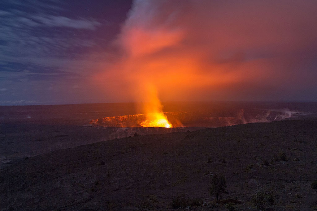
Global impacts of volcanic eruptions |
2019-02-26 | Natural hazards, weather |
See the description |
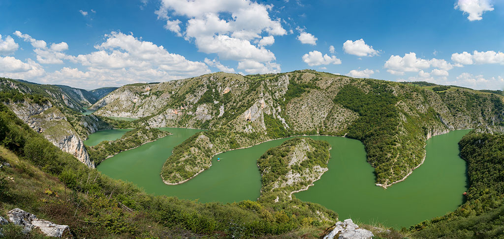
 |
Meandering rivers: wet wanderers |
2019-02-26 | Water bodies |
See the description |
 |
Beaches - waves of activity and life! |
2019-03-05 | Landforms |
See the description |
 |
Facts about cracks! |
2019-03-05 | Landforms |
See the description |
 |
Sea ice and its ongoing disappearing act |
2019-03-05 | Cryosphere |
See the description |
 |
Chaparral biomes help us detect climate change |
2019-03-12 | Terrestrial biomes |
See the description |
 |
The Great Green Wall - fighting desertification |
2019-03-12 | Natural hazards, weather |
See the description |
 |
Urbanization: people moving to the cities |
2019-03-12 | Human footprint |
See the description |
 |
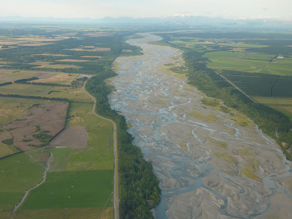
Braided rivers: when a river channel multiplies |
2019-03-19 | Water bodies |
See the description |
 |
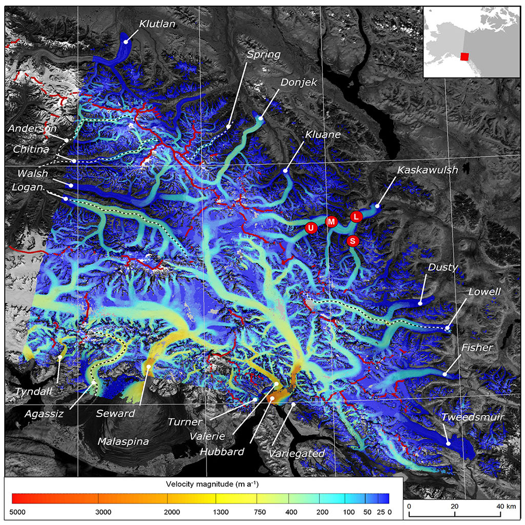
Glaciers: When the ice flows |
2019-03-19 | Cryosphere |
See the description |
 |
Wildfires – signs of a changing climate |
2019-03-19 | Natural hazards, weather |
See the description |
 |
Salt pans: all dried up! |
2019-03-26 | Landforms |
See the description |
 |
From coast to coast to coast - Canada's oceans |
2019-03-26 | Water bodies |
See the description |
 |
Boom! Clap! |
2019-03-26 | Natural hazards, weather |
See the description |
 |
From farm to table |
2019-04-02 | Human footprint |
See the description |
 |
Deforestation - the permanent destruction of forests |
2019-04-02 | Human footprint |
See the description |
 |
Wetlands are a superpower ecosystem |
2019-04-02 | Landforms |
See the description |
 |
Let it snow, let it snow, let it snow... |
2019-04-09 | Cryosphere |
See the description |
 |
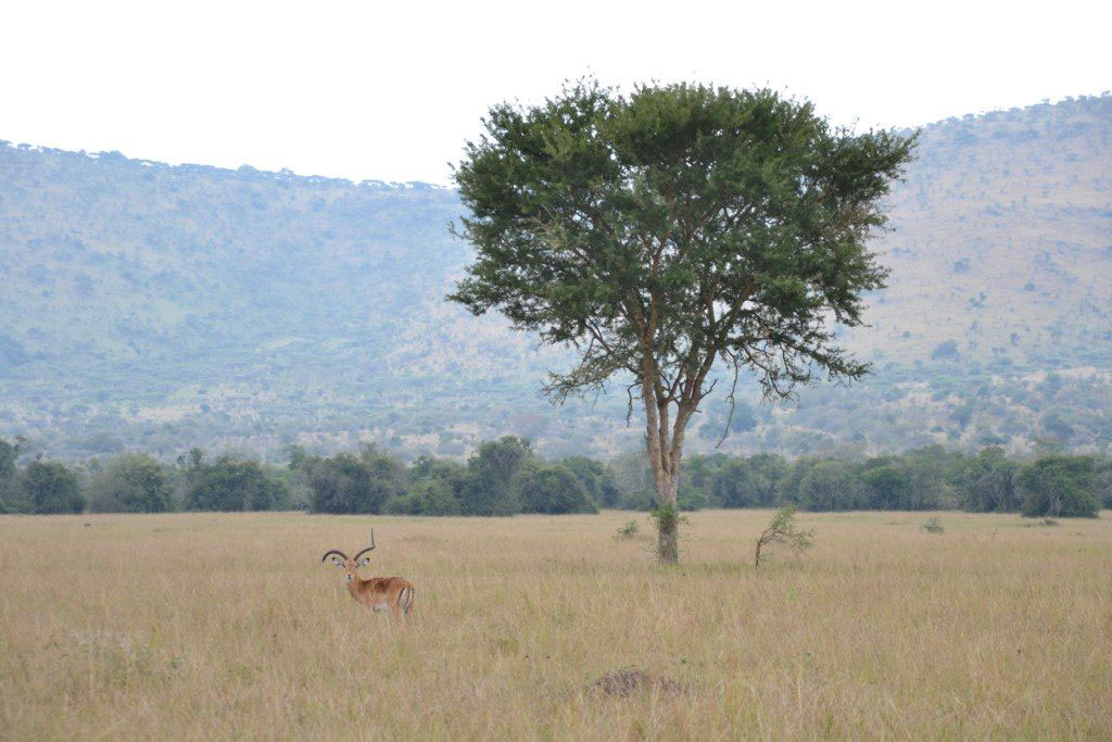
Savannah - where the grass isn't always greener |
2019-04-09 | Terrestrial biomes |
See the description |
 |
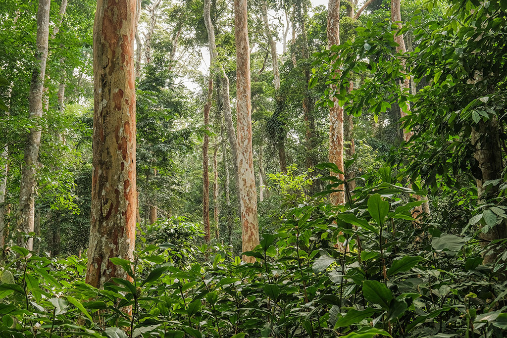
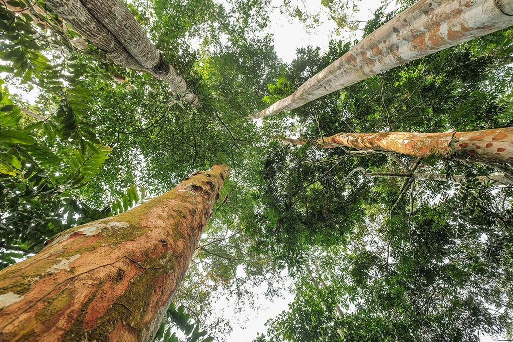
Lush and green rainforests |
2019-04-09 | Terrestrial biomes |
See the description |
 |
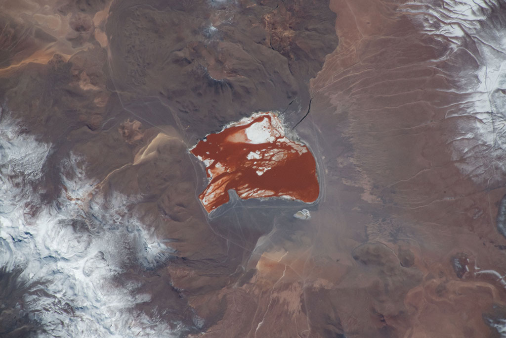
Lagoons: always monster free! |
2019-04-16 | Water bodies |
See the description |
 |
Maritime shipping - moving people and freight over water |
2019-04-16 | Human footprint |
See the description |
 |
Using the sun's energy |
2019-04-16 | Human footprint |
See the description |
 |
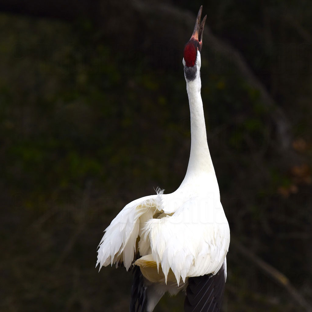
Lake of Salt and Soda: Birthplace of the Lesser Flamingo |
2019-04-23 | Bird migration |
See the description |
 |
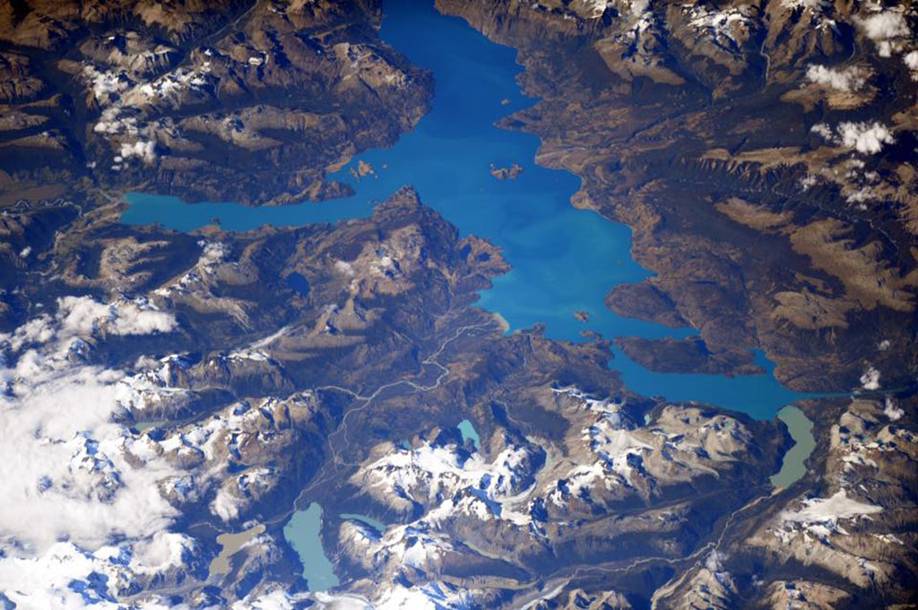
Lakes - the gems of the world |
2019-04-23 | Water bodies |
See the description |
 |
Landslides - the biggest and fastest slides on Earth! |
2019-04-23 | Natural hazards, weather |
See the description |
 |
Borders, are they visible from space? |
2019-04-30 | Human footprint |
See the description |
 |
Fishing: Canada's coastal industry |
2019-04-30 | Human footprint |
See the description |
 |
Peninsulas, the “almost islands” |
2019-04-30 | Landforms |
See the description |
 |
Clouds: wonders of the atmosphere |
2019-05-06 | Natural hazards, weather |
See the description |
 |
Why does the Earth suddenly shake? |
2019-05-06 | Natural hazards, weather |
See the description |
 |
What is a strait anyway? |
2019-05-06 | Water bodies |
See the description |
 |
How can you fold a mountainside? |
2019-05-14 | Landforms |
See the description |
 |
Hit the road! |
2019-05-14 | Human footprint |
See the description |
 |
Forecasting space weather helps to keep lights on |
2019-05-14 | Human footprint |
See the description |
 |
Take a plunge to see the coral reefs |
2019-05-21 | Landforms |
See the description |
 |
Rift Valley Lakes: Lesser Flamingo Hangouts |
2019-05-21 | Bird migration |
See the description |
 |
Tropical forests can be dry too! |
2019-05-21 | Terrestrial biomes |
See the description |
 |
Monitoring oil use from space |
2019-05-28 | Human footprint |
See the description |
 |
Mining: digging for Earth's buried treasure |
2019-05-28 | Human footprint |
See the description |
 |
Home of the mighty maple tree! |
2019-05-28 | Terrestrial biomes |
See the description |
 |
Behold the awesome power of water! |
2019-06-04 | Landforms |
See the description |
 |
Preserving Canada's landscapes |
2019-06-04 | Miscellaneous |
See the description |
 |
Relic glacier forms - ancient beauties |
2019-06-04 | Landforms |
See the description |
 |
The danger of thawing permafrost |
2019-06-11 | Cryosphere |
See the description |
 |
Sinkholes - stay back! |
2019-06-11 | Landforms |
See the description |
 |
Tundras, the treeless forests |
2019-06-11 | Terrestrial biomes |
See the description |
 |
Boreal forest - the spruce-moose biome! |
2019-06-18 | Terrestrial biomes |
See the description |
 |
Protecting Canada's underwater world |
2019-06-18 | Miscellaneous |
See the description |
 |
Temperate rainforests: bring an umbrella! |
2019-06-18 | Terrestrial biomes |
See the description |
 |
Boreal peatlands help keep the Earth cool |
2019-06-25 | Landforms |
See the description |
 |
Oil under the ocean—and on it |
2019-06-25 | Human footprint |
See the description |
 |
Grassy ecosystems |
2019-06-25 | Terrestrial biomes |
See the description |
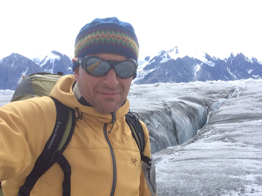
See photos of Earth by David Saint-Jacques
Questions?
If you have questions about the content, the map or the curriculum links, do not hesitate to contact us. We will redirect your questions to the project partner best suited to answer your question.
Explore further
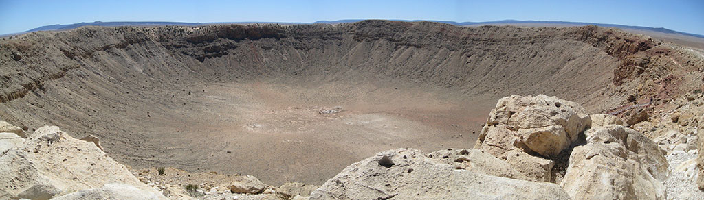
Meteorite impact craters!
Meteorite impact craters!: This photo of the Manicouagan crater in Quebec, Canada, (ring feature, bottom centre) was taken by David Saint-Jacques from aboard the International Space Station. (Credit: Canadian Space Agency/NASA)
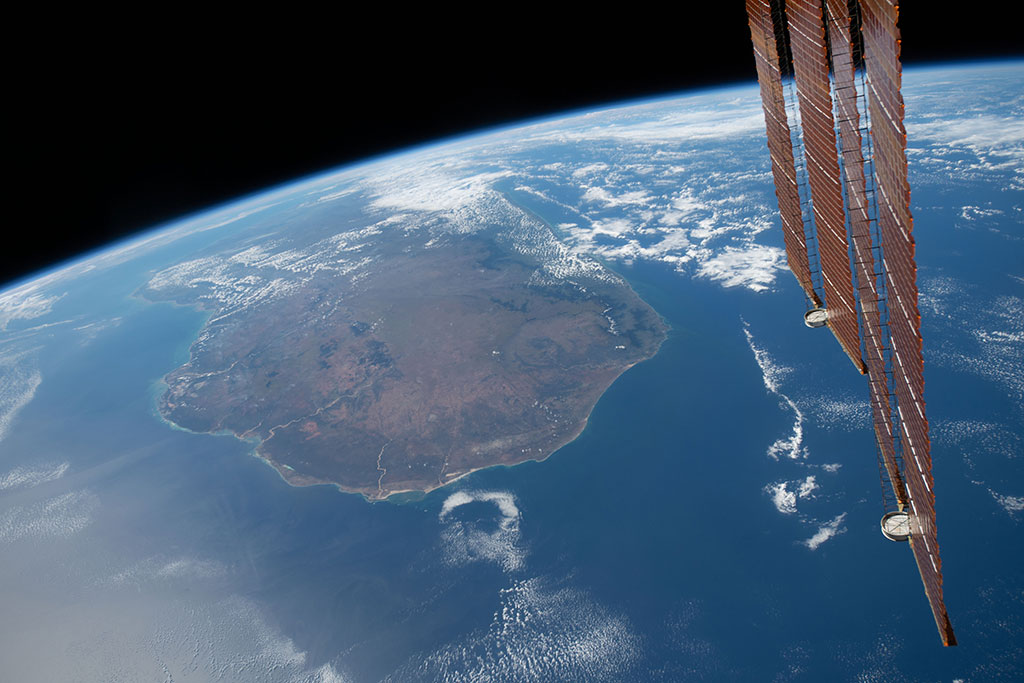
Islands and archipelagos: sunny and icy!
This photo of the Canary Islands was taken by David Saint-Jacques from aboard the International Space Station. (Credit: Canadian Space Agency/NASA)
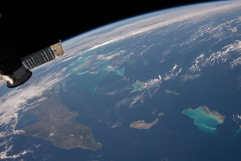
Water as far as you can “sea!”
This photo shows the eastern tip of Cuba as well as the Inagua Islands in the West Indies, located in the Caribbean Sea. (Credit: Canadian Space Agency/NASA)
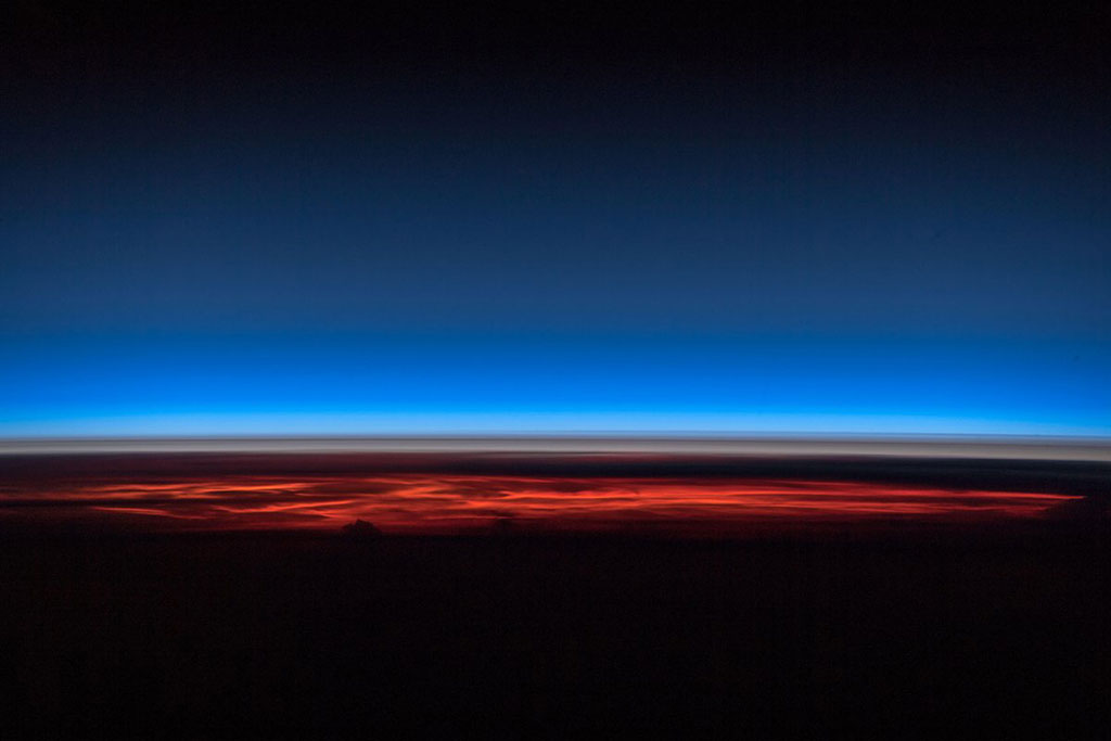
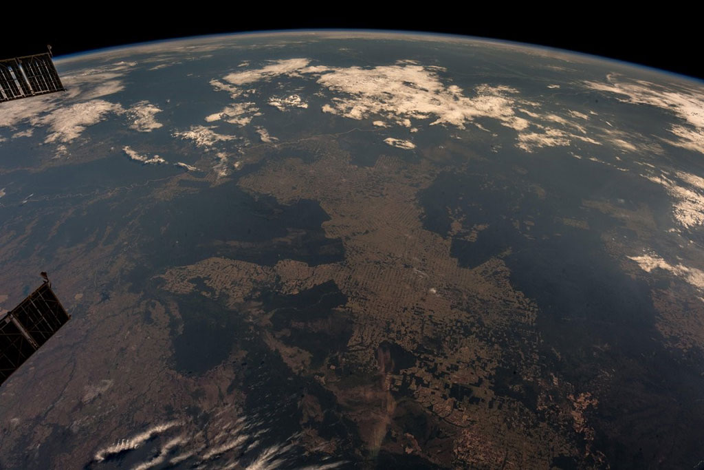
Air pollution and global warming
The thin blue band in this photo taken by David Saint-Jacques from the International Space Station is our planet's atmosphere. (Credit: Canadian Space Agency/NASA)


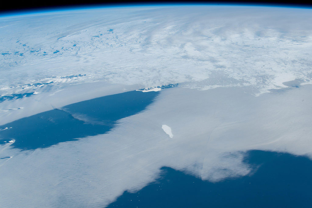
A tall glass of iceberg, please!
The small white dots at the bottom of this photo are large icebergs captured by David Saint-Jacques from the International Space Station. (Credit: Canadian Space Agency/NASA)
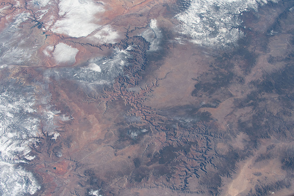
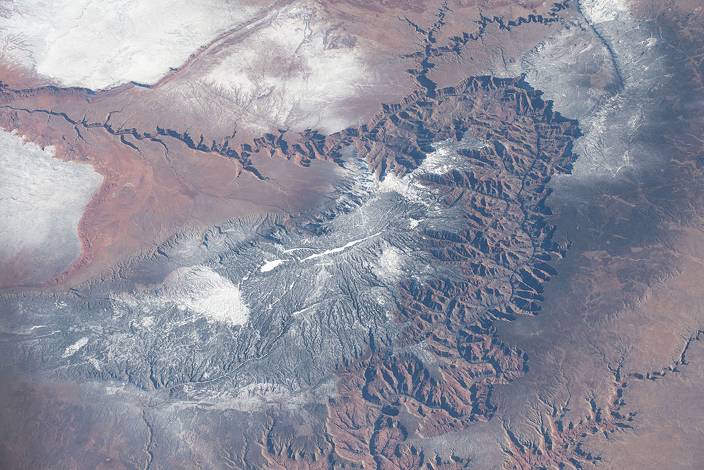
Canyons - the result of weathering and erosion!
This photo of the Grand Canyon was taken by David Saint-Jacques from aboard the International Space Station. (Credit: Canadian Space Agency/NASA)
Coastal wetlands: migratory bird lifelines
The Texas Gulf Coast. (Credit: NASA)

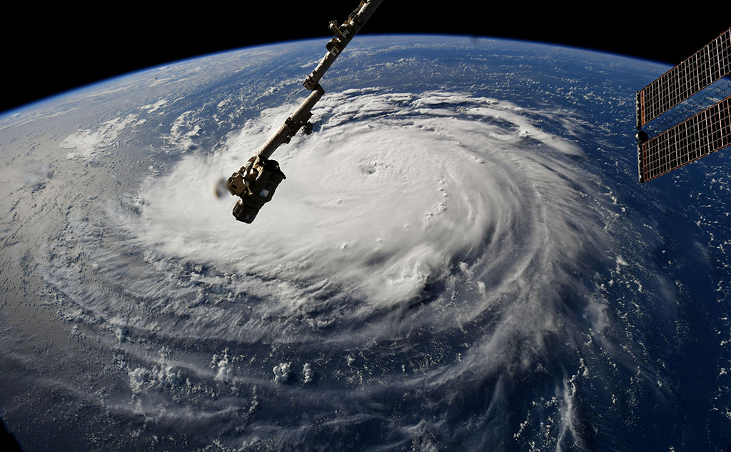
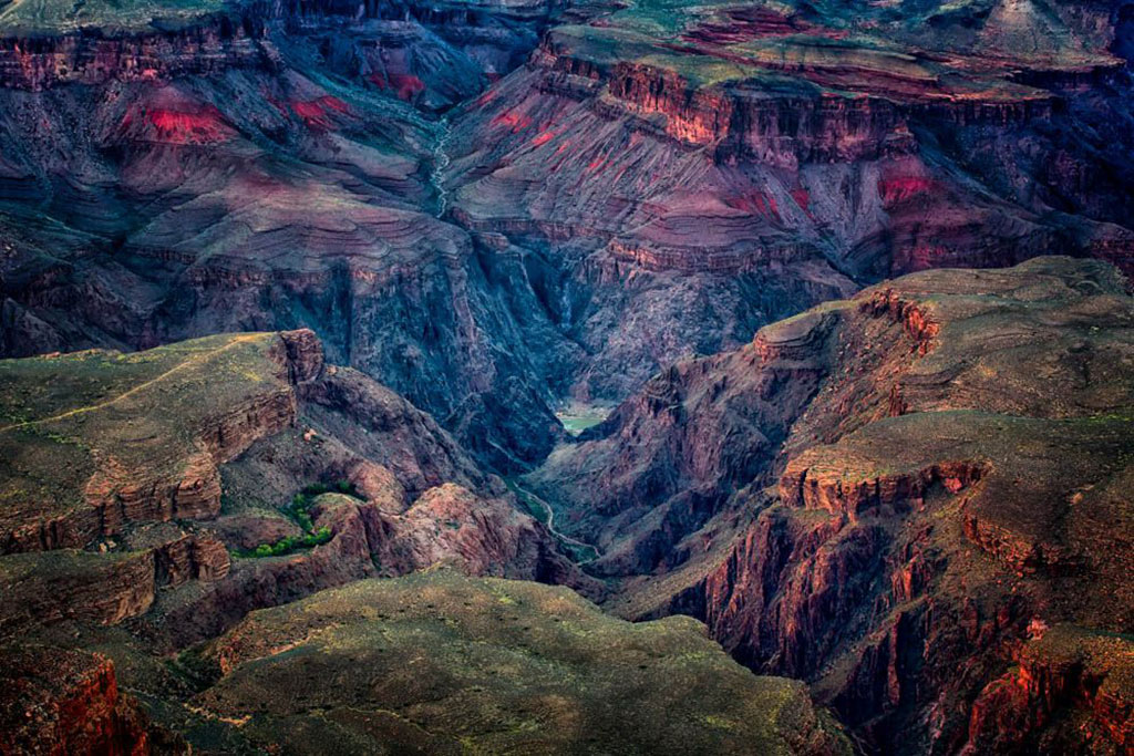
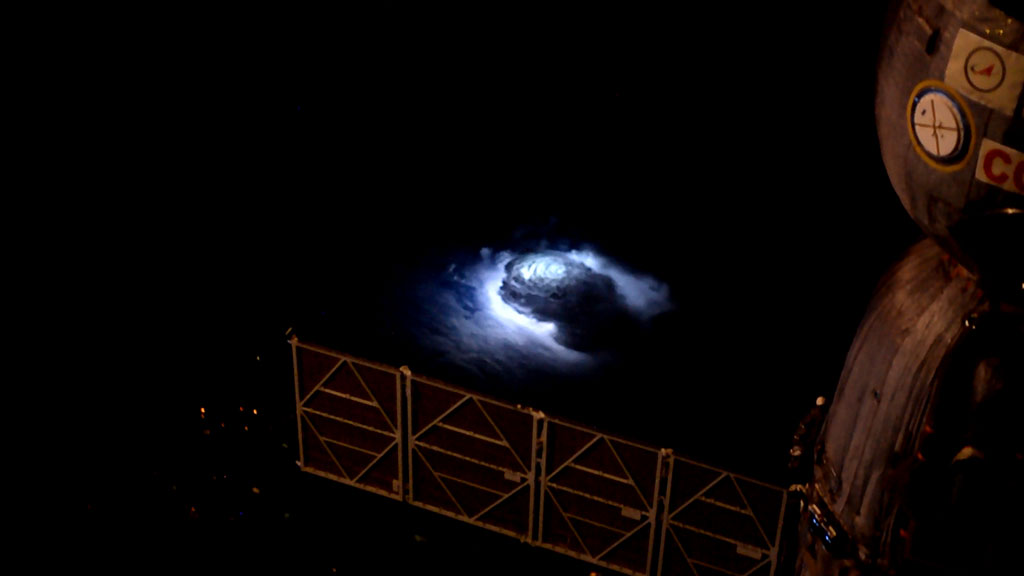
The one-eyed monster
Deep in the Grand Canyon. (Credit: Steward Baird)

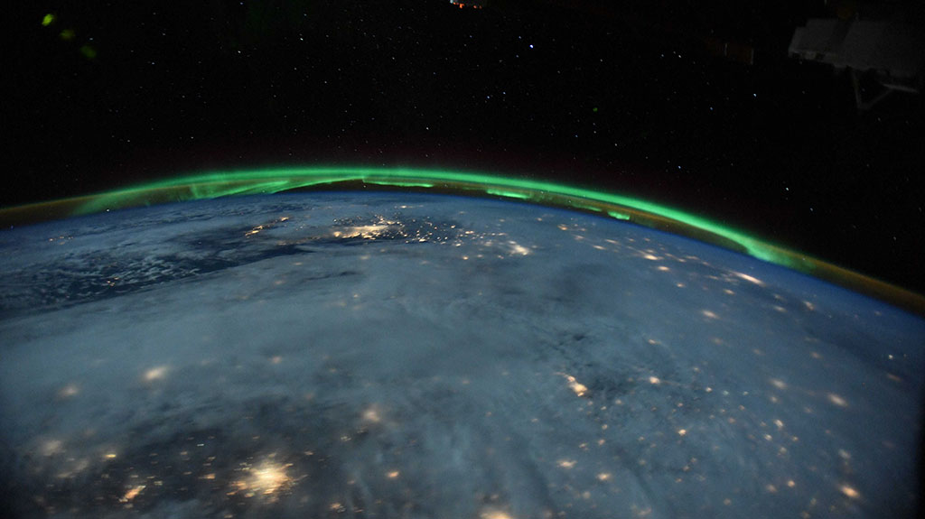
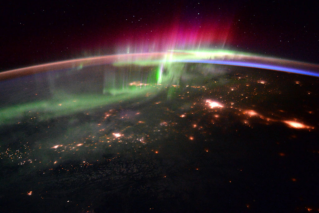
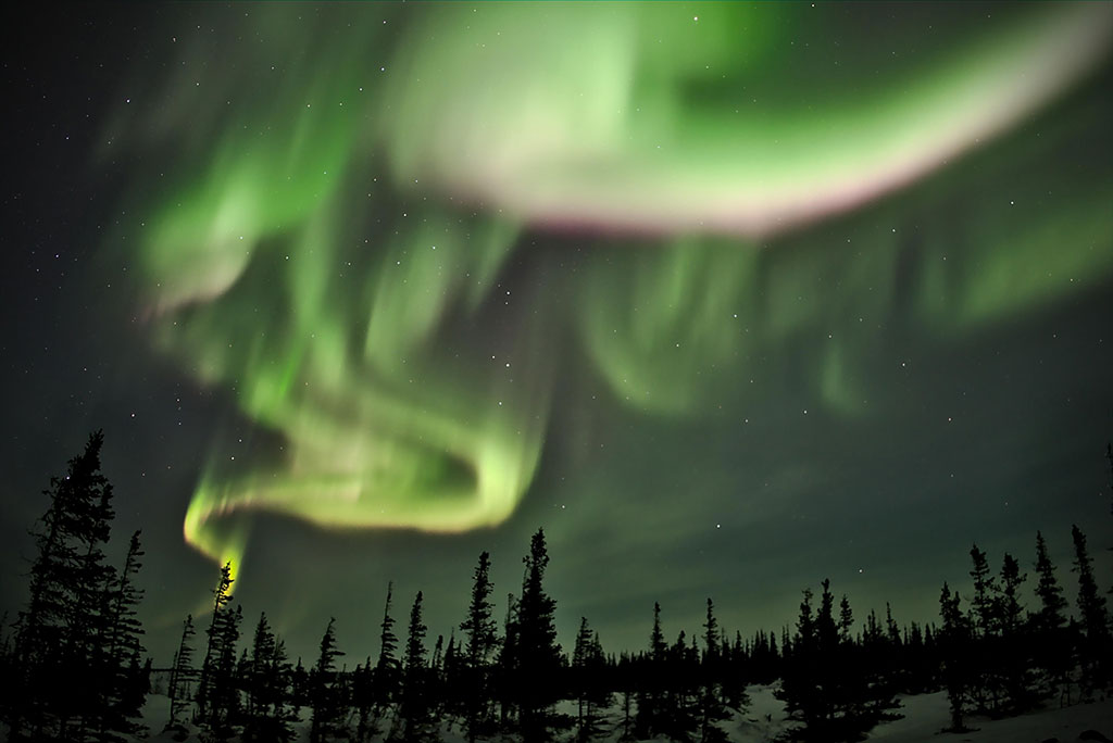
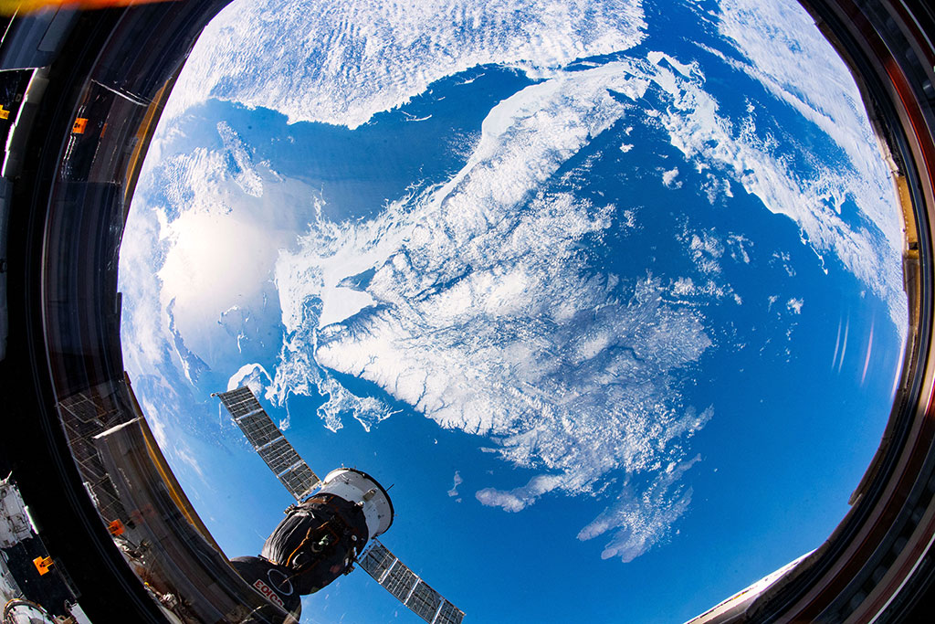
Aurora borealis – dancing polar lights
The first aurora borealis seen and captured by David Saint-Jacques from the International Space Station, on January 16, 2019. (Credit: Canadian Space Agency/NASA)
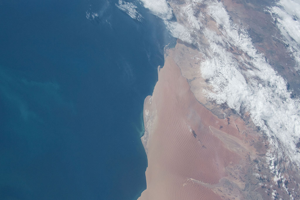
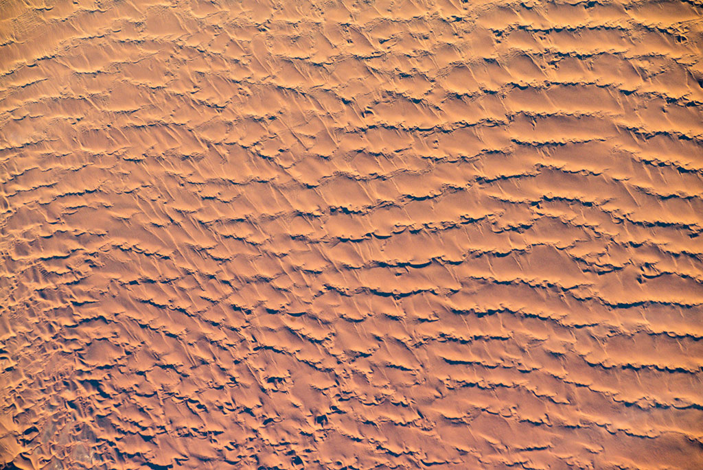
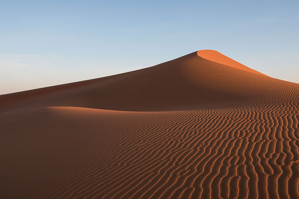
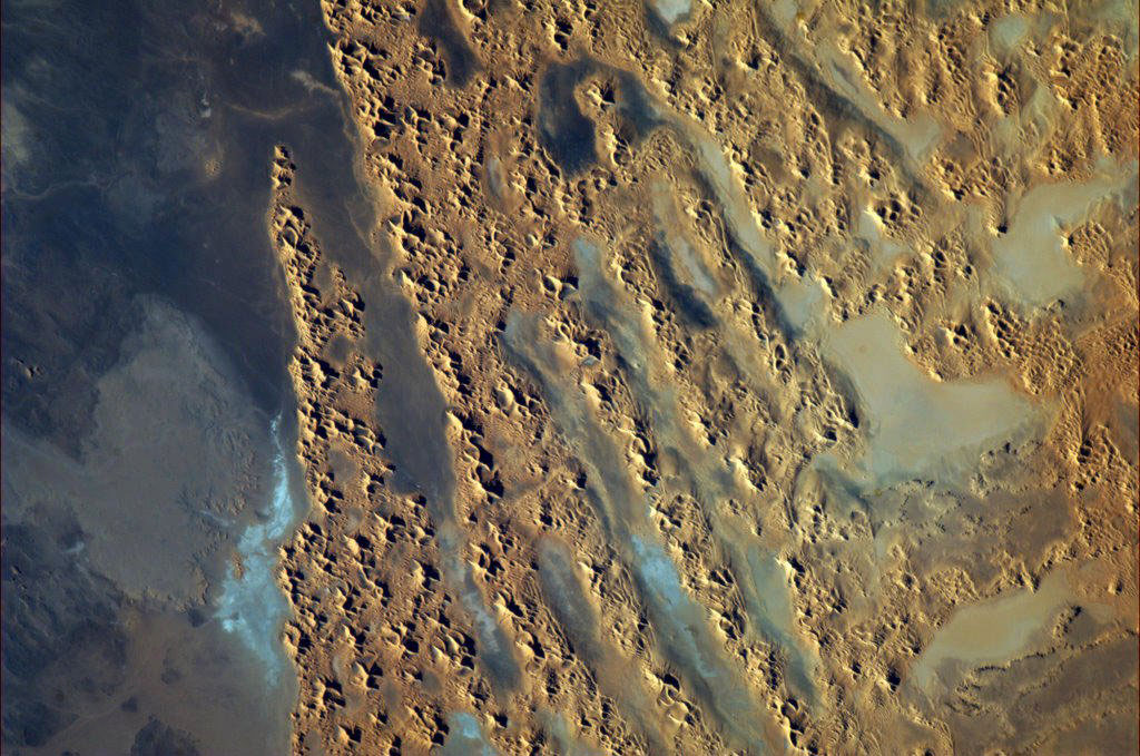
Sand dunes are truly unique!
Dunes in Namibia photographed by David Saint-Jacques from space. (Credit: Canadian Space Agency/NASA)
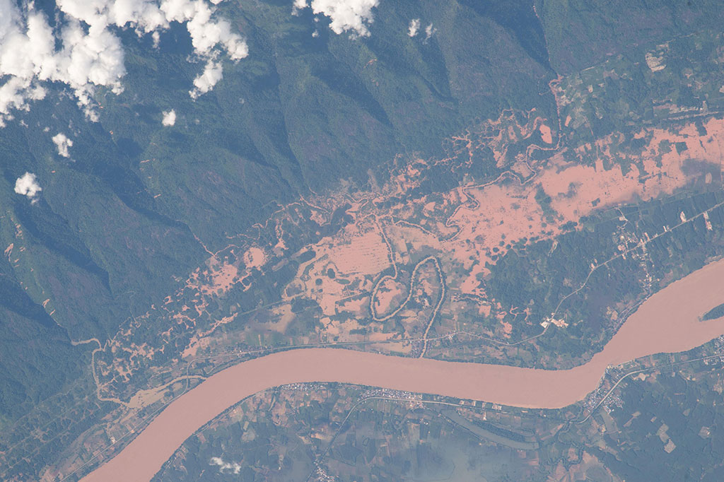
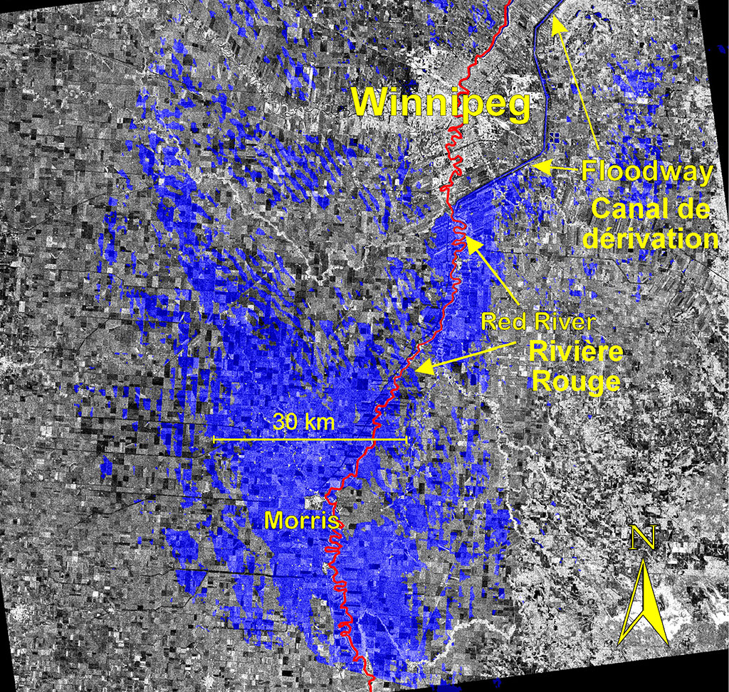
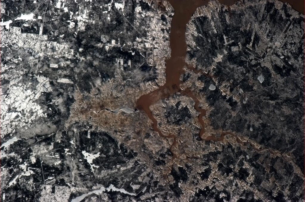
I hope you packed your rain gear!
This photo, taken by a crew member aboard the International Space Station, shows not only roads and buildings in great detail, but also evidence of flooding of Southeast Asia's largest river, the Mekong. The Mekong River serves as a trans-boundary river between Thailand and Laos as it spills a reddish-brown channel of floodwater from a heavy monsoon rainfall. (Credit: NASA)

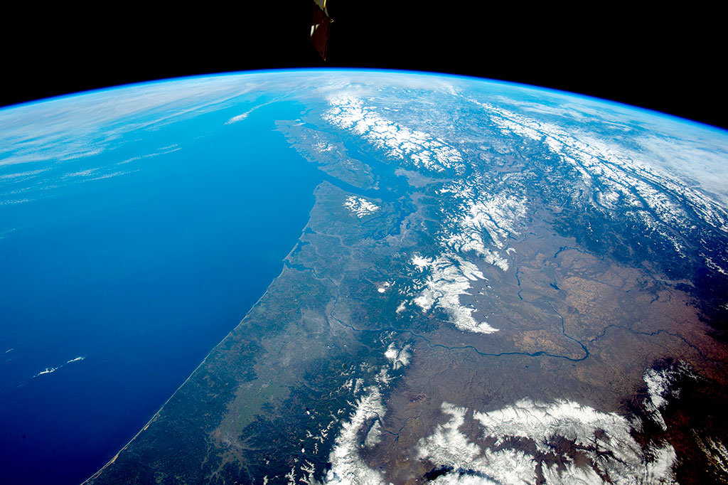
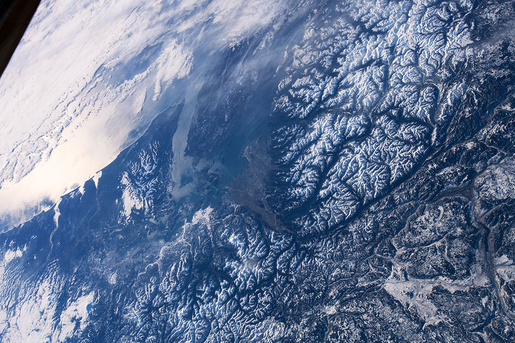
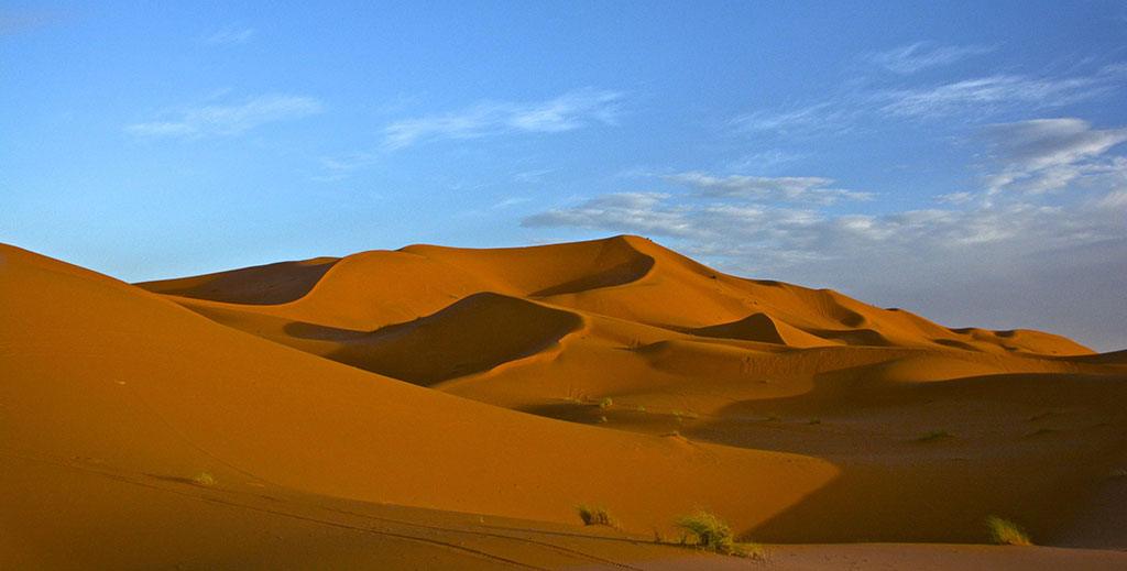
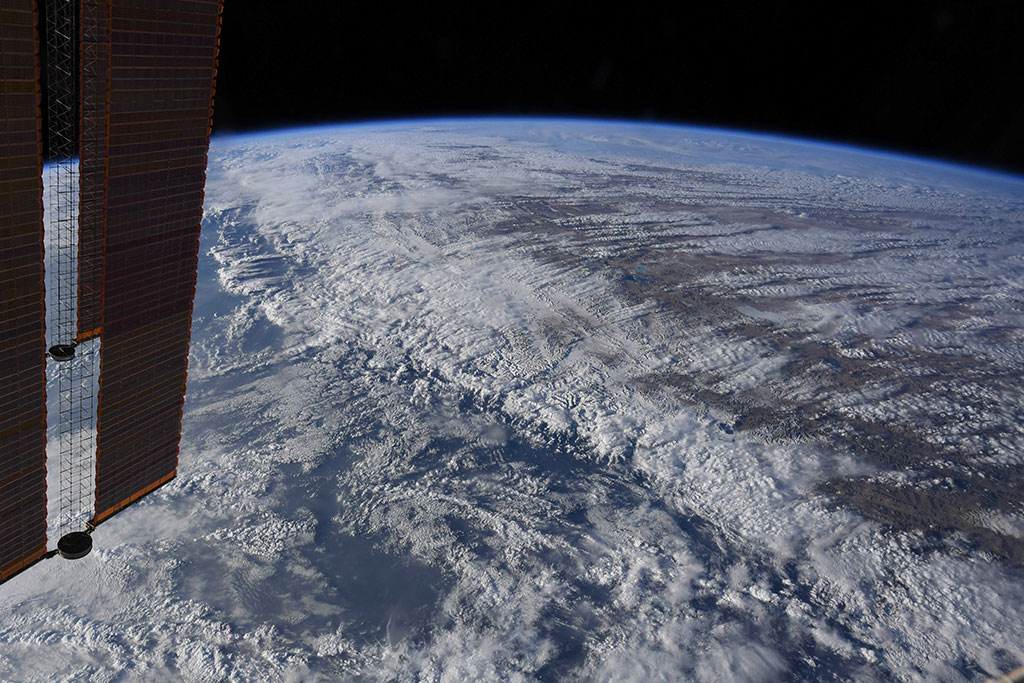
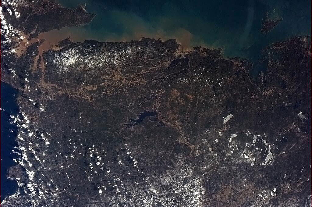
From the Rockies to the Alps
The Andes in Southern Chile photographed by David Saint-Jacques from the International Space Station. (Credit: Canadian Space Agency/NASA)

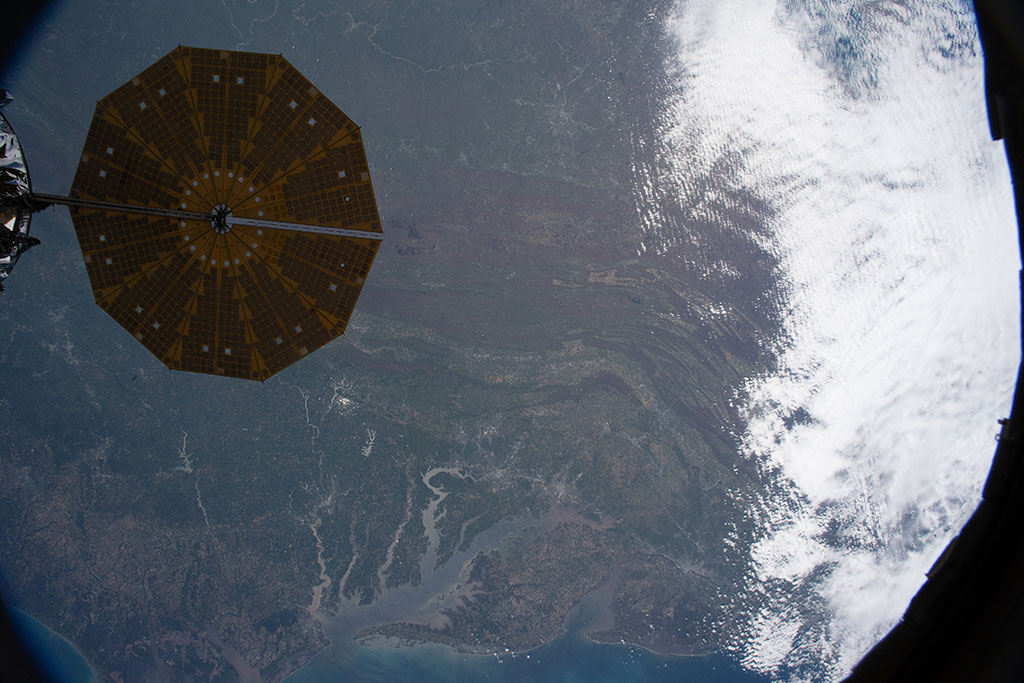
Cruising above the clouds
Former Canadian Space Agency astronaut Chris Hadfield took this photo of the contrail of the Snowbirds flying in formation near Comox, British Columbia, during his last mission aboard the International Space Station in 2013. (Credit: Chris Hadfield/Canadian Space Agency)


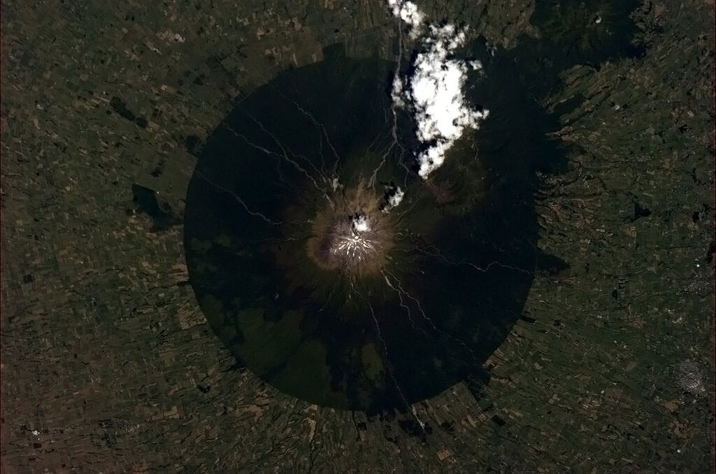
The mountains of fire
The snow-covered Cascade Range in the northwest United States in the foreground gives way to the Rocky Mountains and Coast Mountains in Canada, with Vancouver Island just offshore. Several active volcanoes—Mount St.Helens, Mount Rainier and Mount Hood—dot the Cascades in this photo taken by a crew member of the International Space Station. (Credit: NASA)
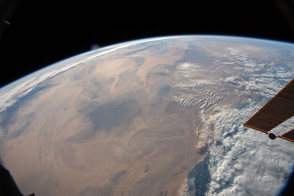
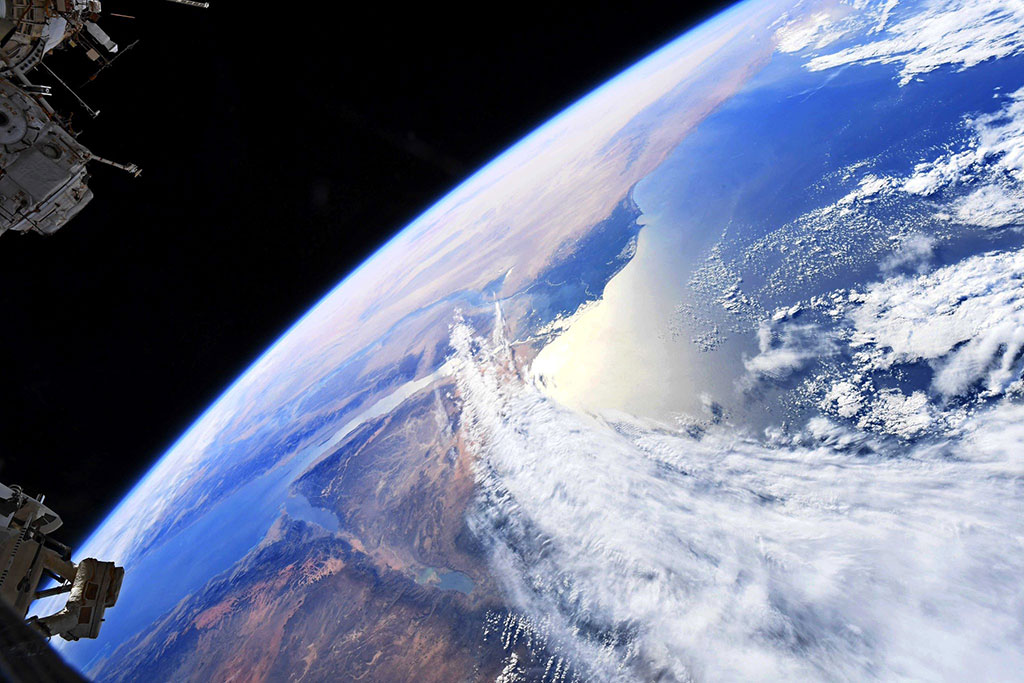
Dust storms - a meteorological mess!
A plume of sand and dust blown from the Sahara desert sweeps over Portugal and Spain. The photo was captured by a crew member of the International Space Station. (Credit: NASA)
Down by the bay, where the watermelons grow…
The Bay of Bengal and the island of Sri Lanka seen through a window of the International Space Station by David Saint-Jacques. (Credit: Canadian Space Agency/NASA)

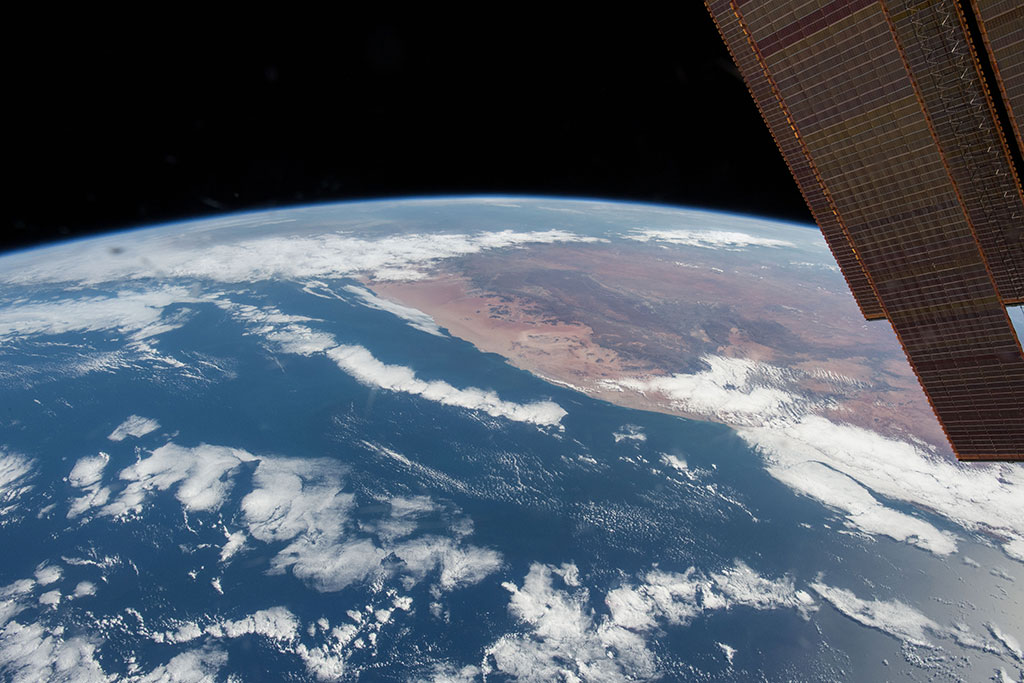
Water in deserts
The Libyan Desert, a 700,000 km2 territory in the north west of the Sahara, as photographed by David Saint-Jacques aboard the International Space Station. (Credit: Canadian Space Agency/NASA)

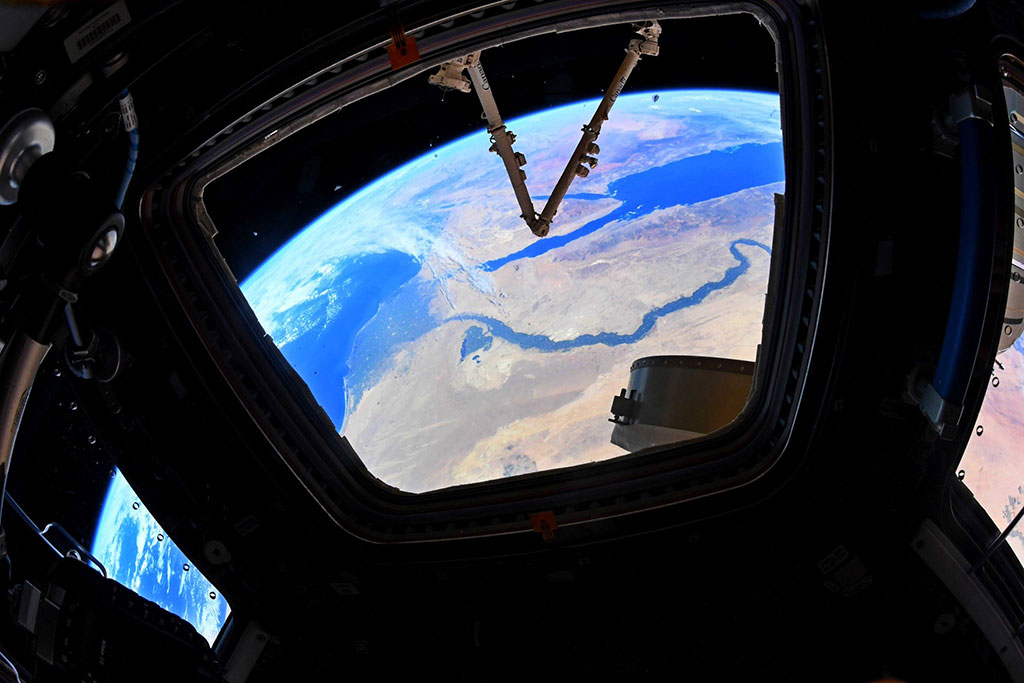
Deltas: where rivers meet the sea
"Egypt is the gift of the Nile." – Herodotus. The Nile River and its delta, striking green ribbon of life in the desert, as photographed by David Saint-Jacques aboard the International Space Station. (Credit: Canadian Space Agency/NASA)
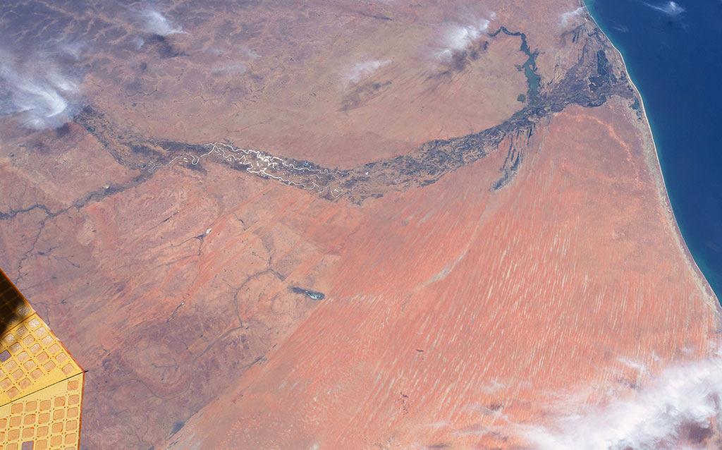
Interior wetlands: shrinking footholds
Limb of the Earth with Saskatchewan at bottom-center edge, and a lake showing the reflection of sunlight on the water. (Credit: NASA)


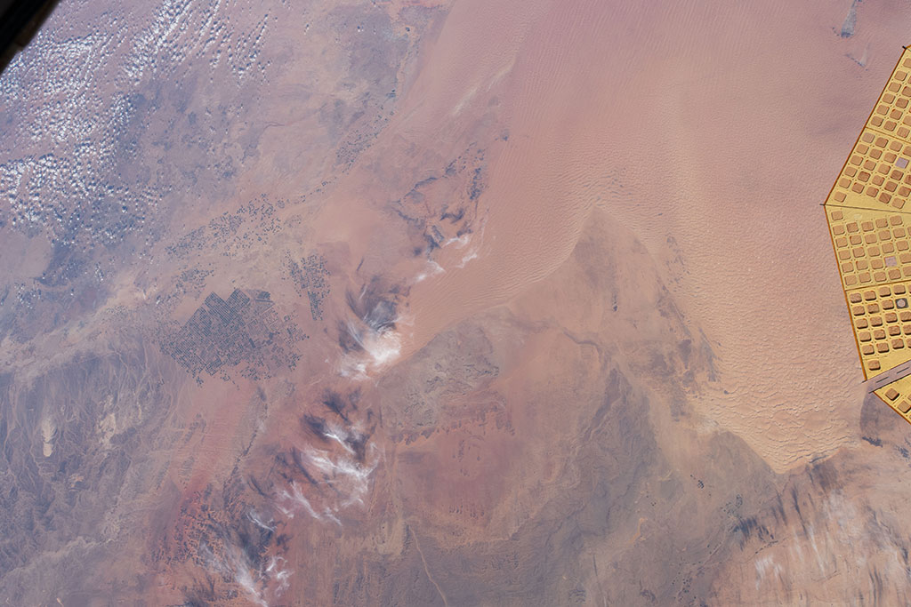
Growing crops in the desert
Picture of irrigated lands in the desert of Saudi Arabia taken by David Saint-Jacques during his space mission. (Credit: Canadian Space Agency/NASA)
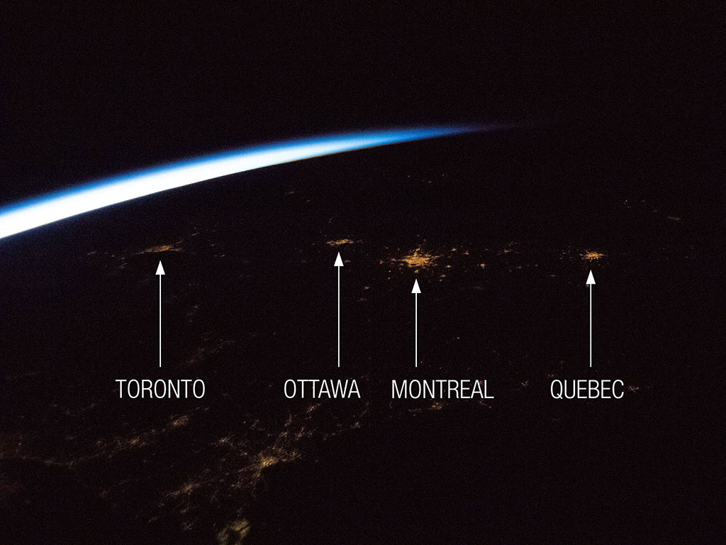
Preserving dark skies for stargazing
The Toronto-Ottawa-Montreal-Quebec City corridor, where approximately 50% of Canada's population lives, is visible through a single cupola window of the International Space Station. Although bigger than Montreal, Toronto lights seem paler because of the angle and distance of the station when astronaut David Saint-Jacques captured the photo. (Credit: Canadian Space Agency/NASA)

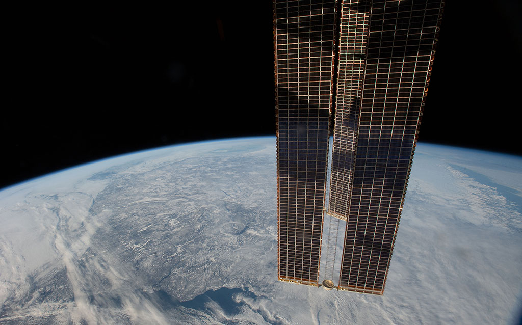
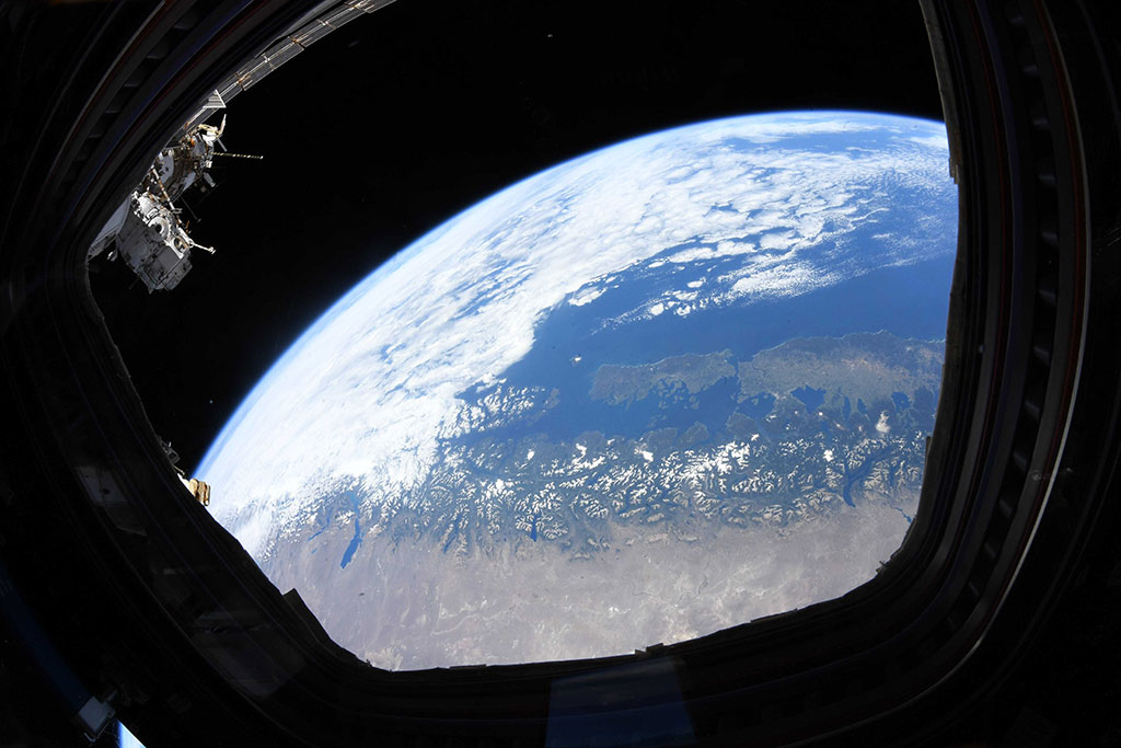
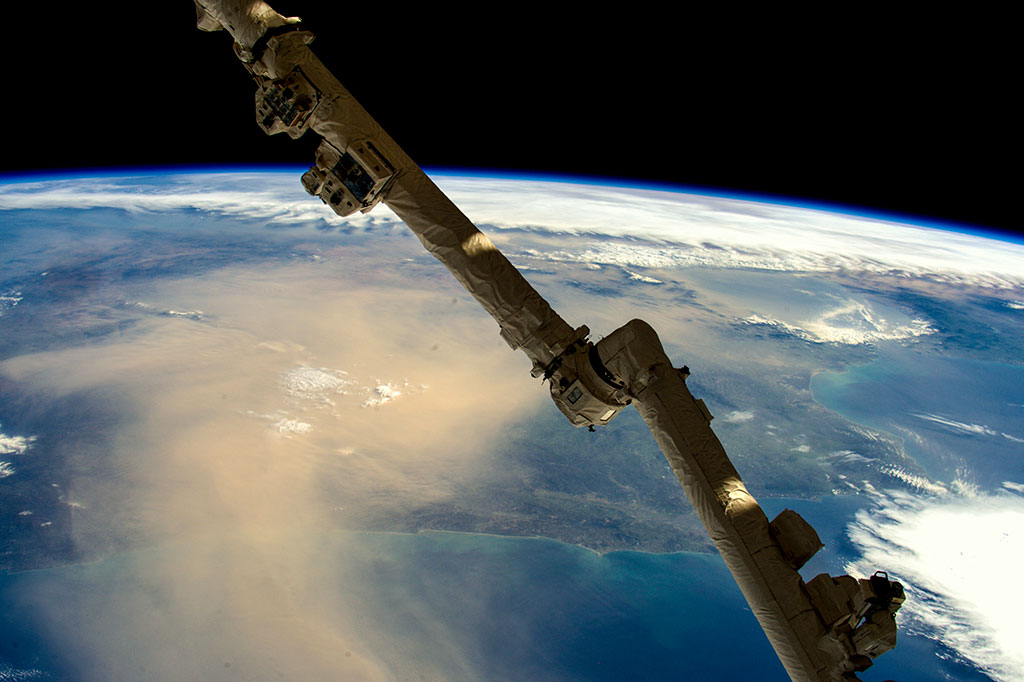
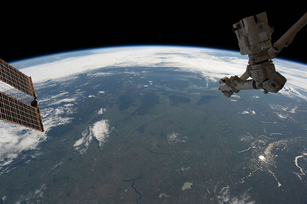
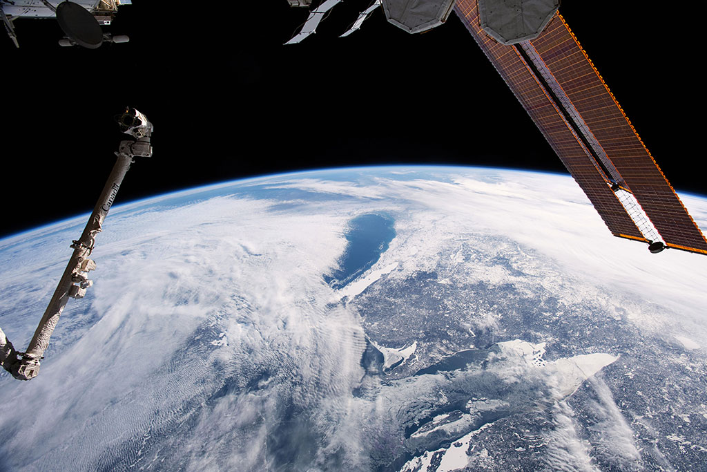
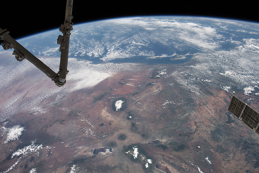
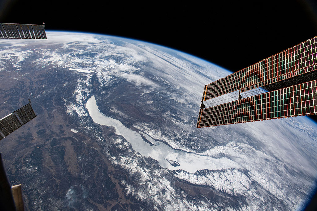
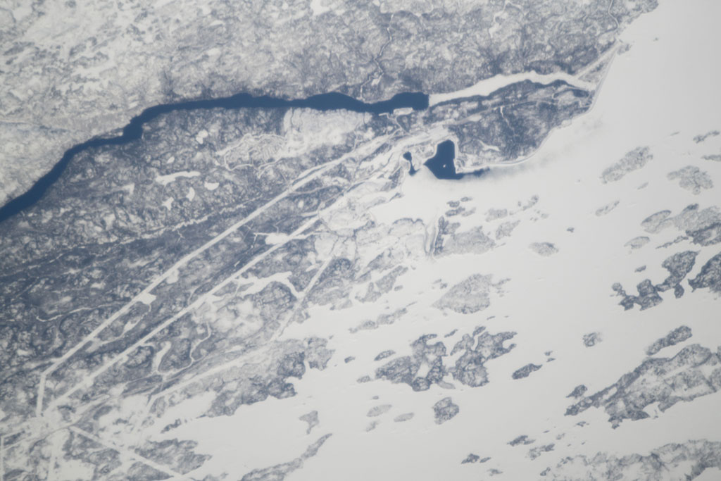
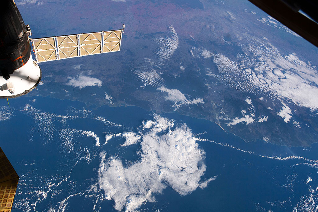
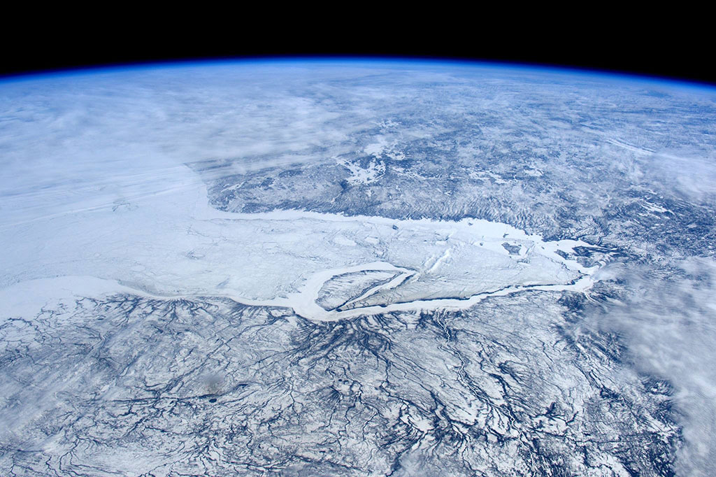
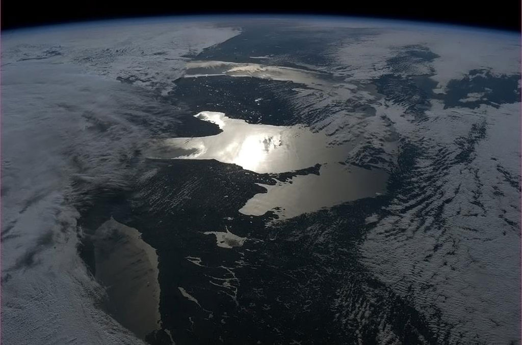
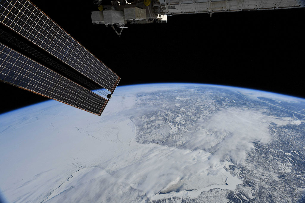
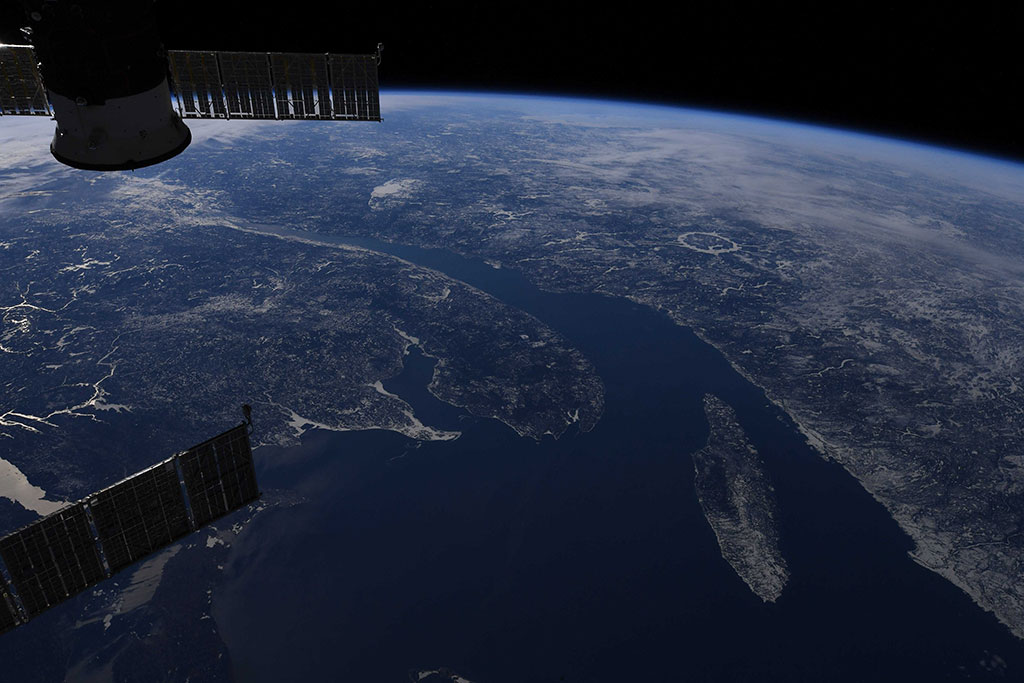
Ice on the Great Lakes
Part of Lake Superior (forefront) and Lake Huron are seen under clouds (and photobombed by Canadarm2!) in this photo of the chilly Great Lakes region. It was taken by David Saint-Jacques from the International Space Station. (Credit: Canadian Space Agency/NASA)

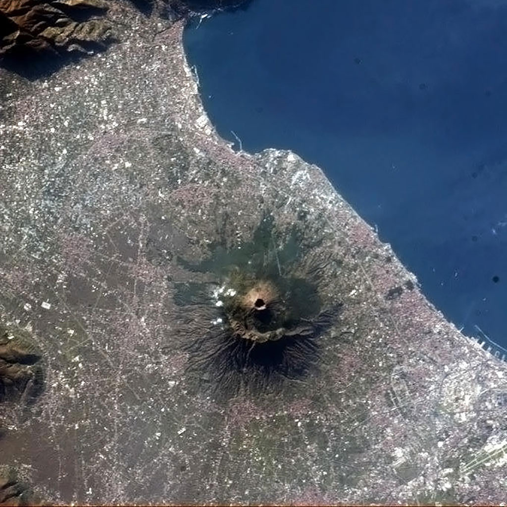
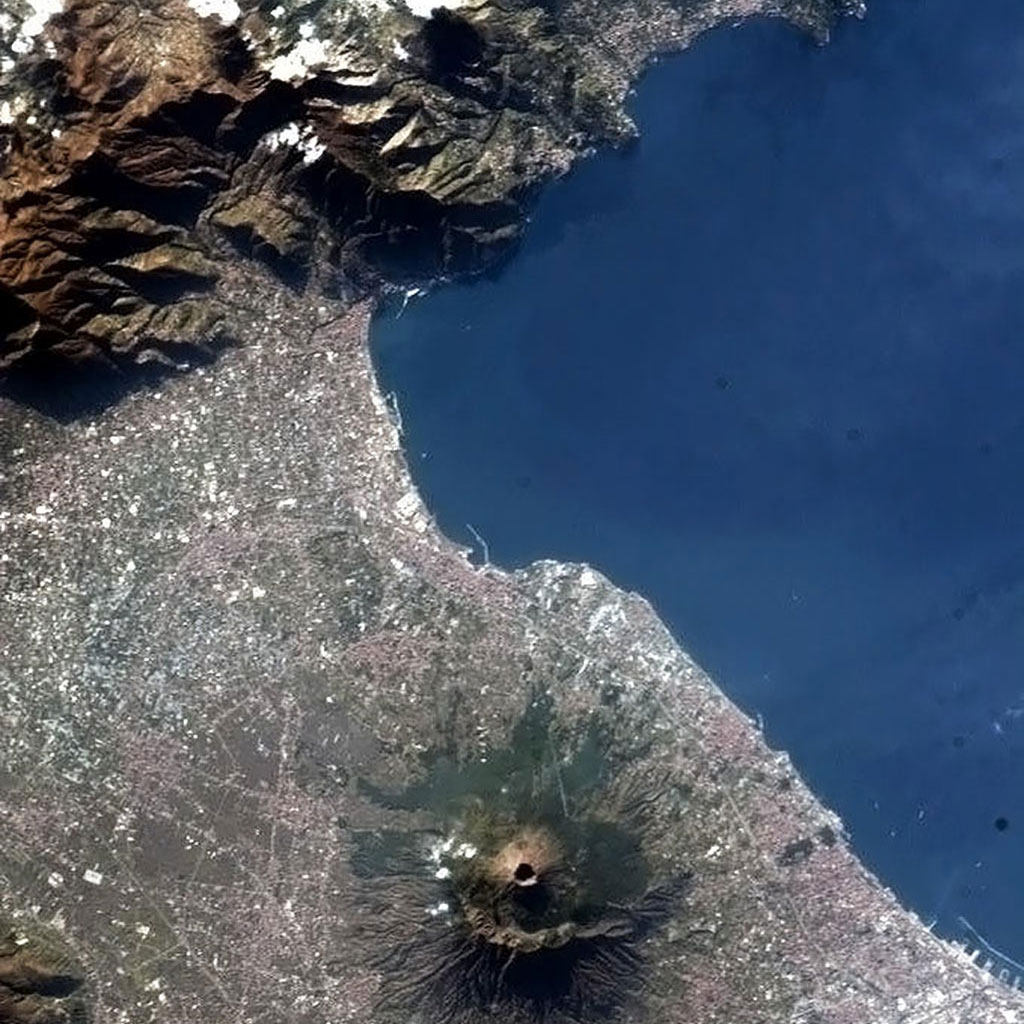
Global impacts of volcanic eruptions
Mauna Kea, captured by David Saint-Jacques from the International Space Station, is one of five volcanoes that form the islands of Hawaii. It is a dormant volcano and its peak is 4,207.3 m above sea level, making it the highest point in the state of Hawaii. Most of the mountain is under water, and when measured from its oceanic base, Mauna Kea is the tallest mountain in the world measuring over 10,000 m. (Credit: Canadian Space Agency/NASA)


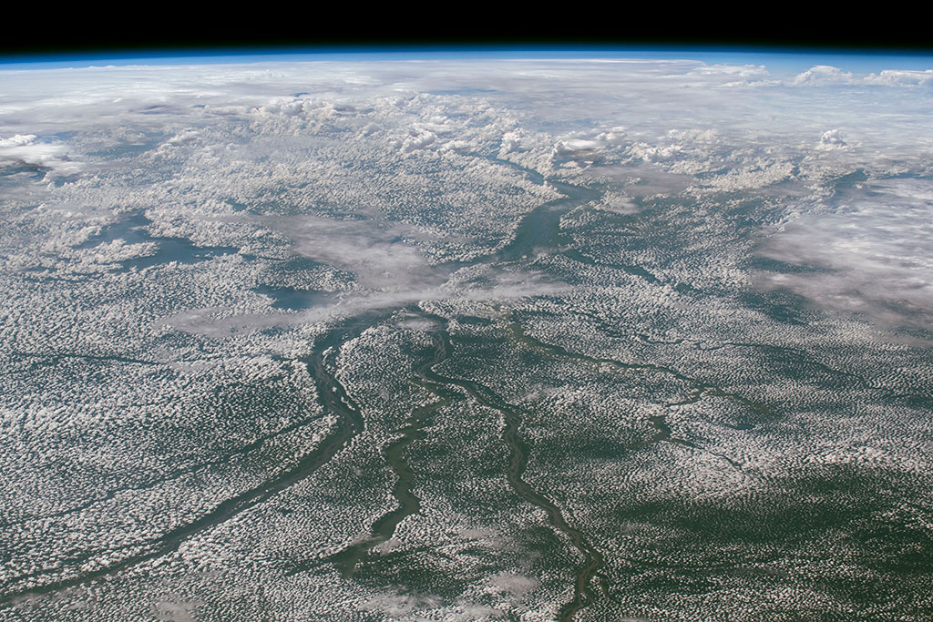
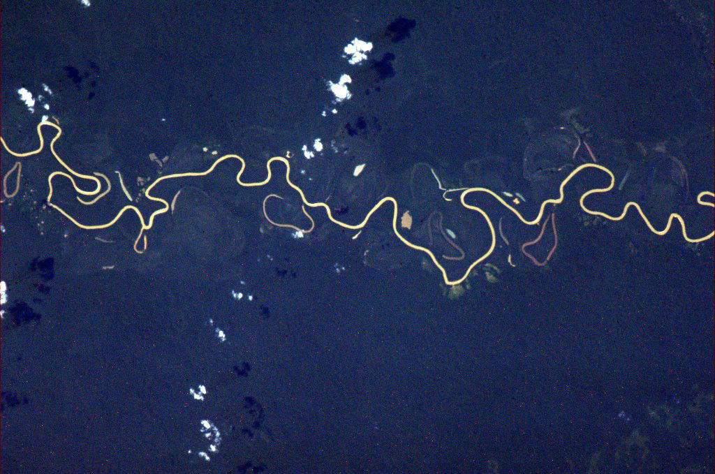
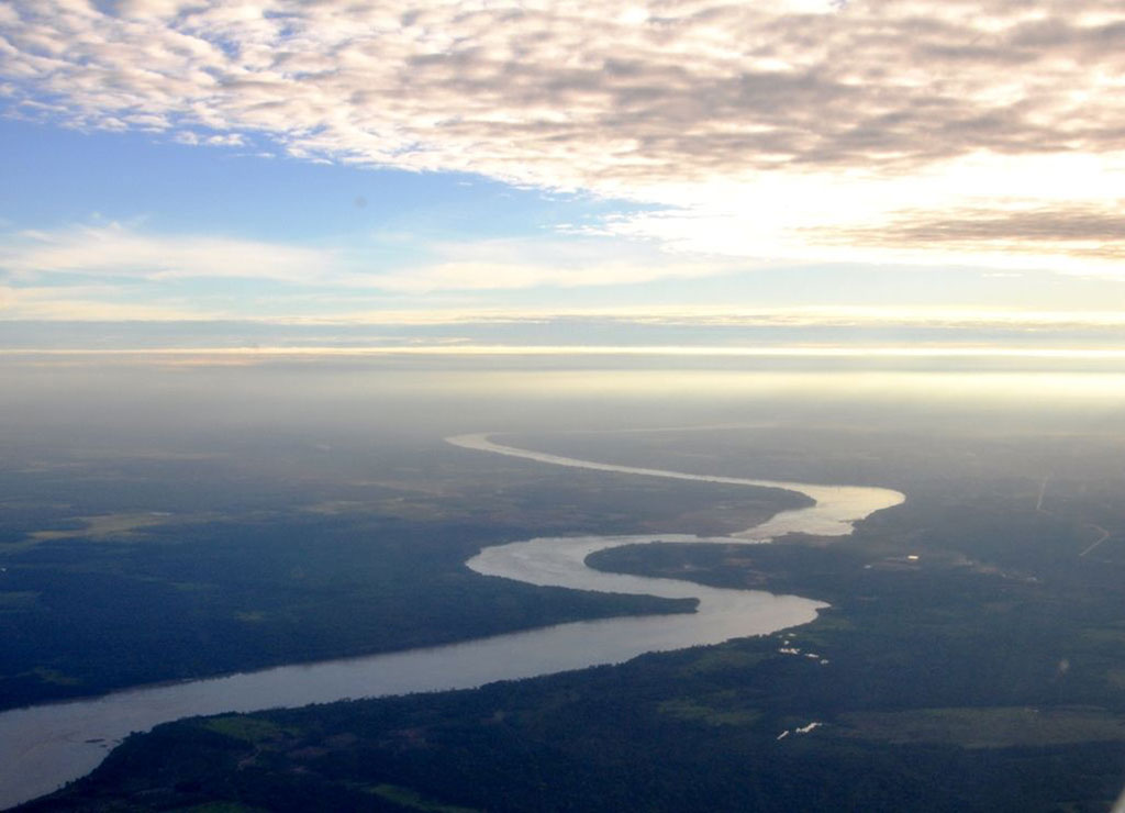
Meandering rivers: wet wanderers
The Senegal River is a 1,086 km long river meandering in West Africa. It forms the border between Senegal and Mauritania. Lake de Guiers, in Senegal, is also seen in this picture captured by David Saint-Jacques from the International Space Station. If you look closely, irrigation systems (circles) and fields (green rectangles) can be seen on the left of the lake. (Credit: Canadian Space Agency/NASA)
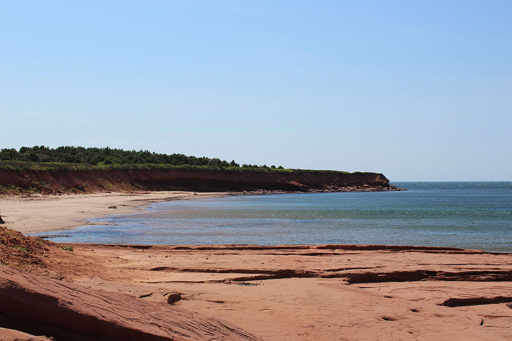
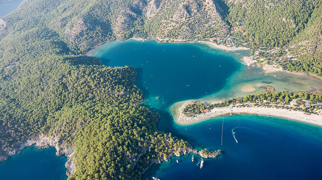
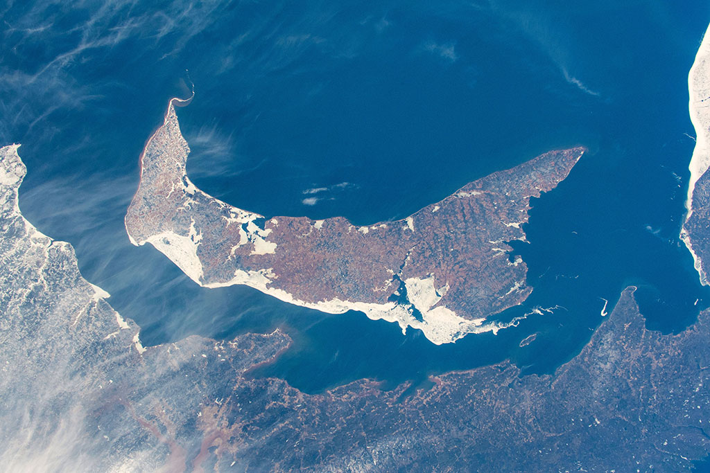
Beaches - waves of activity and life!
The 8-kilometre long Cavendish beach, in Prince Edward Island, can be seen with the cameras aboard the International Space Station. This photo was captured by Chris Hadfield in 2013. (Credit: Canadian Space Agency/Chris Hadfield)
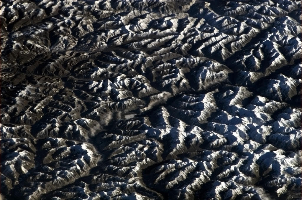
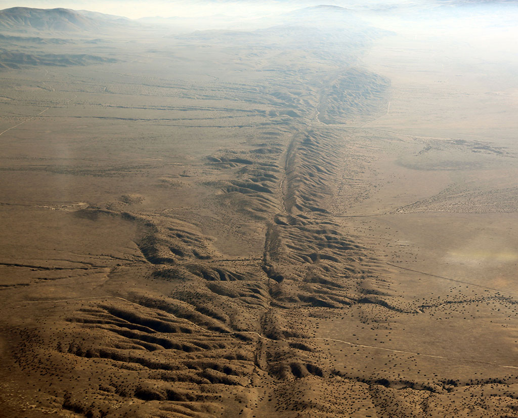
Facts about cracks!
The Rocky Mountain Trench, also known as The Valley of a Thousand Peaks, is a large valley that extends approximately 1,600 km from Montana to just south of the British Columbia-Yukon border. This picture of the southern part of the trench was taken by David Saint-Jacques aboard the International Space Station. (Credit: Canadian Space Agency/NASA)
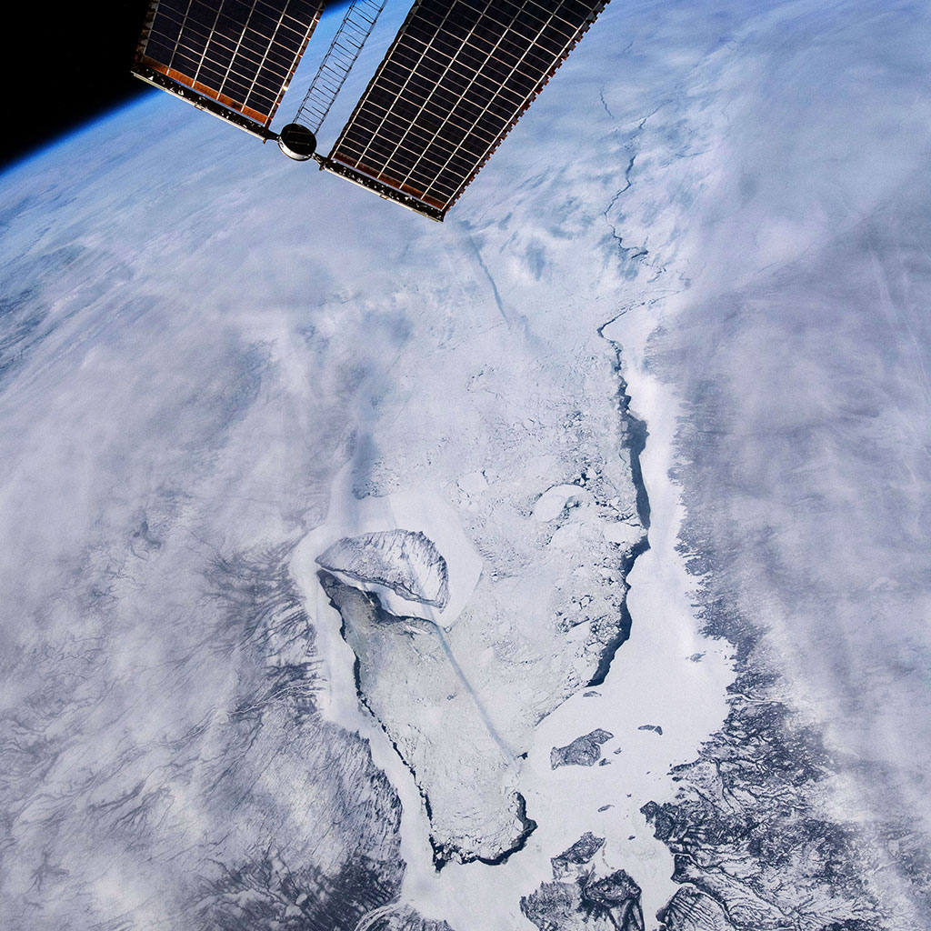
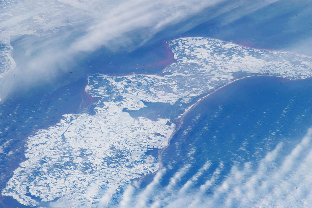
Sea ice and its ongoing disappearing act
Sea ice is taking over James Bay in this photo taken by David Saint-Jacques from the International Space Station. Akimiski Island seems on the verge of being grabbed by a giant ice hook. (Credit: Canadian Space Agency/NASA)

Chaparral biomes help us detect climate change
This photo of the western tip of Australia, where chaparral biomes can be found, was taken from the International Space Station by David Saint-Jacques. (Credit: Canadian Space Agency/NASA)
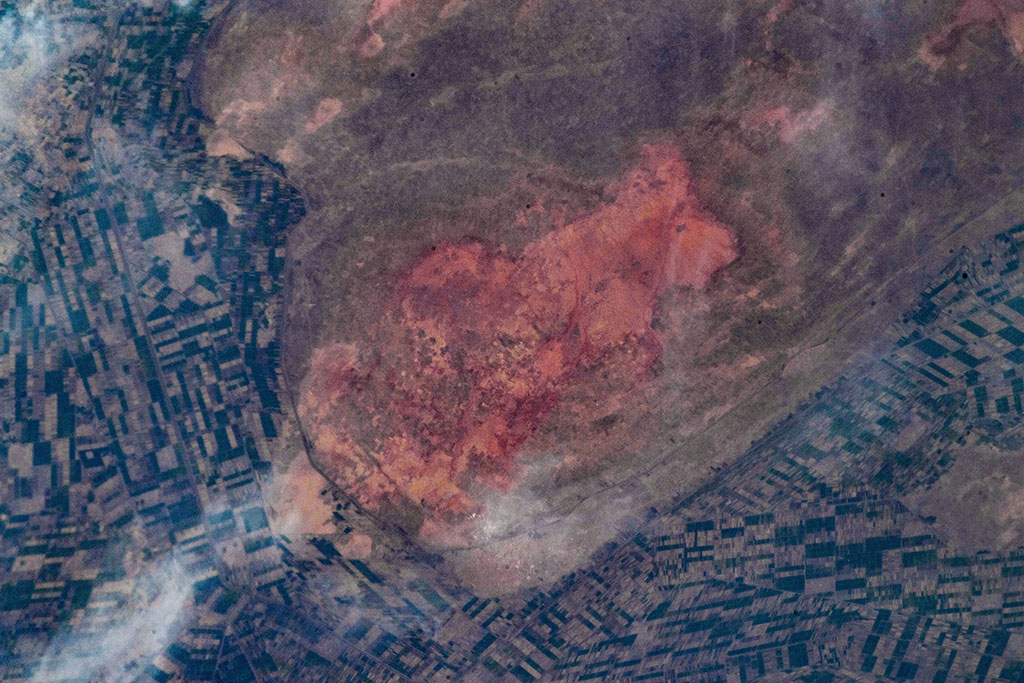
The Great Green Wall - fighting desertification
This photo of Kinanah, Sudan, was taken by David Saint-Jacques from the International Space Station. (Credit: Canadian Space Agency/NASA)
Urbanization: people moving to the cities
Bamako, Mali, is one of the fastest-growing cities in the world. This photo was taken from the International Space Station by David Saint-Jacques. (Credit: Canadian Space Agency/NASA)
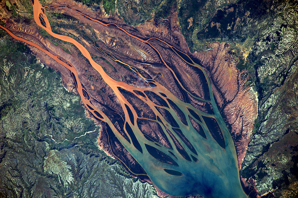
Braided rivers: when a river channel multiplies
Picture of the Betsiboka River in Madagascar, taken by French astronaut Thomas Pesquet from the International Space Station. (Credit: European Space Agency/NASA)

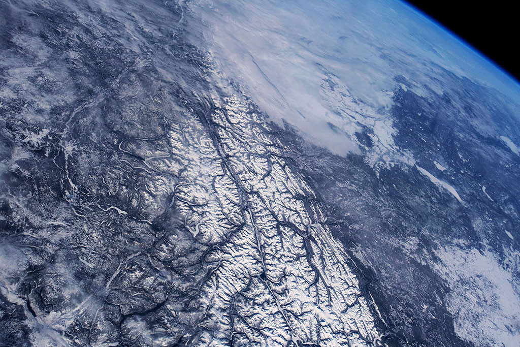
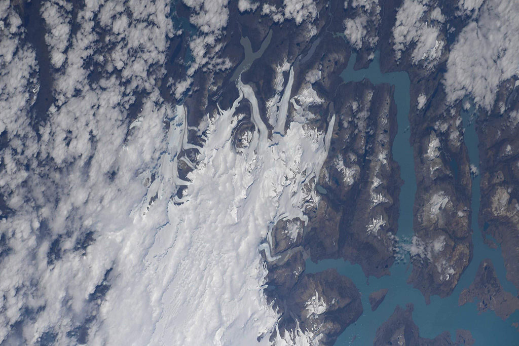
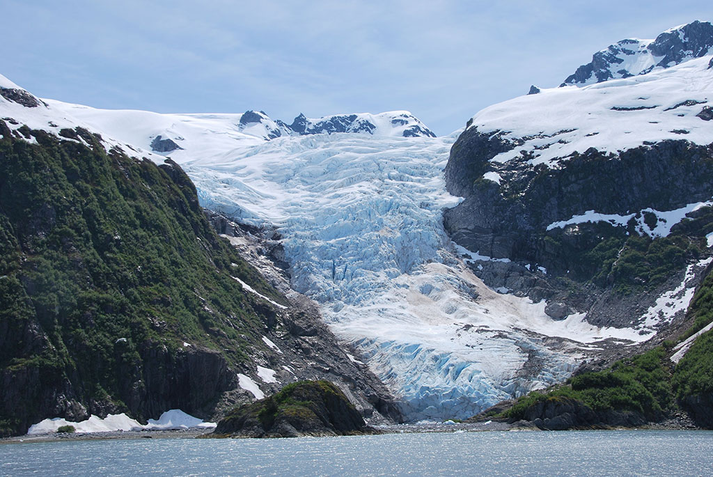
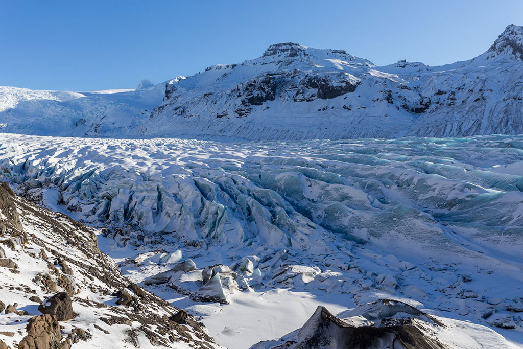
Glaciers: When the ice flows
Giant glacier fields of Southern Chile, like tongues of ice snaking down valleys. This photo was taken by David Saint-Jacques from the International Space Station. (Credit: Canadian Space Agency/NASA)
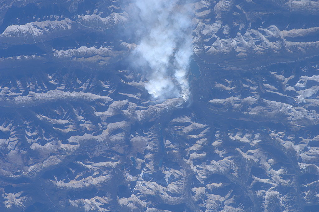
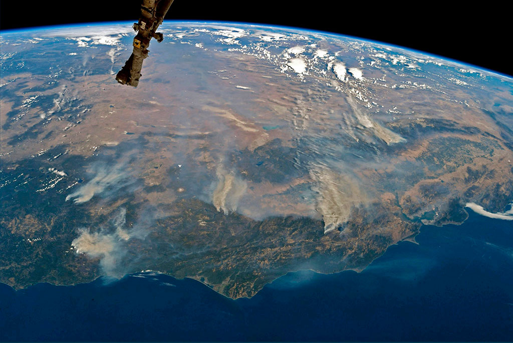
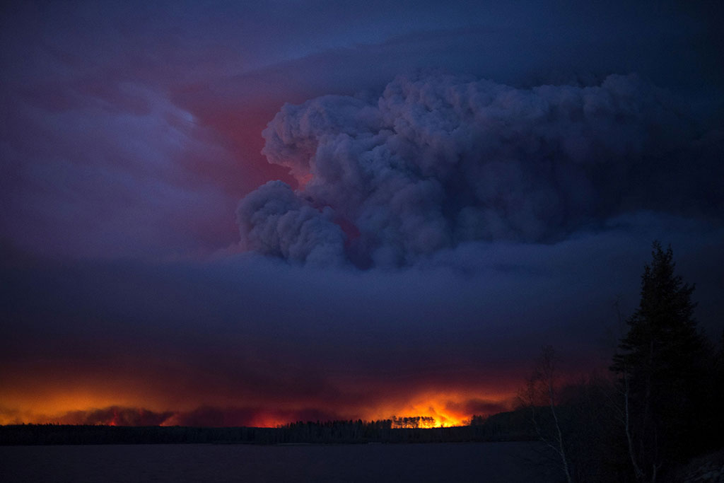
Wildfires – signs of a changing climate
This roiling plume of smoke, a fire set in the mountains near Canmore, Alberta, was taken by Canadian Space Agency Astronaut Bob Thirsk from the International Space Station. Strong winds had pushed the smoke towards areas of Calgary and Cochrane, generating concern among its citizens. Alberta Health Services has issued a precautionary smoke advisory for Bragg Creek, Canmore, Springbank, Cochrane and Calgary. (Credit: NASA)

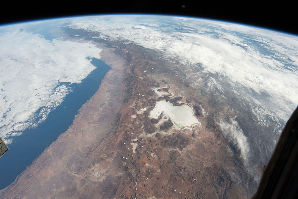
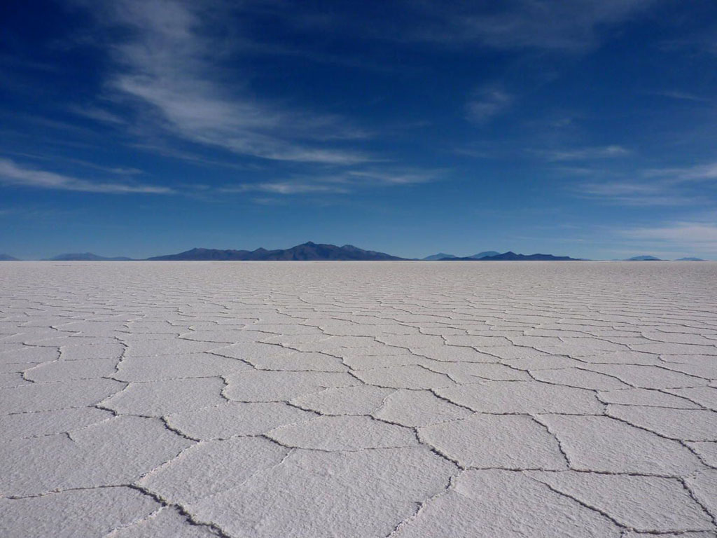
Salt pans: all dried up!
What appears in the centre of this photo taken by David Saint-Jacques from the International Space Station are not lakes, but the Uyuni Salt Flat, in Bolivia. (Credit: Canadian Space Agency/NASA)
From coast to coast to coast - Canada's oceans
Vancouver Island and the coast of the Pacific Ocean appear on this photo taken by David Saint-Jacques from the International Space Station. (Credit: Canadian Space Agency/NASA)
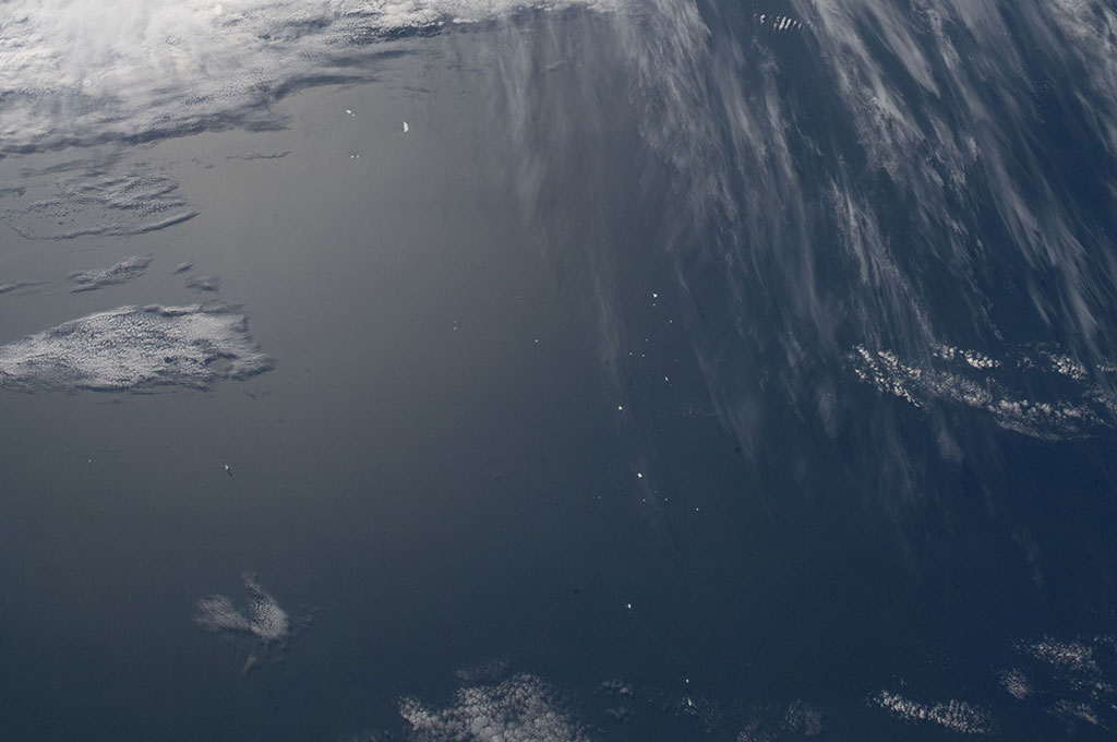
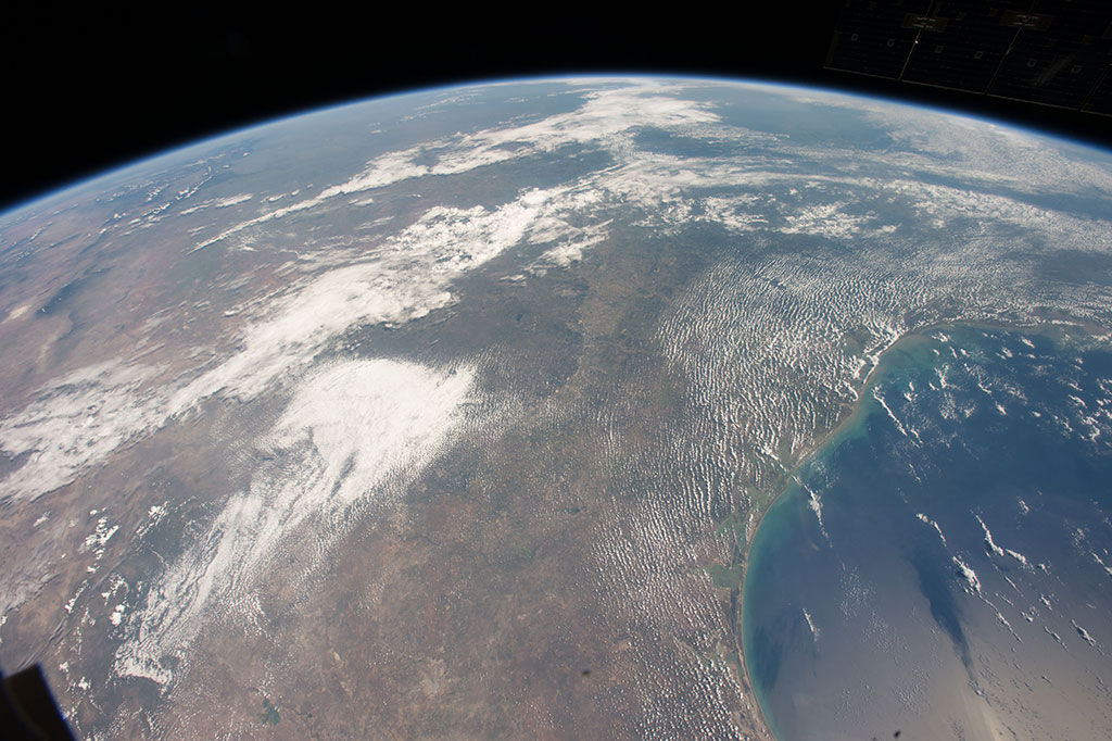
Boom! Clap!
The tiny white dots that we see through the clouds in this photo taken from the International Space Station are actually thunderstorms over Africa. (Credit: NASA)
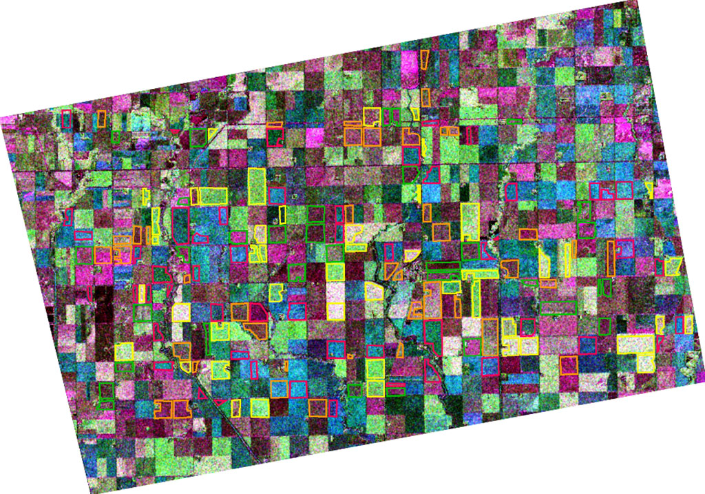
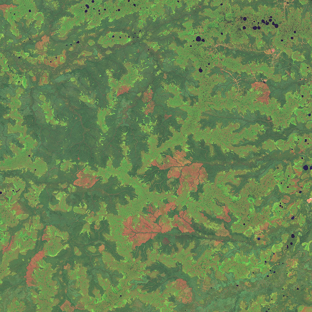
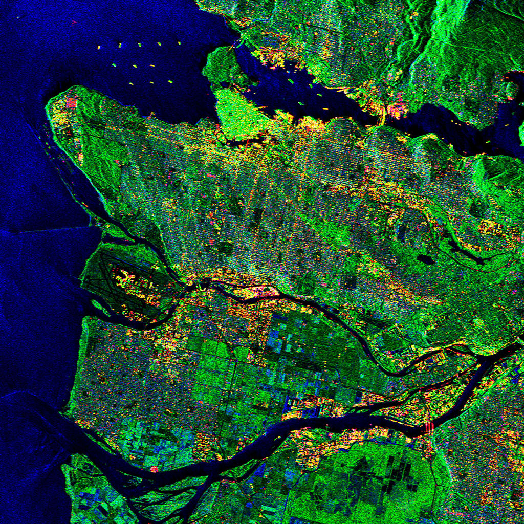
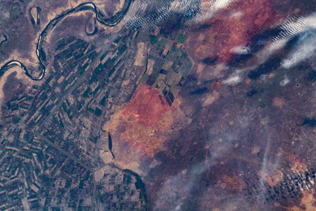
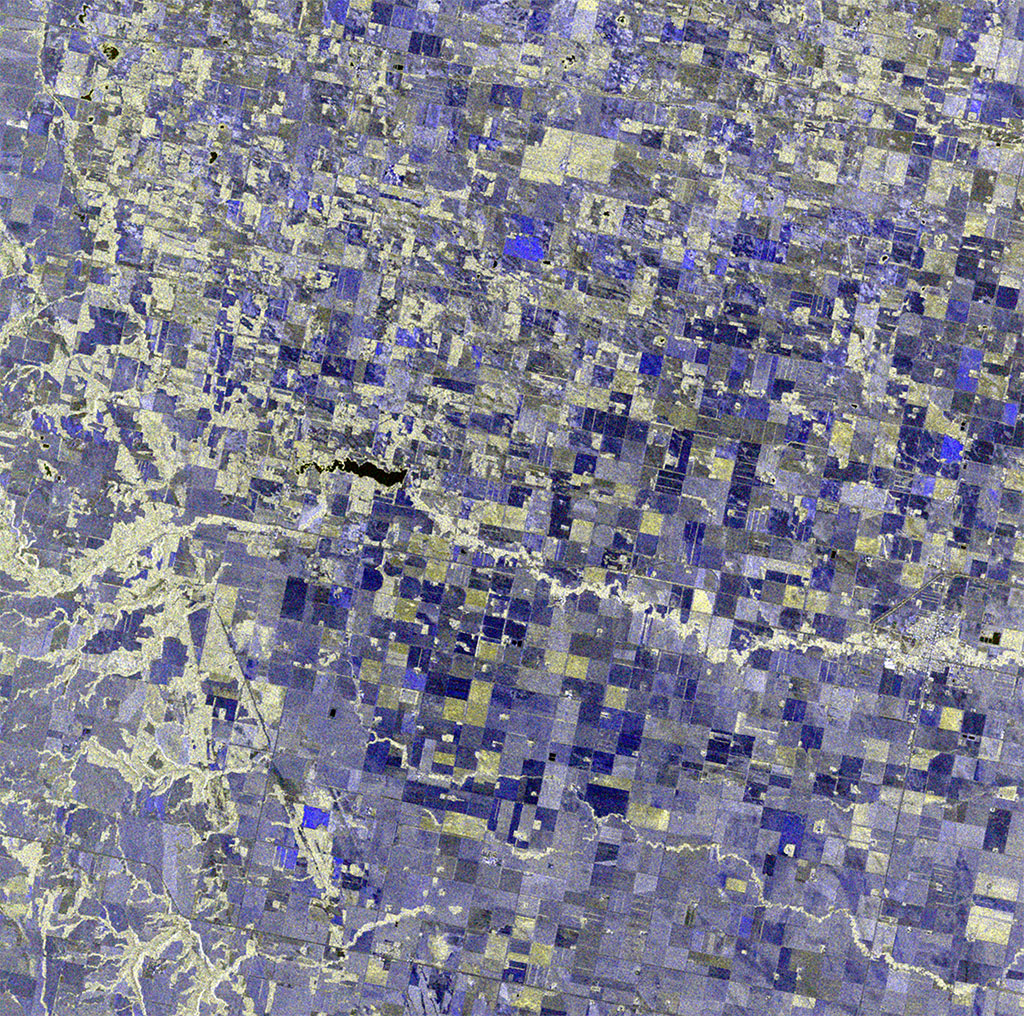
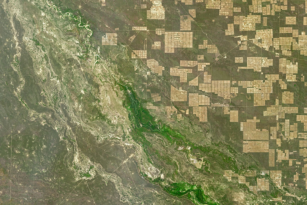
From farm to table
RADARSAT-2 image of farmland near Carman, Manitoba. Different crops respond differently to waves sent by the satellite's radar. This is represented in the map by different colours. Major crop types are identified using coloured outlines with yellow representing canola fields, orange representing soybean fields, green representing corn fields, and red representing wheat fields. (Credit: Map courtesy of Dr. Jiali Shang, Agriculture and Agri-Food Canada. RADARSAT-2 Data and Products © MacDonald, Dettwiler and Associates Ltd. (2009) – All rights reserved. RADARSAT is an official trademark of the Canadian Space Agency)
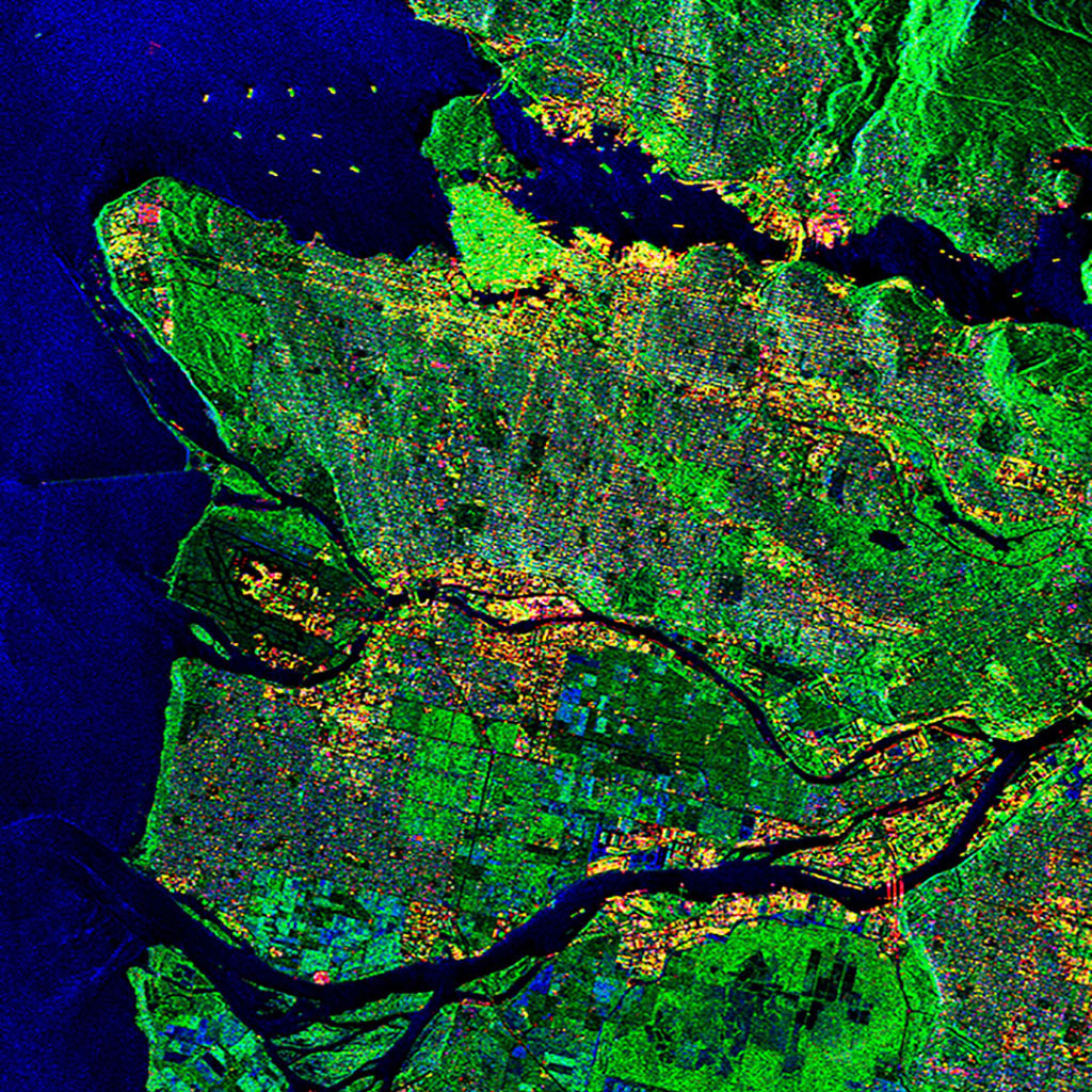
Deforestation - the permanent destruction of forests
This composite image of the western Amazon in Brazil clearly shows the difference between the dense unlogged section of the forest and the more developed, less dense section of forest. The radar sensor of Canada's RADARSAT-2 satellite is ideal for monitoring cloud-covered tropical regions as it can image through clouds and in any weather conditions. It can help detect illegal logging, including clear cuts as well as selective deforestation. (Credit: RADARSAT-2 Data and Products © MacDonald, Dettwiler and Associates Ltd. (2013) – All rights reserved. RADARSAT is an official trademark of the Canadian Space Agency)
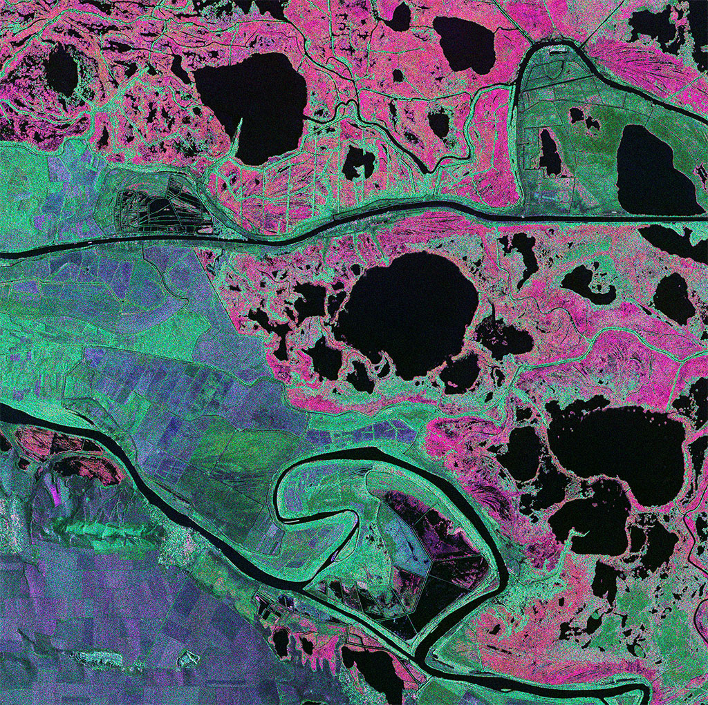
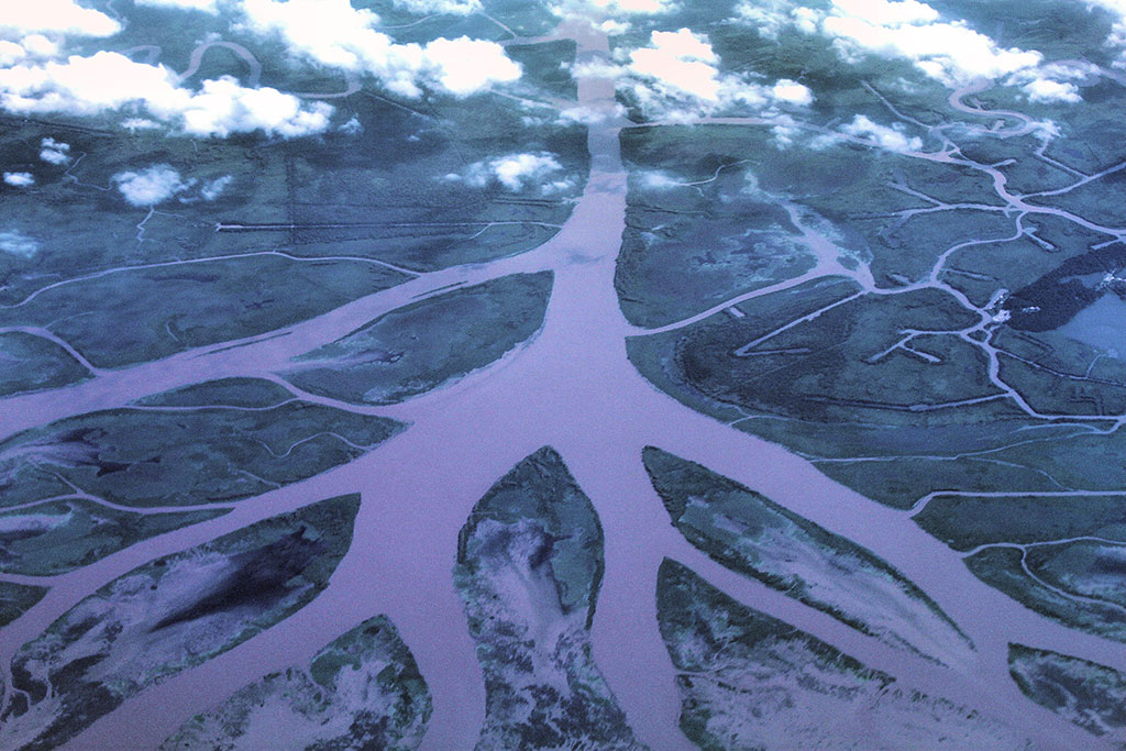
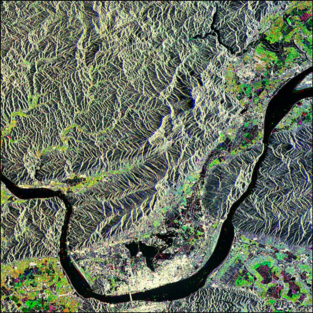
Wetlands are a superpower ecosystem
The Danube Delta is the second largest river delta in Europe, situated on the Romanian border with the Ukraine. This composite image from Canada's RADARSAT-2 satellite shows an interesting combination of agriculture and wetlands. A clearly defined, dark canal bisects the image, while high water levels in the marsh land clearly show as pink. Agricultural areas are displayed in variations of green and purple. (Credit: RADARSAT-2 Data and Products © MacDonald, Dettwiler and Associates Ltd. 2013 – All rights reserved. RADARSAT is an official trademark of the Canadian Space Agency)
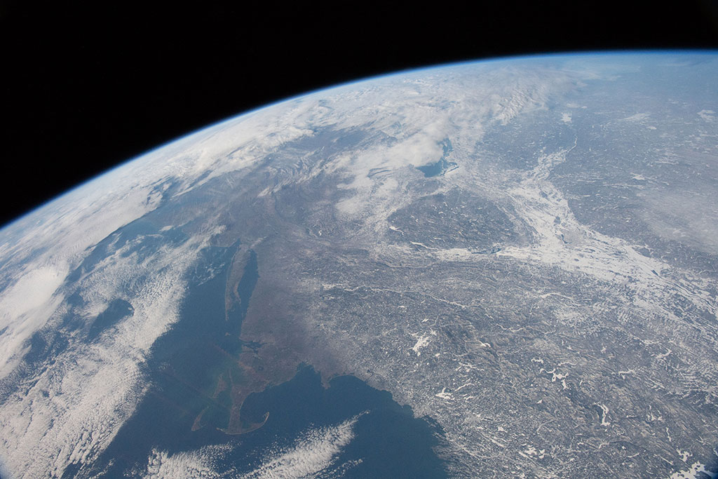
Let it snow, let it snow, let it snow...
Snowpacks are found in cold areas, such as the Arctic and Antarctica, and on mountains like the Coast Range, seen in this picture taken by David Saint-Jacques from the International Space Station. Vancouver, Victoria and the Fraser River valley are clearly visible as well. The Fraser is the longest river within British Columbia, flowing for 1,375 kilometres, into the Strait of Georgia at the city of Vancouver. (Credit: Canadian Space Agency/NASA)
Savannah - where the grass isn't always greener
The savannah covers approximately 20% or the Earth's surface. It is also the largest biome in southern Africa, occupying 46% of its area. The savannah covers over one-third of South Africa, seen in this photo taken from the International Space Station by David Saint-Jacques. More than 5700 plant species grow in the savanna biome, which is also famous for its wild animals like the lion, leopard, cheetah, elephant, giraffe, zebra and numerous birds. (Credit: Canadian Space Agency/NASA)

Lush and green rainforests
This photo of the Congo River Basin, in Central Africa, was taken by an astronaut aboard the International Space Station. It is the second biggest river basin in the world after the Amazon. It is adjacent to the Nile basin and is home to one of the richest and most diverse tropical forests on the planet. (Credit: NASA)
Lagoons: always monster free!
Laguna Colorada is a shallow salt lake in Bolivia, close to the border with Chile. It can easily be seen from space due the reddish color of its waters, caused by red sediments and pigmentation of some algae. The lake also contains borax islands, which appear white and contrast with the water. This photo was taken by David Saint-Jacques from the International Space Station. (Credit: Canadian Space Agency/NASA)
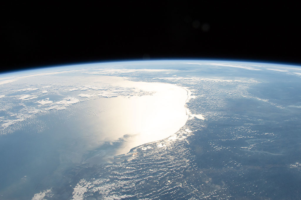
Maritime shipping - moving people and freight over water
The Atlantic Ocean waters flow through the Strait of Gibraltar, where Europe and Africa meet, into the Mediterranean Sea. Spain is to the north (top) and Morocco to the south in this photo taken from the International Space Station by David Saint-Jacques. (Credit: Canadian Space Agency/NASA)
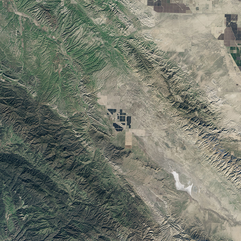
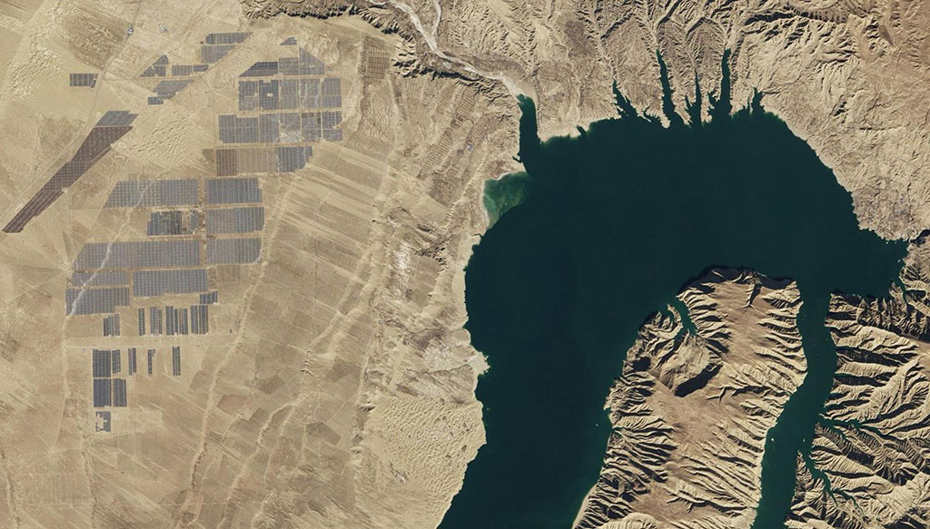
Using the sun's energy
Topaz Solar Farm, in southern California, is one of the largest photovoltaic power plants in the world. At 925.6 square kilometers, the facility is about the equivalent of 4,600 football fields. This image was captured in 2015 by the American Landsat 8 satellite. Solar arrays appear gray and charcoal. The surrounding farmland and grasslands appear brown and green. (Credit: USGS/NASA Landsat)
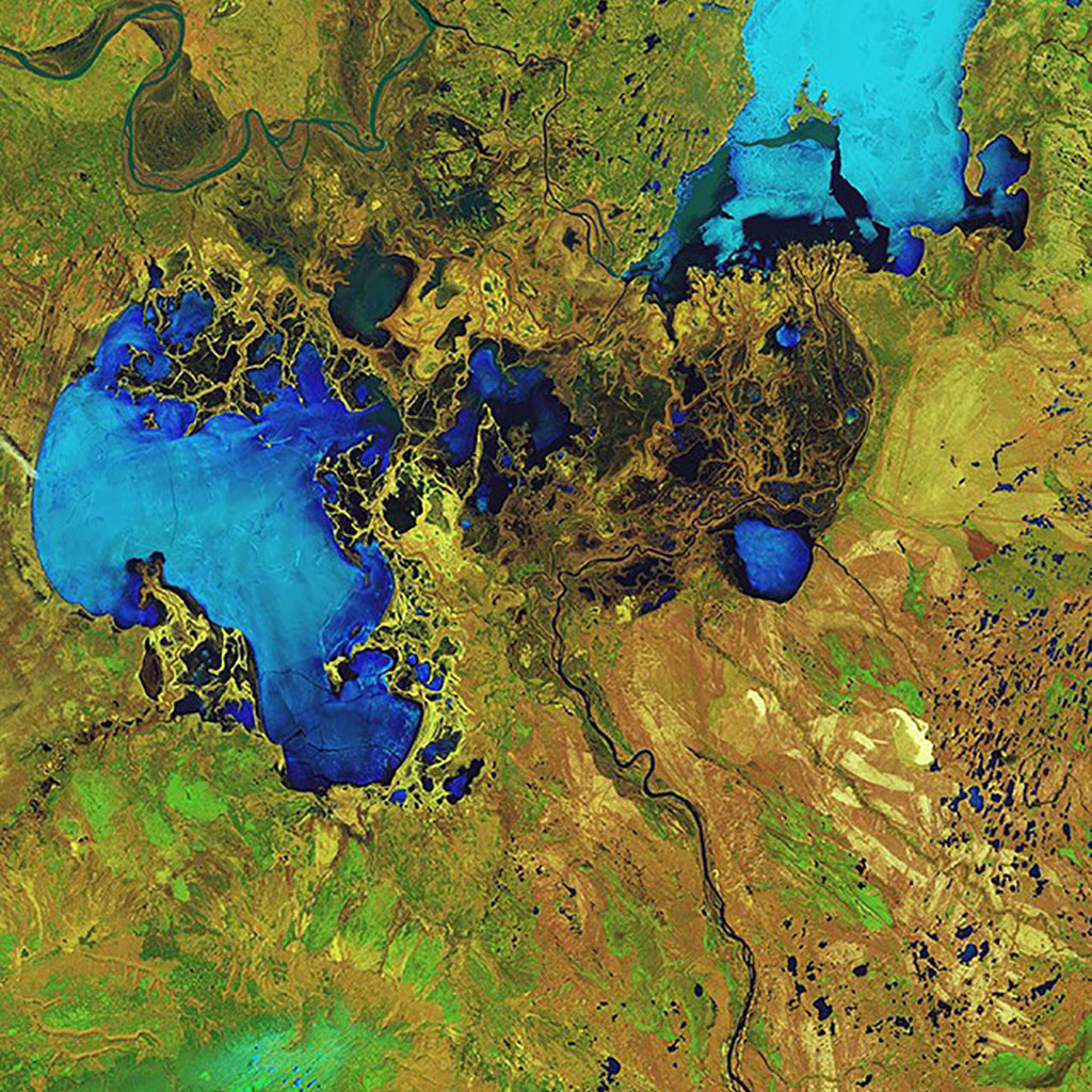
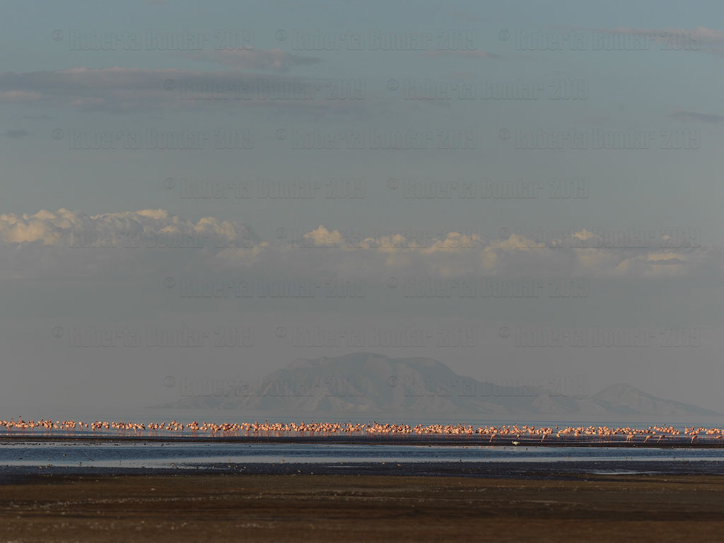
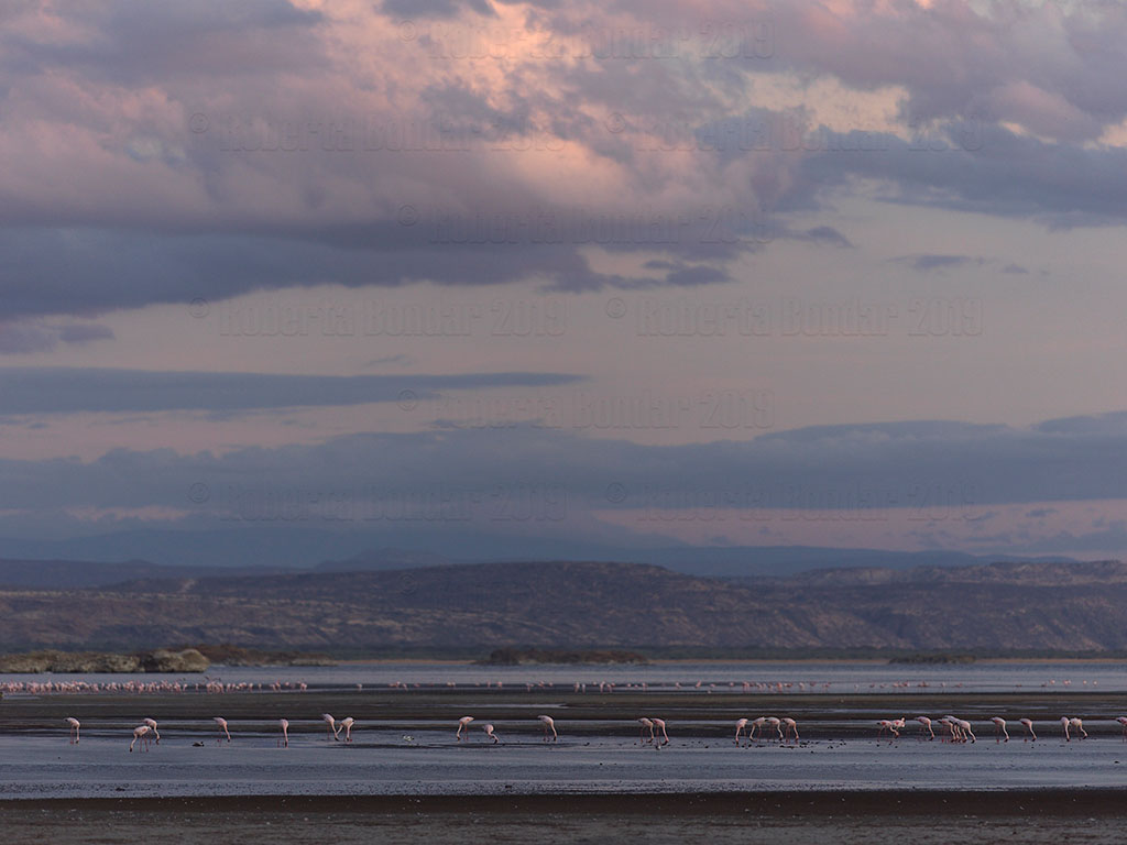
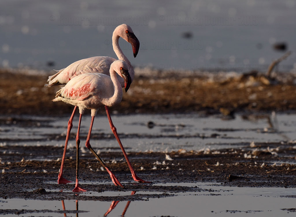
Lake of Salt and Soda: Birthplace of the Lesser Flamingo
At the bottom, just to the left of the centre of this photo, is Lake Natron in Tanzania. (Credit: NASA)

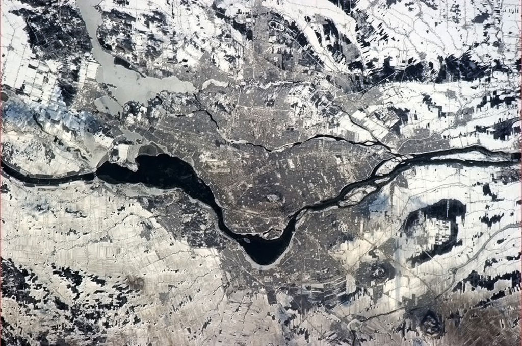
Lakes - the gems of the world
Lake Baikal is the world's deepest and oldest lake. It contains one fifth of the Earth's fresh water, which is more than all of the North American Great Lakes put together. Located in Siberia, Russia, Lake Baikal was listed as a UNESCO World Heritage Site in 1996 because of its rich and unusual water wildlife. This photo was taken by David Saint-Jacques from the International Space Station. (Credit: Canadian Space Agency/NASA)
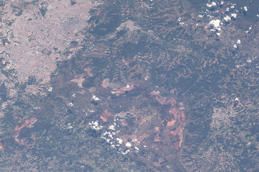
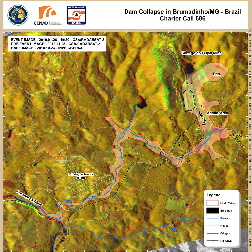
Landslides - the biggest and fastest slides on Earth!
On January 25, a tailings dam collapsed at an iron ore mining site in the town of Brumadinho in southeastern Brazil. This photo of the area was taken by an astronaut aboard the International Space Station on February 2, 2019. The landslide is visible in the bottom right corner. (Credit: NASA)

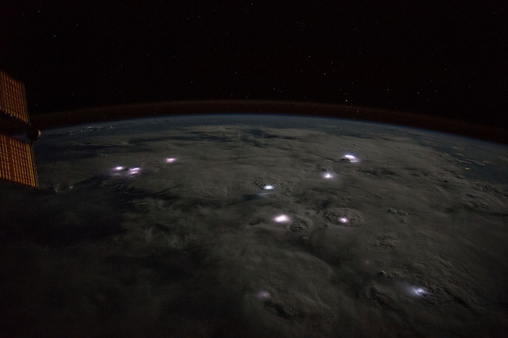
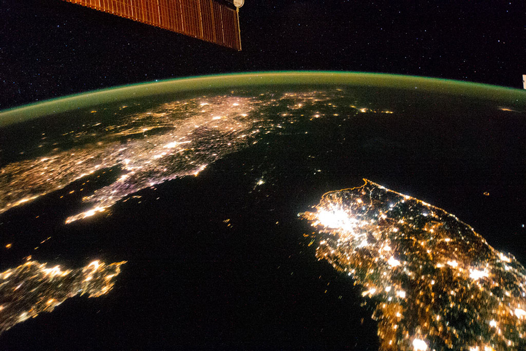
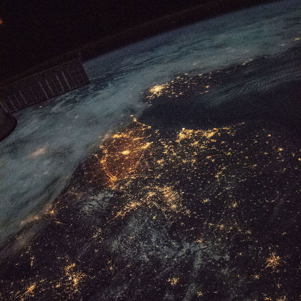
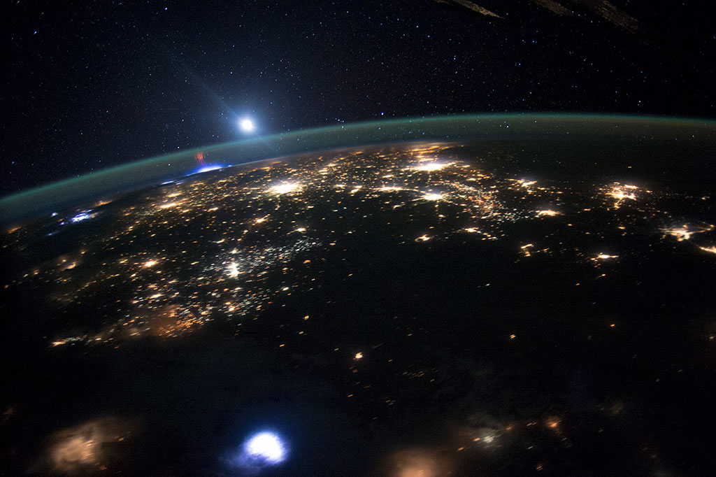
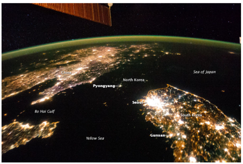
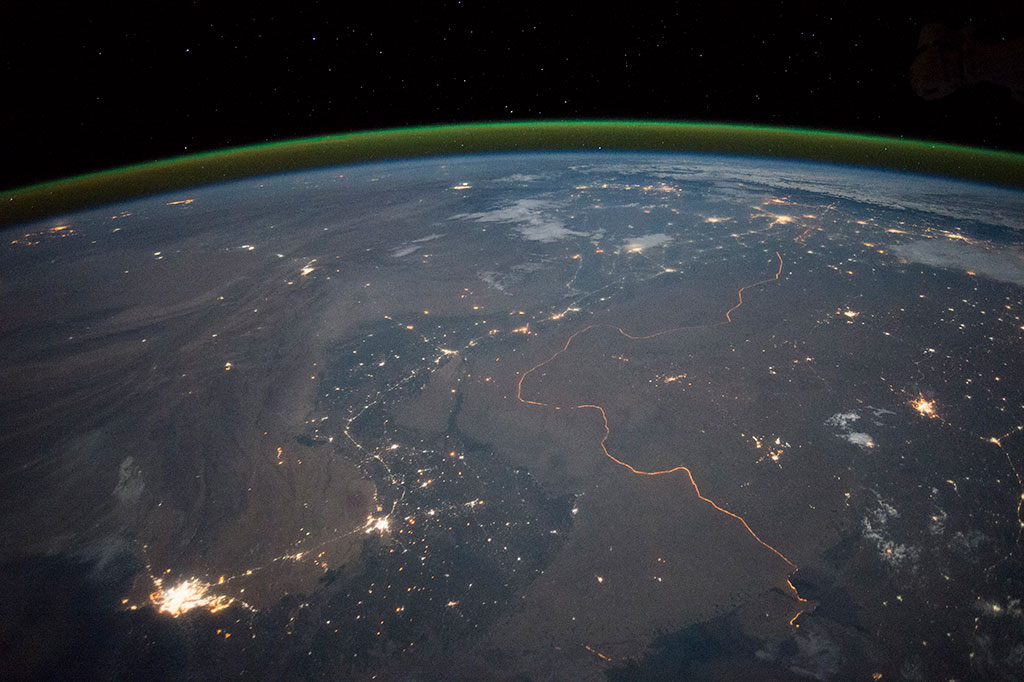
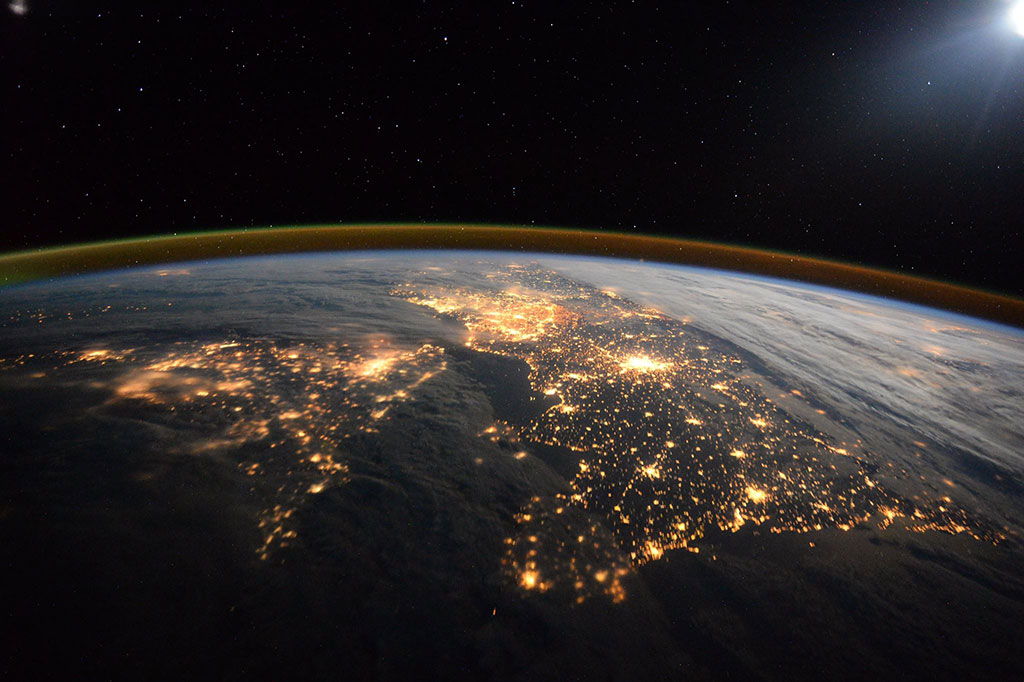
Borders, are they visible from space?
North Korea appears almost fully blacked out between China (top left) and South Korea (bottom right) in this night image of the Korean Peninsula taken by an astronaut aboard the International Space Station 2014. The capital city, Pyongyang, is the dot of light visible in the center. The countries' borders are so dark they are almost indistinguishable from the Yellow Sea and Sea of Japan on either side. (Credit: NASA)
Fishing: Canada's coastal industry
The tiny white dots on this photo taken by Dutch astronaut Andre Kuipers from the International Space Station are fishing boats on the coastline of Vietnam. (Credit: European Space Agency/NASA)
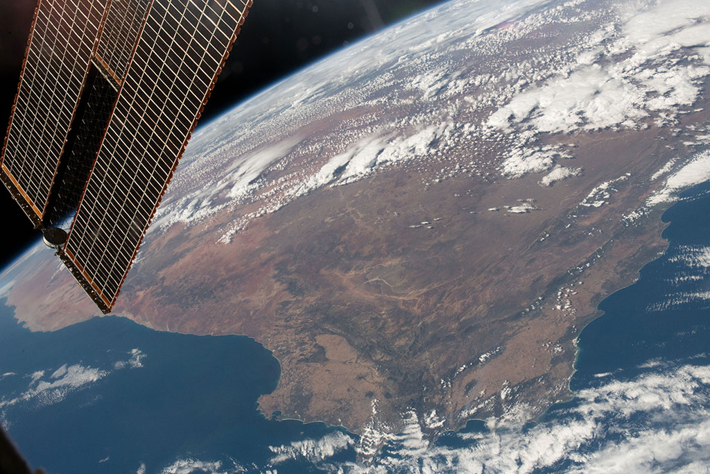
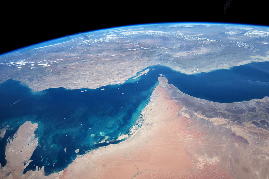
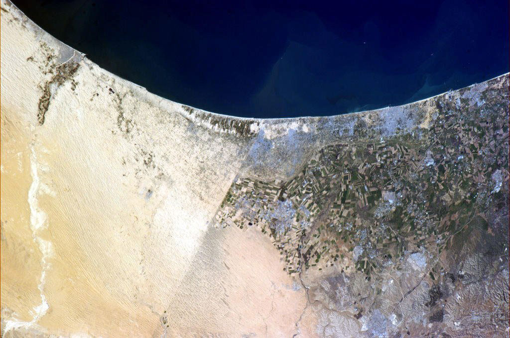
Peninsulas, the “almost islands”
At more than three million square kilometres, the Arabian Peninsula is the largest peninsula in the world. This photo was taken by David Saint-Jacques from the International Space Station. (Credit: Canadian Space Agency/NASA)

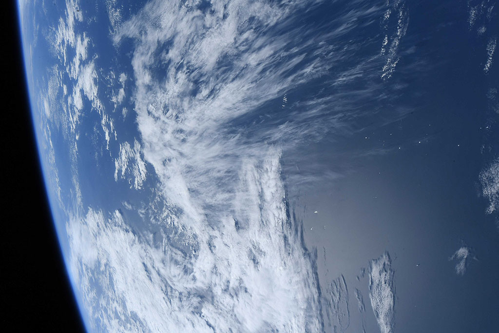
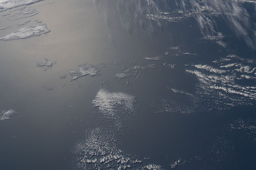
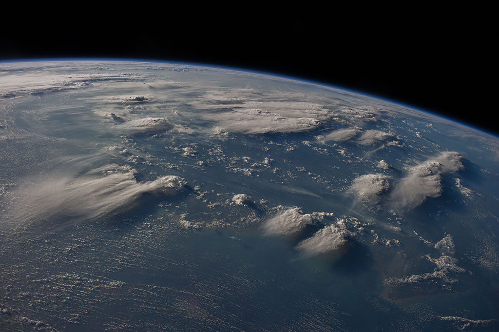
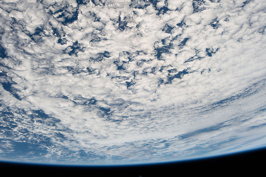
Clouds: wonders of the atmosphere
David Saint-Jacques took this photo of clouds from the International Space Station. How different do you think they looked from the ground? (Credit: Canadian Space Agency/NASA)

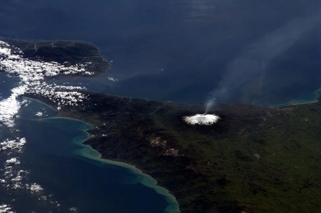
Why does the Earth suddenly shake?
Situated on the western fringes of the Pacific Ring of Fire, the Philippines experiences frequent seismic and volcanic activity. Around 20 earthquakes are registered daily, though most are too weak to be felt. The last major earthquakes were in April 2019 (magnitude 6.3 and 6.1) and in 1990 (magnitude 7.7). (Credit: Canadian Space Agency/NASA)
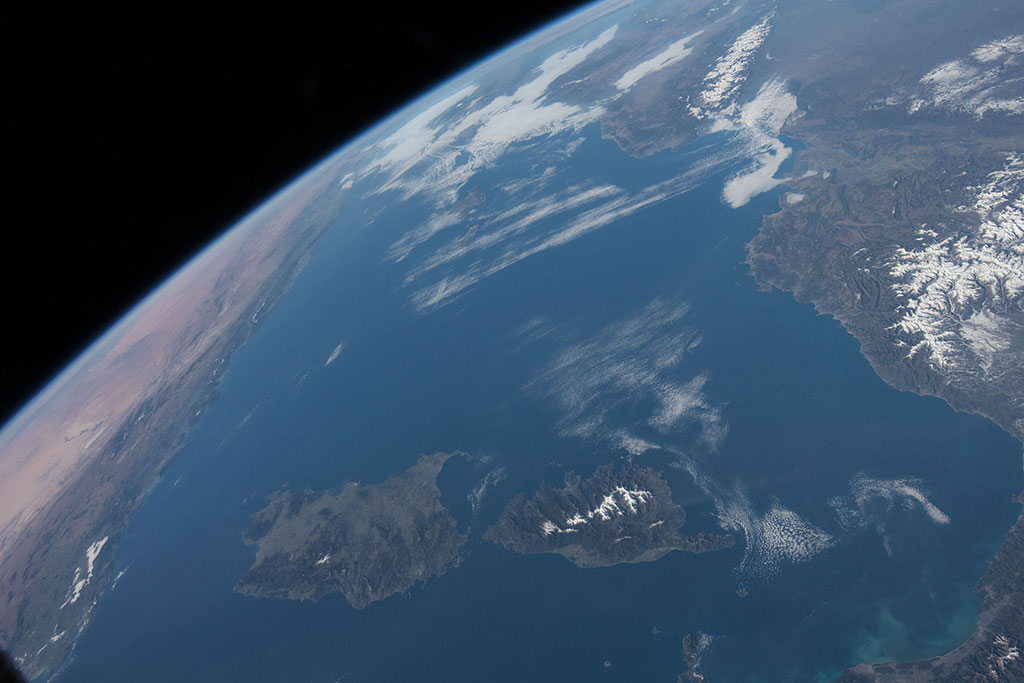
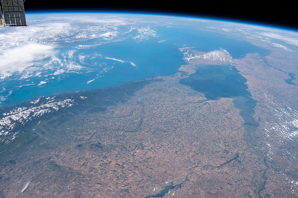
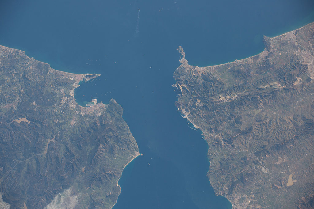
What is a strait anyway?
The Strait of Bonifacio is the strait between Corsica and Sardinia. This photo was taken by David Saint-Jacques from the International Space Station. (Credit: Canadian Space Agency/NASA)

How can you fold a mountainside?
The Pennsylvania Salient is the giant curve in the Appalachian Mountains seen in this photo captured by David Saint-Jacques from the International Space Station. (Credit: Canadian Space Agency/NASA)
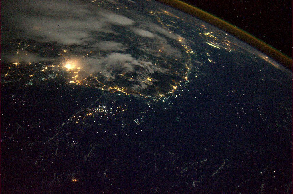
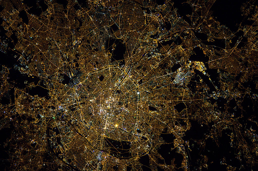
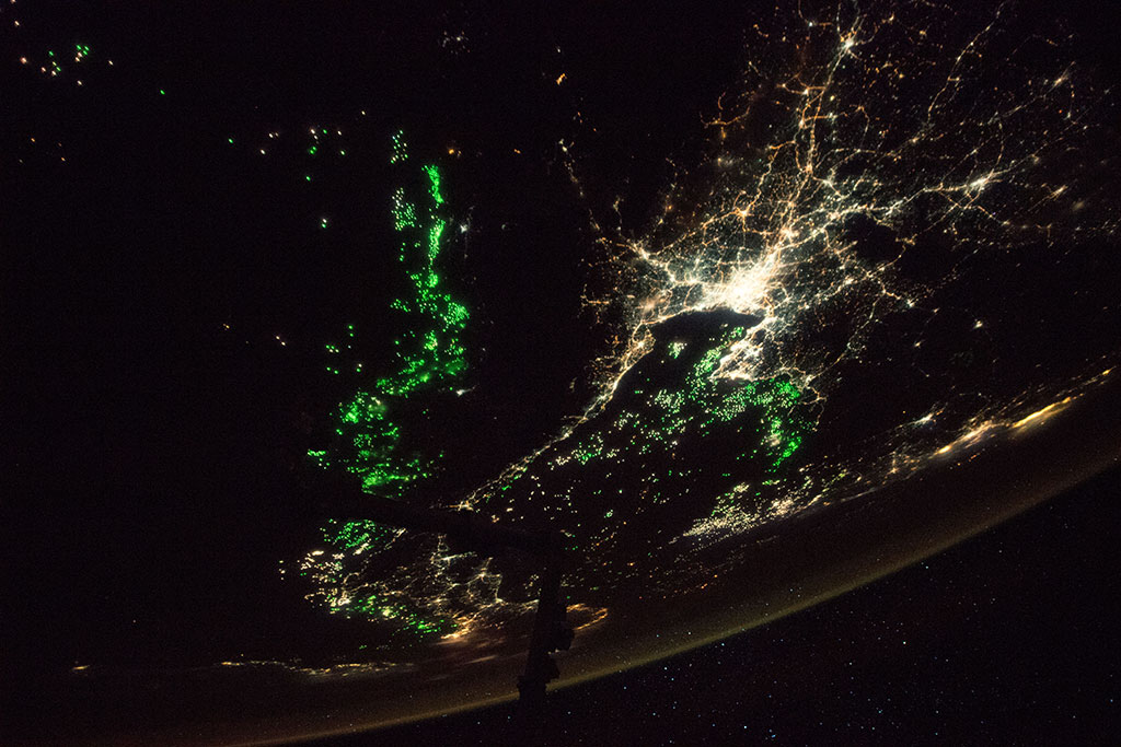
Hit the road!
A web of roads and highways is clearly visible in this nighttime photo of Paris taken by French astronaut Thomas Pesquet from aboard the International Space Station. (Credit: European Space Agency)
Forecasting space weather helps to keep lights on
The Robert-Bourassa generating station is the main facility of the James Bay hydroelectric project, a large hydroelectric complex built on the La Grande River. It is Canada's largest hydroelectric power station and its spillway and powerline paths are visible from space as shown in this picture taken by David Saint-Jacques from the International Space Station. (Credit: Canadian Space Agency/NASA)
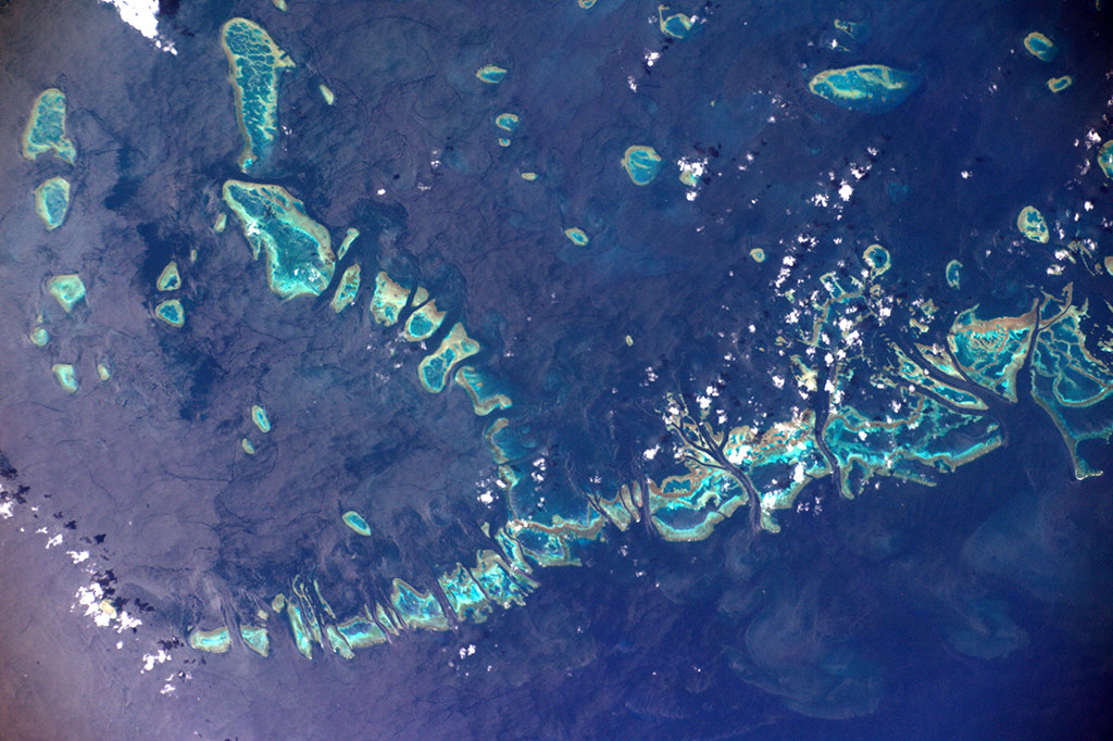
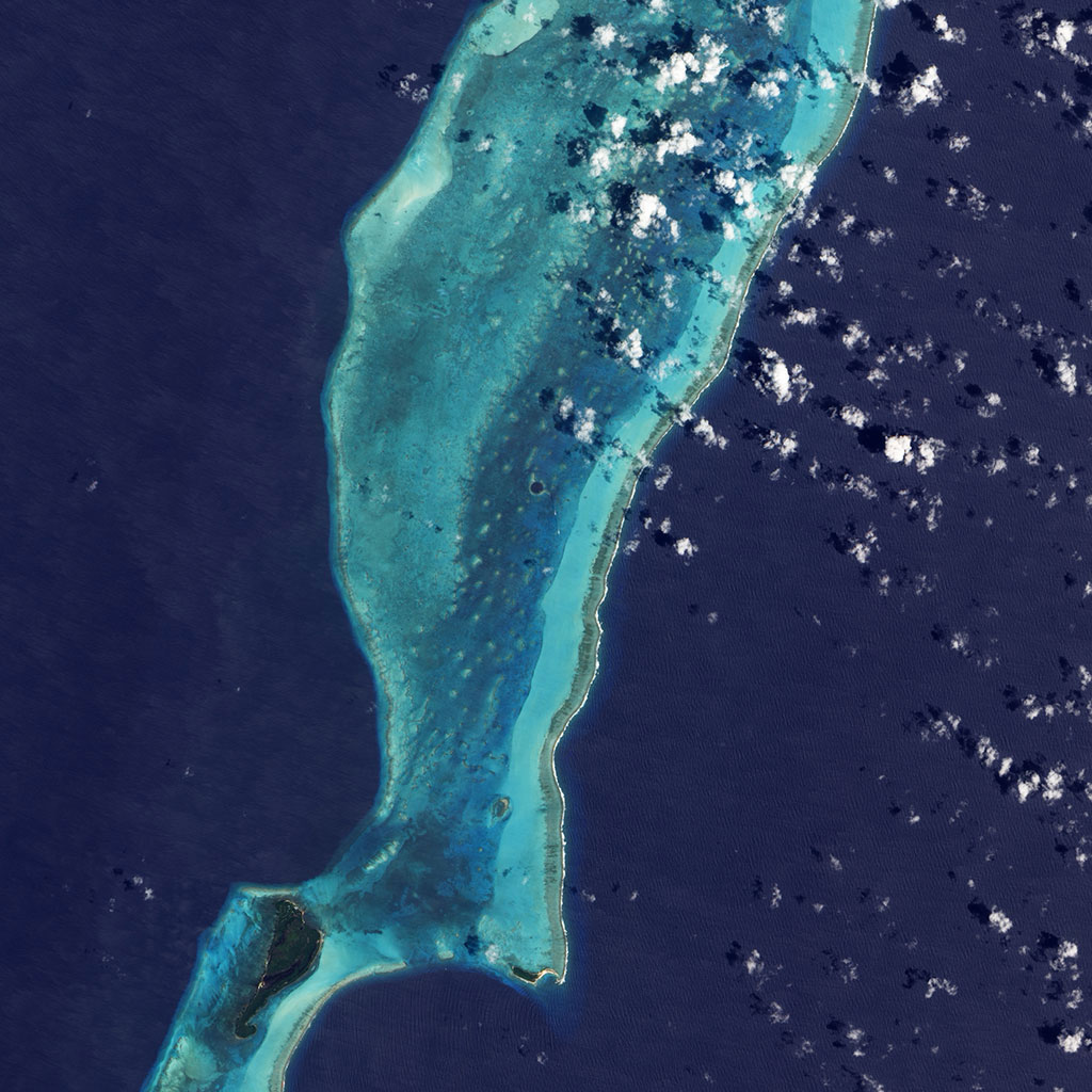
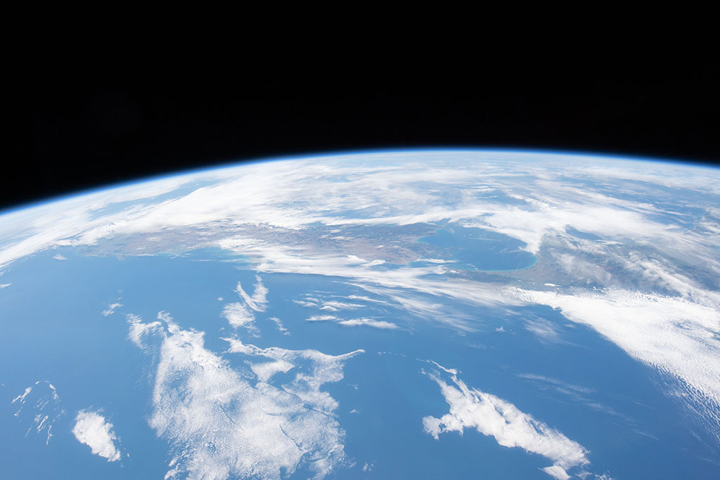
Take a plunge to see the coral reefs
The Great Barrier Reef, a UNESCO World Heritage Site, is the world\'s largest coral reef system composed of over 2,900 individual reefs and 900 islands stretching for over 2,300 kilometres, off the coast of Australia. This photo was taken by French astronaut Thomas Pesquet from the International Space Station. (Credit: European Space Agency)
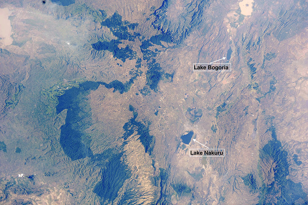
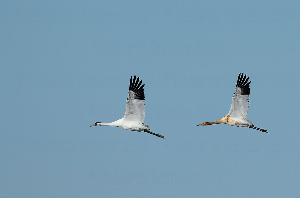
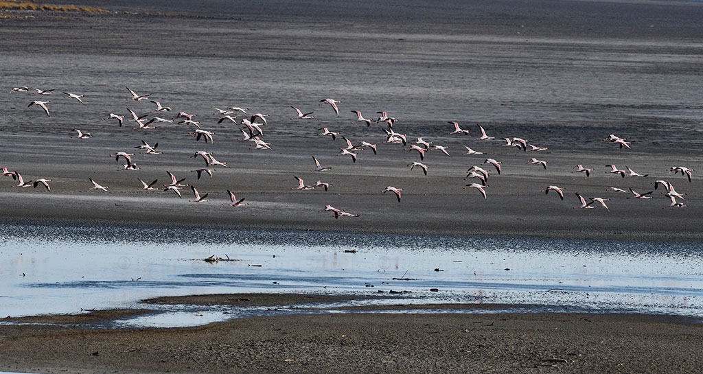
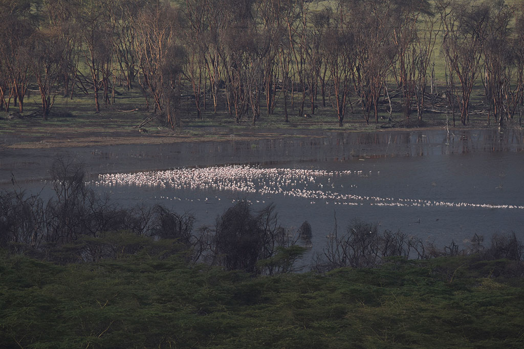
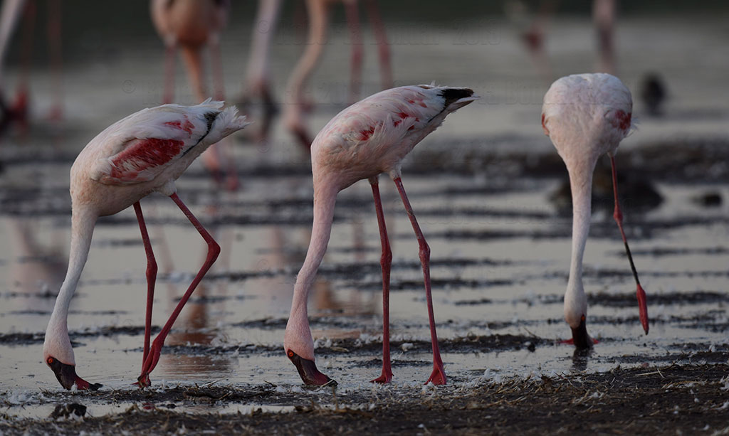
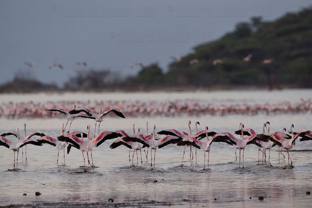
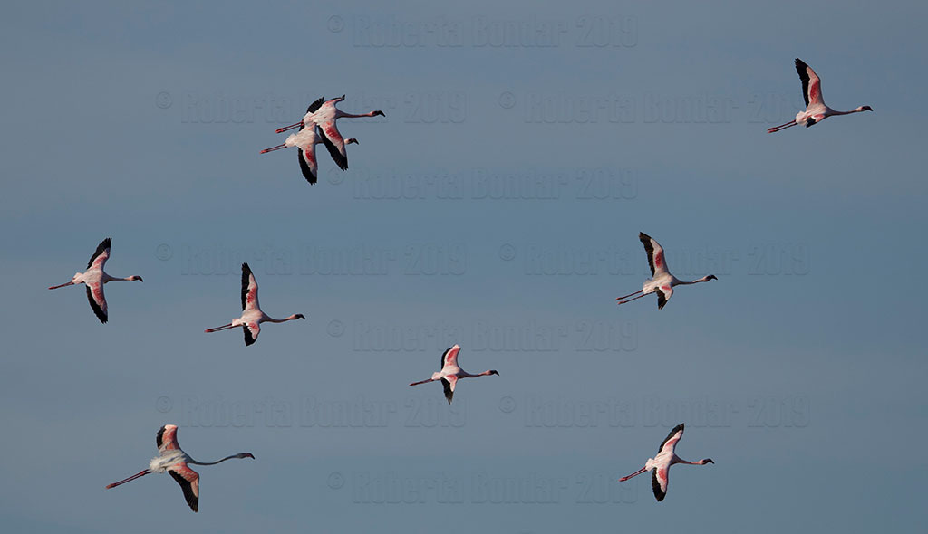
Rift Valley Lakes: Lesser Flamingo Hangouts
Lesser Flamingo feeding and resting habitats in the Rift Valley Lakes, Kenya. (Credit: NASA)
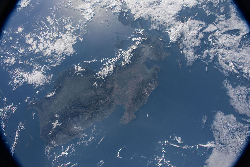
Tropical forests can be dry too!
Baobabs are trees that store water in their distinctive large trunks to get through the dry season. There are nine different species, six of which are only found in Madagascar, the island shown in this photo captured by David Saint-Jacques from the International Space Station. (Credit: Canadian Space Agency/NASA)
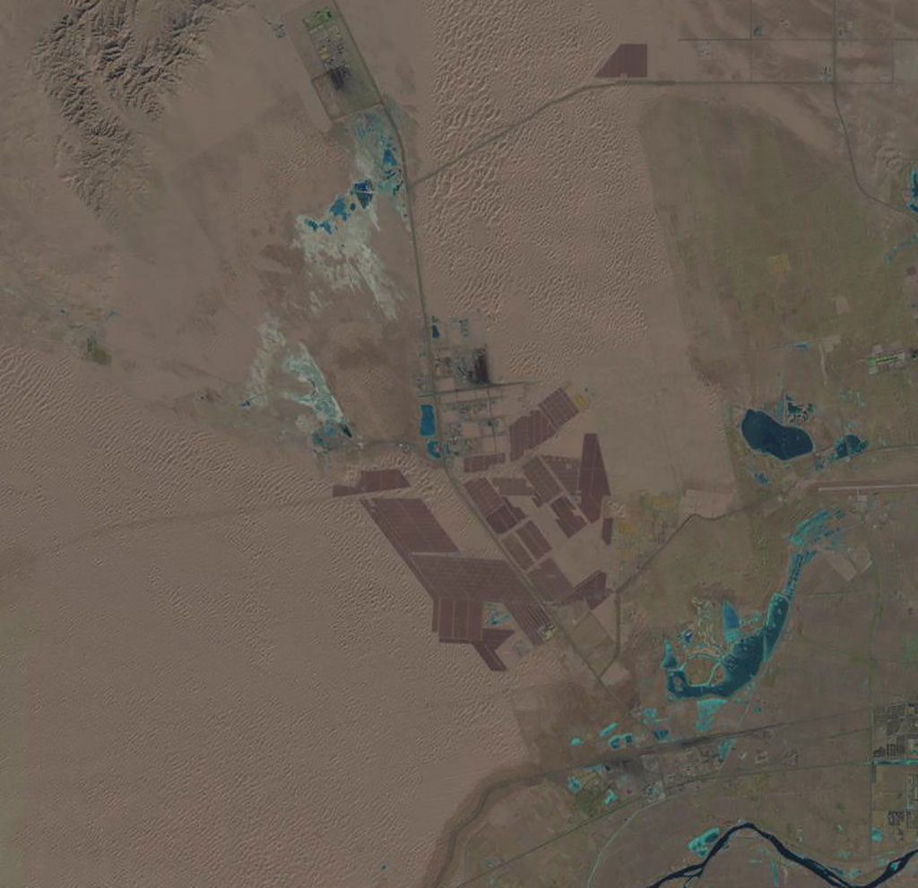
Monitoring oil use from space
The lower half of this Landsat-8 satellite image shows the Athabasca oil sands, in Alberta. It is the world's largest known reservoir of crude bitumen. (Credit: USGS/European Space Agency)
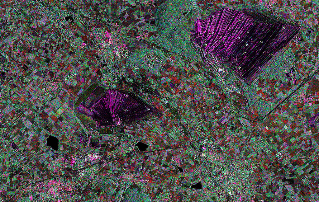
Mining: digging for Earth's buried treasure
The Tagebau Hambach lignite mine in Germany dominates the top of this RADARSAT-2 image. Satellites like RADARSAT-2 are used by the mining industry to monitor ground movements. (Credit: RADARSAT-2 Data and Products © MacDonald, Dettwiler and Associates Ltd. 2013 – All Rights Reserved. RADARSAT is an official mark of the Canadian Space Agency)
Home of the mighty maple tree!
North America's Eastern Deciduous Forest ecosystem stretches over 26 American states, from Florida up to New England, and southern Canada. This photo of North Carolina taken by David Saint-Jacques from the International Space Station. (Credit: Canadian Space Agency/NASA)
Behold the awesome power of water!
Victoria Falls, at the border of Zambia and Zimbabwe, is very hard to spot from space eventhough it is roughly twice the height of Niagara Falls. French astronaut Thomas Pesquet was able to capture this photo from the International Space Station. (Credit: Thomas Pesquet/European Space Agency)
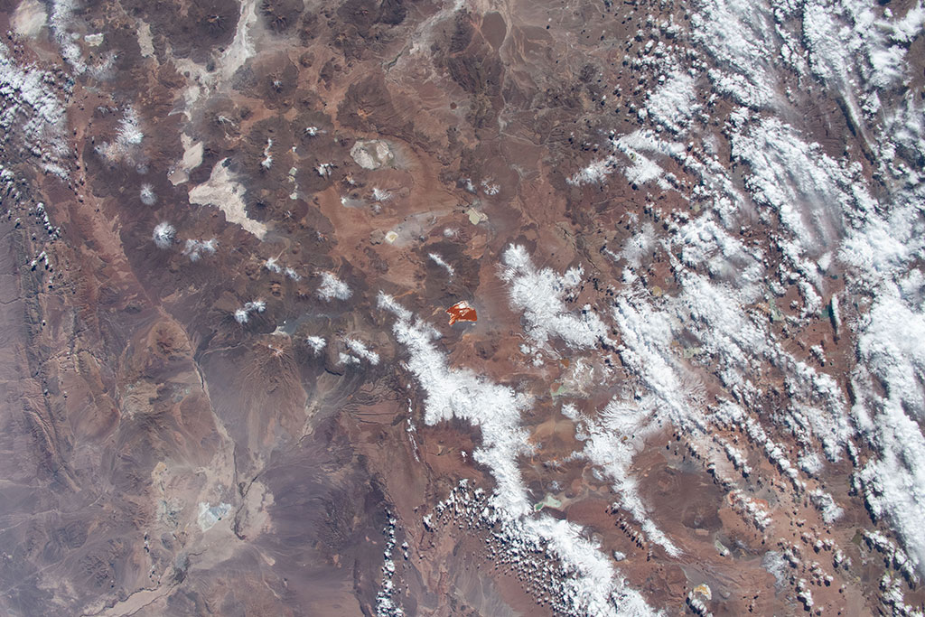
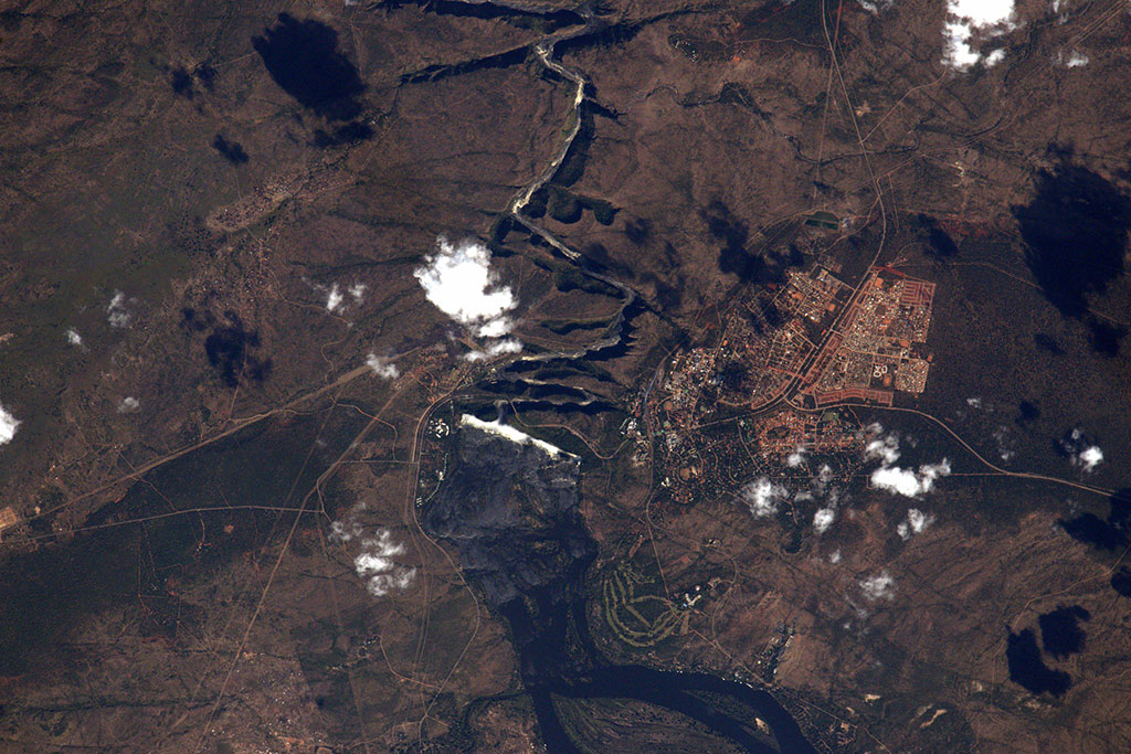
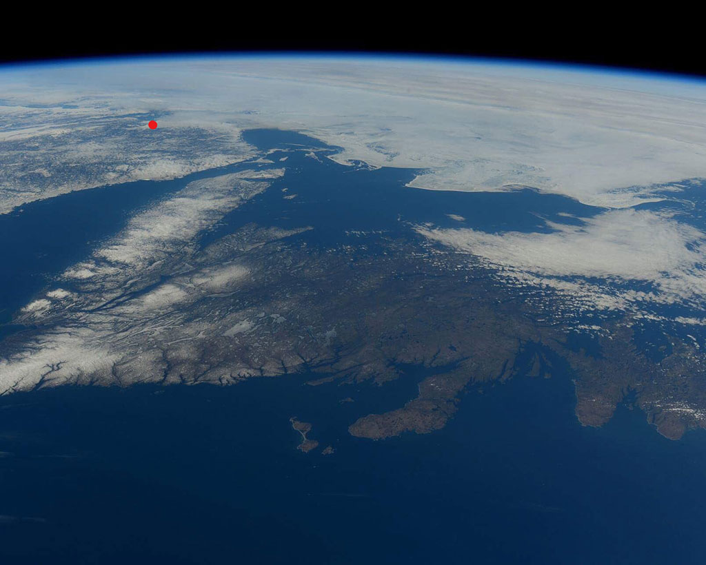
Preserving Canada's landscapes
Canada has one of the oldest and largest national parks systems in the world. Gwaii Haanas National Park Reserve, National Marine Conservation Area and Haida Heritage Site is located at the southern tip (red dot) of an island 130 km off the coast of British Columbia, which faintly appears in this photo of Canada's west coast taken by David Saint-Jacques from the International Space Station. It is also a UNESCO World Heritage site and a National Historic site of Canada. (Credit: Canadian Space Agency/NASA)
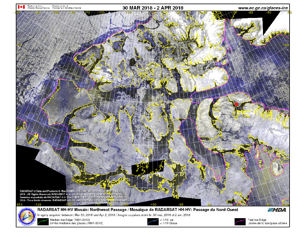
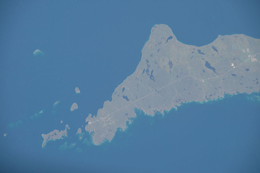
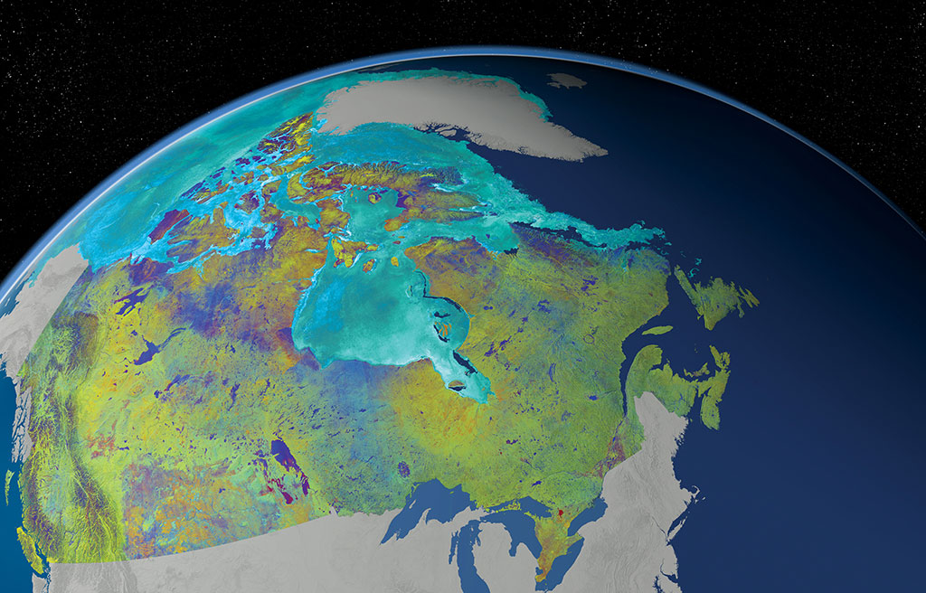
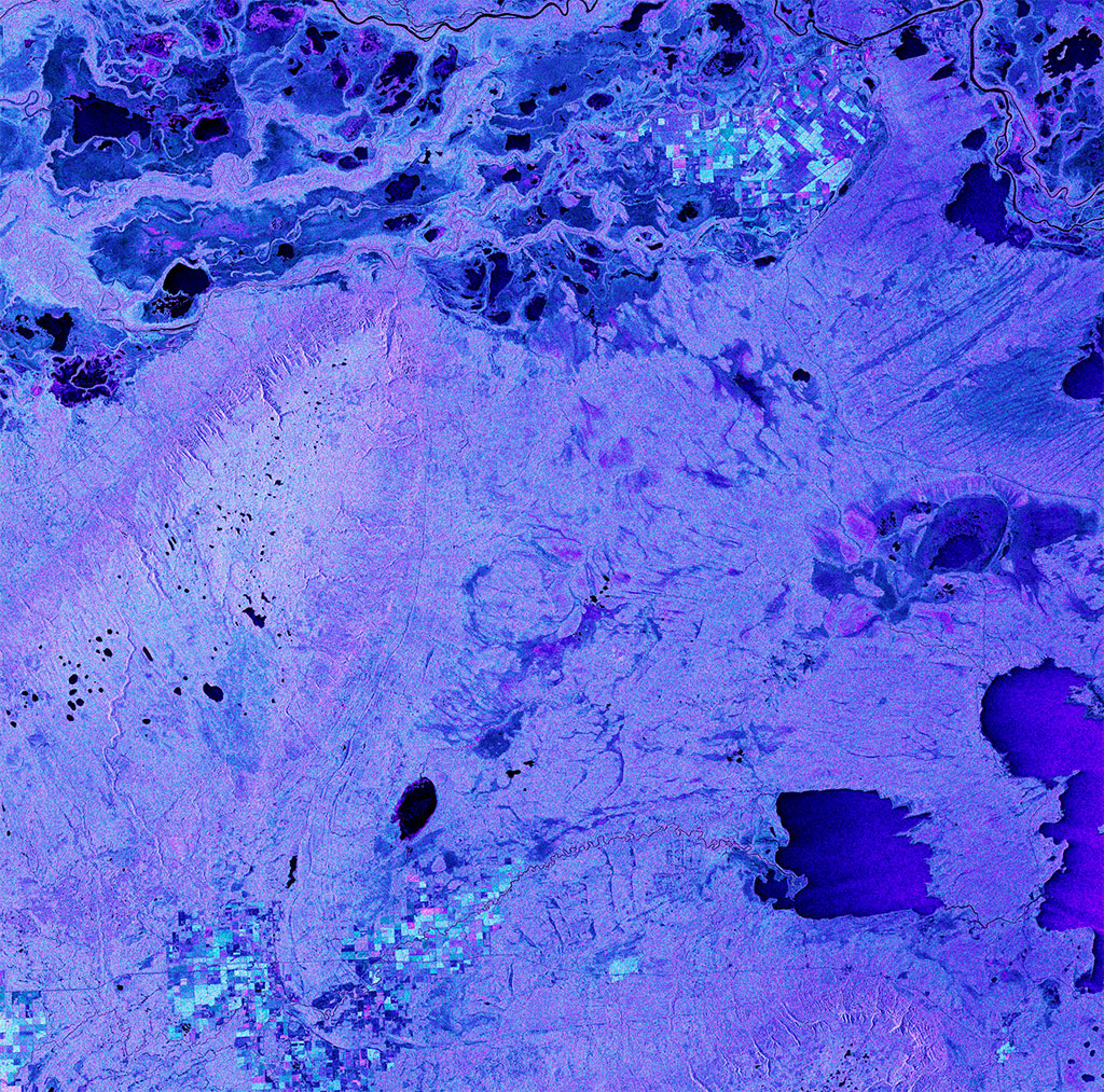
Relic glacier forms - ancient beauties
There are 13 national parks in the Canadian Arctic. Sirmilik National Park (red dot), in northern Baffin Island, Nunavut, is filled with leftovers from past glacial activity. This mosaic of the Arctic is made of images captured by Canada's RADARSAT-2 satellite between March 30 and April 2, 2018. (Credit: Canadian Ice Service)
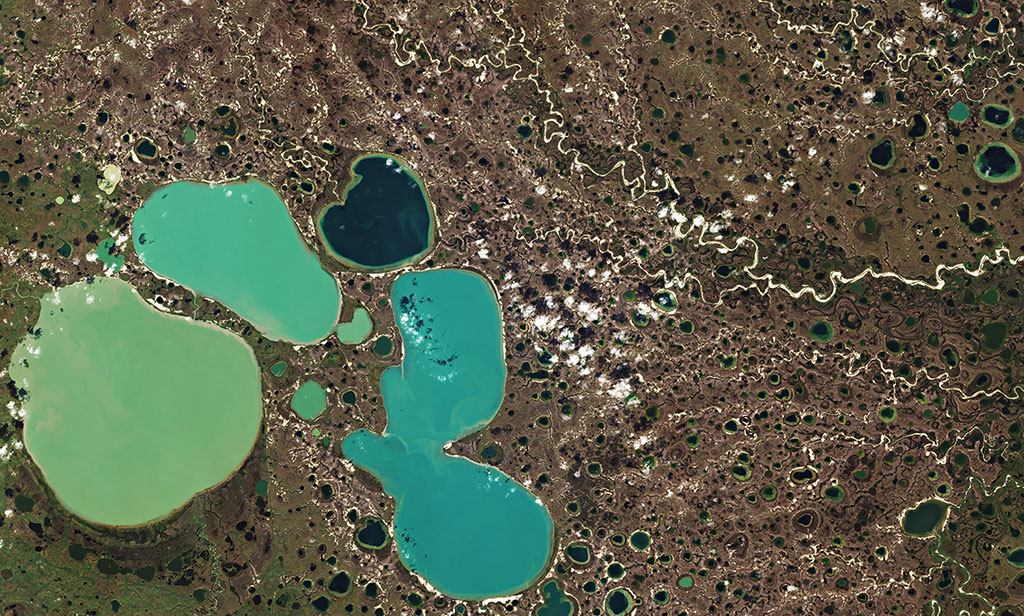
The danger of thawing permafrost
Ponds resulting from thawing permafrost in the Yamal Peninsula in Siberia captured by the Copernicus Sentinel-2 mission. (Credit: European Space Agency)
Sinkholes - stay back!
The Great Blue Hole is a giant marine sinkhole off the coast of Belize. It is roughly 300 meters across and 125 meters deep. A popular diving site, the sinkhole appears at the center of the image. (Credit: NASA image created by Jesse Allen, using EO-1 ALI data provided courtesy of the NASA EO-1 Team.)
Tundras, the treeless forests
The West Siberian Plain is one of the largest flatland areas in the world. It encompasses multiple biomes, including tundra. (Credit: NASA Landsat)
Boreal forest - the spruce-moose biome!
The boreal forest can be found in Akami-Uapishkᵁ-KakKasuak-Mealy Mountains National Park Reserve located in Labrador. This photo was taken from the International Space Station. (Credit: NASA)
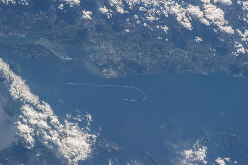
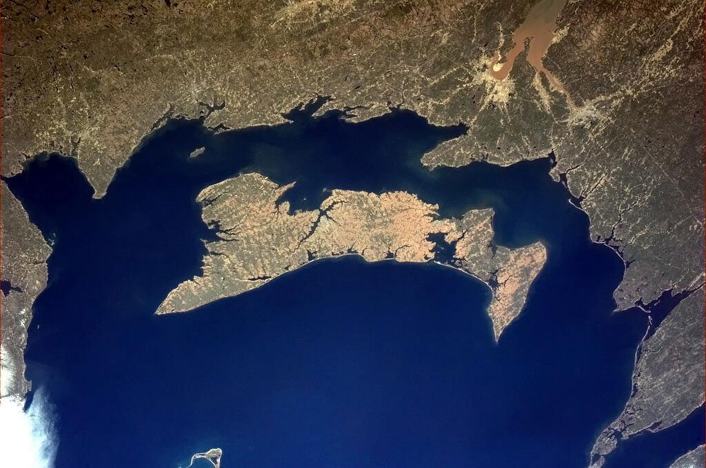
Protecting Canada's underwater world
Fathom Five National Marine Park is in the Georgian Bay part of Lake Huron. This photo was taken from the International Space Station by David Saint-Jacques. (Credit: Canadian Space Agency/NASA)
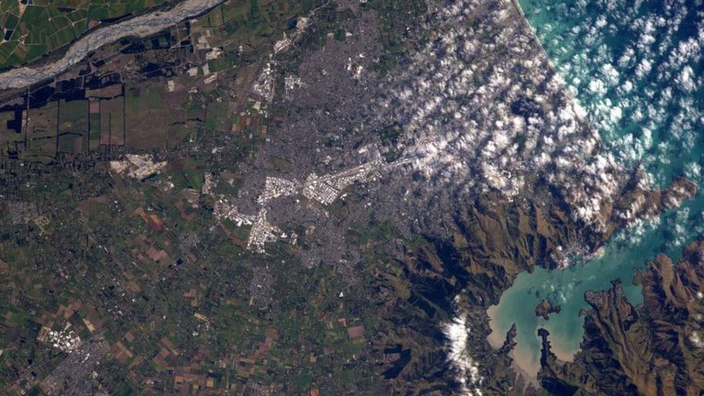
Temperate rainforests: bring an umbrella!
Temperate rainforests can be found in oceanic moist regions like New Zealand. This photo was taken from the International Space Station by David Saint-Jacques. (Credit: Canadian Space Agency/NASA)
Boreal peatlands help keep the Earth cool
Peatlands are found in at least 175 countries around the globe. While they are pretty rare in Australia, the largest peatland of the country is the Wingecarribee Swamp (centre left), about 140 km southwest of Sydney. This photo was captured by David Saint-Jacques aboard the International Space Station. (Credit: Canadian Space Agency/NASA)
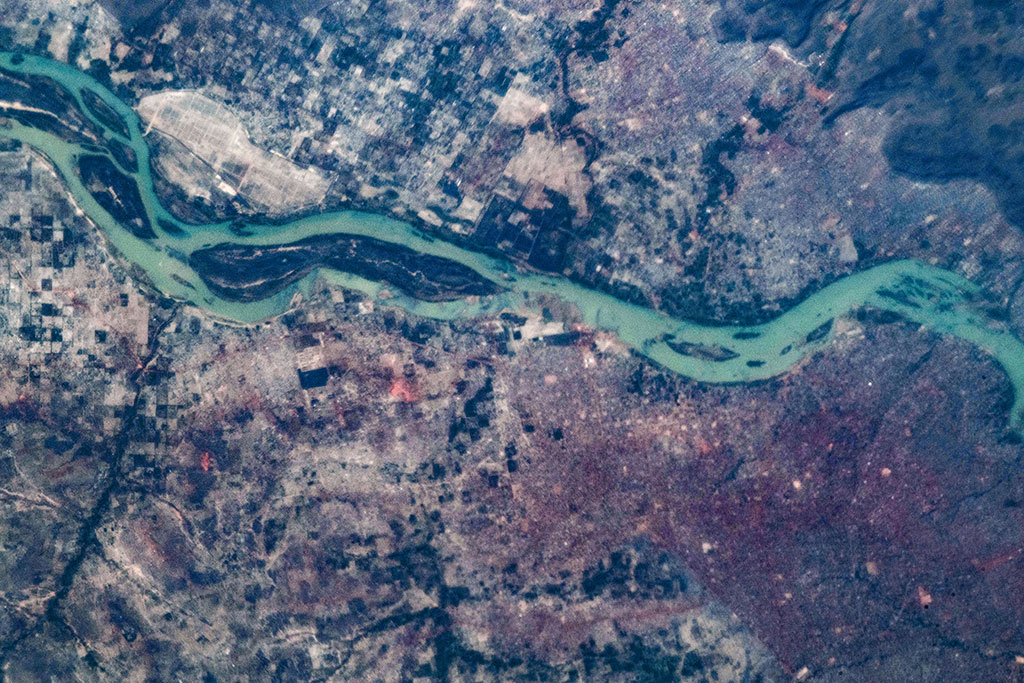
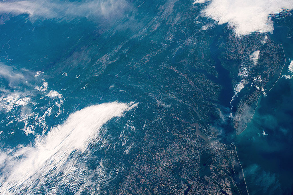
Oil under the ocean—and on it
The sun's glint reflects off the Gulf of Mexico and outlines the coasts of Texas and Louisiana. This photo was taken by an astronaut during David Saint-Jacques' mission to the International Space Station. (Credit: NASA)
Grassy ecosystems
The Pontic–Caspian steppe is a vast temperate grassland stretching from the northern shores of the Black Sea (top half) and Ukraine (top right) to Kazakhstan. This photo was captured by David Saint-Jacques aboard the International Space Station. (Credit: Canadian Space Agency/NASA)