
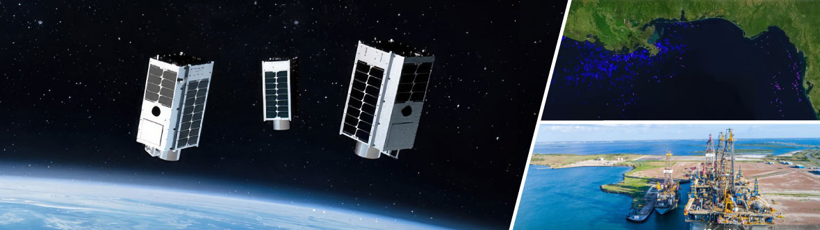
Satellite solution: detecting methane emissions offshore
Methane emissions pose a significant threat to our planet's climate, particularly those originating from offshore sources like oil and gas platforms. Innovative Canadian companies are using satellite data to tackle this challenge. By detecting and monitoring methane leaks from space, these efforts represent a promising step towards environmental protection and mitigating climate change.
The challenge
The greenhouse effect is a well-known phenomenon: sunlight is shining through the glass panels of a greenhouse and the heat is trapped because it cannot radiate through the glass into the cool outdoors, resulting in rising temperature. Likewise, Earth's atmosphere is a natural layer that can maintain favourable conditions for life by retaining solar heat on our planet. However, since the industrial revolution, we have released enormous amounts of harmful gases into the upper atmosphere that now contribute to trapping that heat and cause global warming.
A very strong greenhouse gas is methane; it can trap heat 80 times more effectively than carbon dioxide. The amount of methane has doubled over the past 150 years and continues to increase, mainly because of human activities. Common sources of methane release all over the world include raising cattle, landfills, biomass burning, as well as oil and gas production both on land and at sea.
The project
For several years, the Canadian Space Agency (CSA) has supported the Canadian company GHGSat to develop satellite-based sensors that can detect and precisely locate methane emissions not only in Canada, but around the world as well. The key tool is a small but very capable GHGSat satellite system.
C-CORE, a Newfoundland-based company, has been working with GHGSat since to support advances in GHGSat technology and services. Through a smartEarth funding opportunity, C-CORE developed the Offshore Emissions Monitoring (OEM) project in partnership with GHGSat to address offshore emission challenges using a multiple satellite approach.
The OEM project is ambitious: assemble the world's first satellite-based system capable of identifying methane emissions from offshore platforms using imagery from various freely available satellite missions. The project can provide a worldwide service to identify possible sources of greenhouse gases that require detailed investigation. This tip-and-cue process focus the GHGSat satellites to measure more precise levels of emissions at the platform under investigation. The preliminary trials of the system yielded promising results, demonstrating its capability to deliver precise and comprehensive measurements of methane with high accuracy.
The how
The primary hurdle in developing the satellite-based system was developing glint mode approaches for the freely available missions and the GHGSat satellites. For C-CORE using freely available images, this meant identifying areas in the image that provided glint mode data, and developing the analytics that could detect platforms with methane emissions. This is the tipping part of the operation. C-CORE also added flaring analytics and database mining to highlight platforms at high risk of emitting.
For GHGSat this meant demonstrating the ability to manoeuvre the GHGSat satellites to point at the platforms to acquire data in glint mode and new approaches to derive methane measurements. Methane plumes can best be imaged from space against the backdrop of sun-glint from the ocean (the very bright reflection of water surfaces under specific sun illumination conditions).
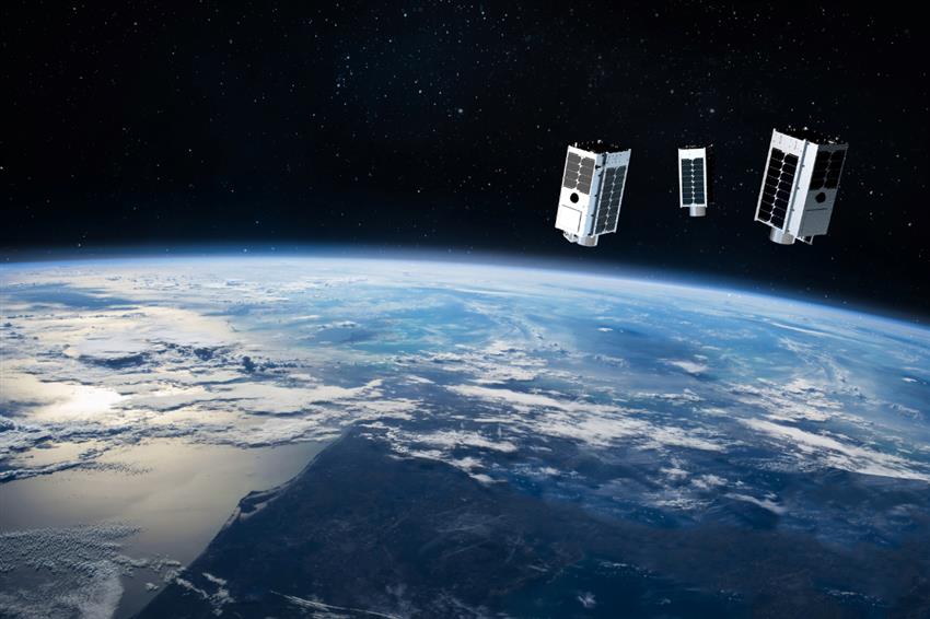
Artistic rendering of the three satellites (Luca, Penny and Diako) from the GHGSat fleet orbiting Earth. (Credit: GHGSat)
Once the locations of these methane plumes had been reliably marked, the cueing part of the operation began. Oil production platform locations that revealed methane emissions then became subject to closer investigation and subject to monitoring efforts. Now the maps of the platform locations were overlaid by GHGSat image maps that contained point-source methane emission measurements.
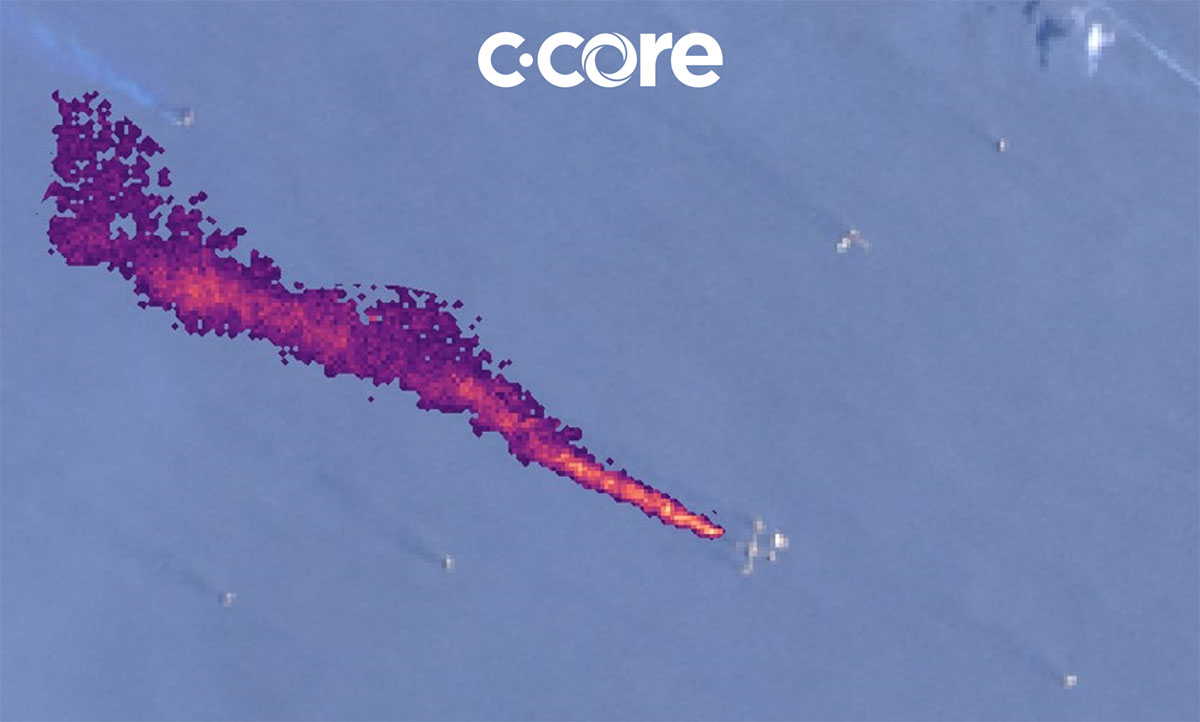
(Dramatic methane plume detected using C-CORE's proprietary algorithms and satellite data from Landsat 9, on with an estimate of over 10,000 kg/hour. Credit: C-CORE)
During the trial phase, the project partners gained valuable experience. Using its patented infrared sensor, GHGSat recorded and fine-tuned the unique signature of controlled methane releases. This validated and quantified the emission measurements. C-CORE developed a method where they used extensive archives of Landsat and Sentinel Earth observation satellite imagery of the Gulf of Mexico to collect evidence of methane plumes from over 1800 offshore platforms in that part of the world. That information was then used to identify platforms with a history of major emissions and to steer GHGSat data collection toward these sites for potential methane release monitoring from space.
Next, the OEM project was put into practice. The platform and plume detection procedures were successfully demonstrated in to finally enable the global monitoring of methane plumes from offshore platforms. Using the orbiting Earth observation satellites and their data streams regularly has decreased the time for pinpointing harmful methane emissions from hours to mere seconds. This opened the doors for operational use and global applications.
With the CSA's support, C-CORE and GHGSat successfully explored and implemented space-based solutions to localizing, measuring, and monitoring offshore emissions of one of the most potent greenhouse gases.
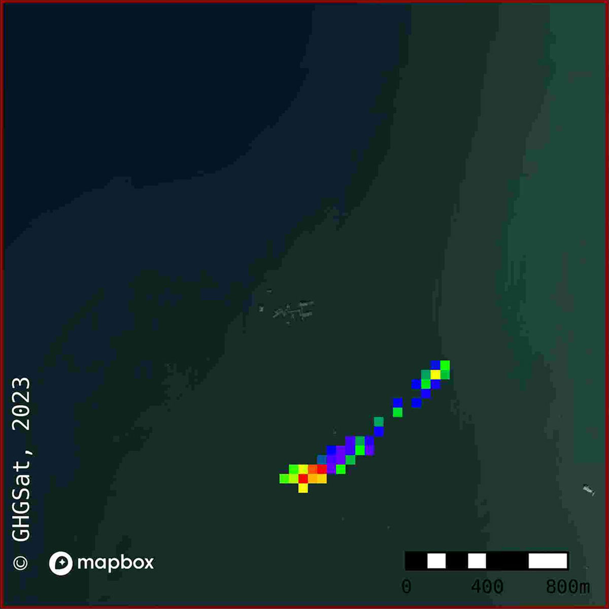
Smallest methane plume ever detected by satellites. It was measured at 182 kg/hour by GHGSat-C3 on . (Credit: C-CORE and GHGSat).
The benefits
The service offered by the OEM project is an excellent example of Canadian ingenuity. It shows that the use of space technology can have far-reaching impacts on detecting and monitoring greenhouse gas sources in remote offshore regions which, in turn, brings significant benefits for Canada:
- Environmental protection: by detecting and pinpointing methane emissions not only within Canada but also globally, the project contributes to environmental protection efforts. Methane being a potent greenhouse gas, mitigating its emissions is crucial for combating climate change.
- Improved monitoring and response: the ability to detect methane emissions over offshore marine areas using satellite-based systems enables more comprehensive monitoring of greenhouse gas sources. This capability allows for more targeted and effective responses to mitigate emissions.
- Technological advancement: Canadian innovation in satellite technology enhances our global reputation and opens doors for economic opportunities.
- Expanded monitoring: the project can broaden space-based monitoring beyond offshore areas, including urban emissions in Canada, for a more comprehensive understanding of methane sources.