
The Arctic Observing Mission: Monitoring the Arctic in new and profound ways
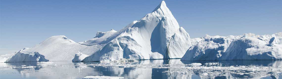
The Arctic is warming at about three times the average rate of other regions on Earth. As a result, the rate of ice and snow melt is increasing, along with other environmental changes. These changes affect ecosystems in the North, like boreal forests, but also the global climate.
Meanwhile, human activities in other areas around the world are contributing to the warming trend in the Arctic. The world needs to know as much as possible about climate shifts going on in the North to inform government decisions regarding climate change.
In collaboration with Environment and Climate Change Canada (ECCC), the Canadian Space Agency (CSA) is leading an international Earth observation mission concept to put two satellites into orbit that could observe the Arctic like never before. The Arctic Observing Mission aims to give scientists a new view of weather and climate patterns. It could deliver major benefits for people living in northern communities, including Indigenous peoples, by increasing safety and quality of life thanks to improved weather and air quality forecasts. It would also provide humanity with valuable information about climate change.
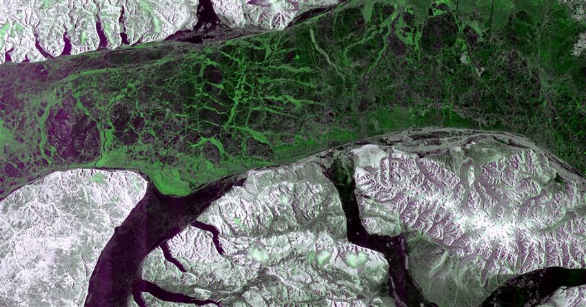
The RCM's one millionth image, acquired on . This image of the Canadian Arctic shows the tip of Borden Peninsula and Brodeur Peninsula, on Baffin Island, as well as Devon Island in Nunavut. (Source : Imagerie de la mission de la Constellation RADARSAT © Gouvernement du Canada []. RADARSAT est une marque officielle de l'Agence spatiale canadienne.)
Four key instruments
CSA and ECCC experts, in collaboration with an industry team, are working on designs for the two spacecraft and instruments and are putting together an overall plan for how the mission would operate. Four key instruments are considered for the satellites:
-
A meteorological imager
This instrument, an advanced baseline imager, aims to give meteorologists better observations over the Arctic in order to improve weather forecasting. For people living in the Arctic and neighbouring regions, this means having more accurate weather data, which is crucial for their safety and well-being.
-
A greenhouse gas imaging Fourier transform spectrometer
This innovative instrument aims to measure the concentration of greenhouse gases such as carbon dioxide and methane, as well as pollutants like carbon monoxide. It would track gases and pollutants in the atmosphere so we can monitor their natural cycles, as well as changes caused by expanding industries in the North, climate impacts on forests and tundra, or the release of carbon dioxide and methane due to permafrost thaw.
-
A dispersive spectrometer for air quality observations
This instrument would observe gases affecting air quality, such as emissions from wildfires and pollution from cities and industry. Today, Canada relies on ground-based instruments to make these observations. Satellite data would improve how air quality is forecasted, providing a major benefit for all and particularly for people whose health is more sensitive to changes in air quality.
-
A collection of space weather instruments (auroral imager, particle sensors and magnetometer)
Space weather refers to the conditions in the area of space close to Earth, especially electromagnetic radiation and charged particles that come from the Sun during solar flares. These instruments aim to improve space weather forecasting in order to better protect satellites and other ground-based infrastructures.
Monitoring the permafrost
Permafrost is one major example of a feature in Arctic ecosystems that we need to study closely. Thawing permafrost could be a major threat facing humanity. Permafrost stores nearly twice as much carbon as Earth's atmosphere. As it thaws, it releases carbon dioxide and methane to the atmosphere, which causes temperatures to rise further and melt the permafrost even more quickly.
The Arctic Observing Mission would help scientists monitor the permafrost so researchers and policy makers can make decisions based on the highest-quality data. As an Arctic country, Canada has a responsibility to focus on missions in this region.
The world's most detailed view of the Arctic
The Arctic Observing Mission would be a game changer: it could provide data about the atmosphere and situation on the ground in the Arctic in more detail (spatial resolution) and more frequently (temporal resolution) than existing satellites can.
Currently, low Earth orbit satellites are able to see the Arctic, so they have good spatial resolution. However, their orbits prevent them from reporting on atmosphere and surface details as frequently as the Arctic Observing Mission would. Geostationary satellites currently orbiting Earth's equator are able to provide continuous observation – which means they have good temporal resolution – but they cannot see above the 60 degrees North latitude.
The Arctic Observing Mission concept addresses the spatial/temporal gap by passing directly over the Arctic in a highly elliptical orbit. This type of orbit would enable the satellites to spend most of their time over the Arctic making detailed observations.
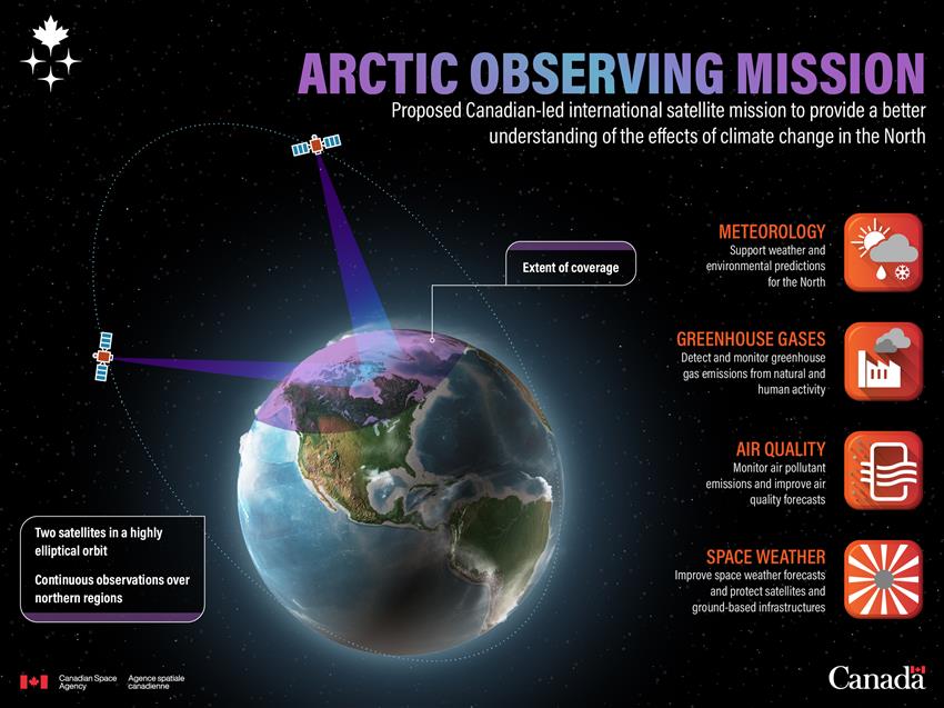
Text version of infographic entitled "Arctic Observing Mission"
Infographic entitled "Arctic Observing Mission". (Credit: CSA.)
International partnerships
As experts at the CSA and ECCC continue to develop plans for the Arctic Observing Mission, they are working with potential international partners in the United States and Europe to determine how these potential partners might contribute to the mission. The CSA is working toward a launch date in the mid-2030s.