
Protecting Canada's caribou by satellite
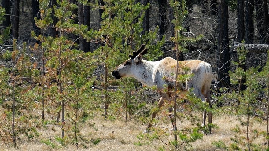
A Boreal caribou near Kearl Lake, Alberta. (Credit: Hatfield Consultants )
Whether roaming the taiga forests of Hudson Bay's coasts, foraging in Canada's boreal forests, or gracing the 25-cent coin in your pocket, the majestic caribou is an iconic symbol of Canada's rich and diverse biodiversity. It is perhaps not a symbol that will stand the test of time, though: the Woodland caribou, the largest of several subspecies in Canada, has been declared a threatened species.
Also known as boreal caribou (Rangifer tarandus caribou), Woodland Caribou are forest-dwellers, living alone or in small groups. Since they do not migrate long distances with the change of the seasons, in order to thrive, they need large areas of habitat rich in mature to old-growth coniferous forest, lichens, muskegs, swamps, peat lands, and upland or hilly areas.
These habitats are changing. Climate change and human activities (such has forest harvesting, oil and gas exploration and extraction and the building of roads) are taking their toll. As a result, Woodland caribou populations have declined in the last few decades.
Monitoring caribou habitats is critical to support their recovery, and one of the most efficient and accurate ways to do so is with the help of satellites.
In , the Government of Canada published a recovery strategy for the boreal caribou which aims to achieve self-sustaining local populations in all 51 boreal caribou ranges throughout Canada. This goal would maintain sufficient population levels and sustain traditional indigenous harvesting activities consistent with existing treaty rights.
The satellite solution
Hatfield, a Vancouver-based environmental company, uses satellite data and deep learning algorithms to identify changes in the habitat of Woodland Caribou in northern Canada, which provides critical information to help better protect them.
Deep learning is a specific type of artificial intelligence (AI) or machine learning, in which computers analyze patterns in a similar way to the human brain. Hatfield is using this cutting-edge technology to detect and classify so-called "linear disturbances" in caribou habitat (roads, for example), which are among the hardest changes in caribous habitats to map accurately. Linear disturbances are a particular threat to boreal caribou. Trees in narrow roads take much longer to regenerate than in wide-area of clear-cut forest. These changes to the forest also make caribou more visible to predators.
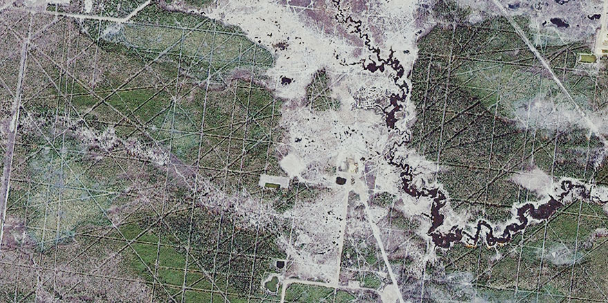
The satellite image on the left shows a boreal forest in Alberta. Forest operations require access roads (the white lines). They can have a negative impact boreal on caribou's habitat. (Credit: SPOT 6/7 image, Airbus, )
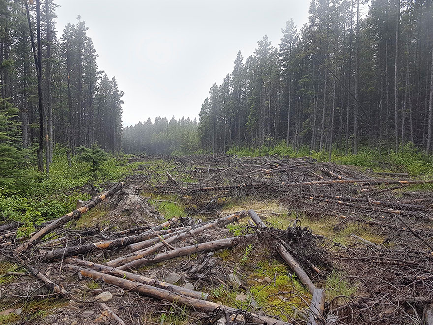
The photo on the right is a close-up of the same boreal forest, showing in detail the changes in caribou habitats due to deforestation. (Credit: Marc Steynen, SERNbc, )
With funding from the Canadian Space Agency's smartEarth initiative, Hatfield's work will help develop maps of caribou habitats more frequently and easily, and help conservation efforts. Using satellite images to observe caribou habitats reduces costs for conservation managers, since they can monitor these areas without having to travel to the site. Microsoft Canada has also invested in this pioneering project. Through an AI for Earth grant, they are providing additional funds to process the massive amounts of data generated by satellites.
"The results of this research would enable government and other organizations to strategically identify areas that need immediate restoration within the context of habitat recovery for boreal caribou. Obtaining this information based on Earth observation satellite technology will help improve efficacy and efficiency and to target high priority sites."