
Enhancing safety on Earth
Warning us of impending natural disasters
Satellites help save lives by gathering data that can be used to predict natural disasters such as hurricanes. This information helps people on the ground by giving them time to prepare or evacuate while enabling the quick deployment of adequate rescue teams.
Supporting emergency relief efforts
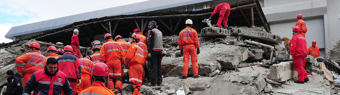
Canada is a co-founder and active member of the International Charter "Space and Major Disasters," an international effort to put space technology at the service of emergency responders in the event of floods, hurricanes, earthquakes, wildfires, tsunamis, volcano eruptions and other disasters.
Since , the Charter's members have made satellite images of devastated regions available to support relief efforts. With reliable information, response teams are better equipped to save lives and limit damage to property, infrastructure and the environment.
Helping search and rescue teams find people in distress
When aircraft, ships or backcountry hikers in distress activate emergency beacons, satellites are used to detect and locate the signals through the International Cospas-Sarsat Programme. Between and , an average of six people per day were rescued by teams using this system.
Measuring ground movements to make infrastructures safer
Some threats are difficult to anticipate, such as ground movements, subsidence and landslides. Satellite-imaging technology provided by RADARSAT-2, and increasingly the RADARSAT Constellation Mission, can help protect critical infrastructure like roads, airports and bridges by detecting and monitoring ground movements that could be as small as a few millimetres. This is particularly useful for the energy sector to assess risks and take action in order to reduce stress on pipelines before they are compromised.
Making buildings and bridges earthquake resistant with shock absorbers
Spacecraft and launch pad equipment undergo extreme stress due to vibration during rocket launches. To make sure that they remain functional in space, shock absorption technology was designed to protect the spacecraft.
During earthquakes, buildings and bridges undergo similar stress. That is why the same shock absorption technology used for spacecraft is now used to strengthen buildings and bridges in earthquake-prone regions.
Learning more about asteroids
Canada has scientists who aim to better understand asteroids, which are small rocky or metallic bodies that orbit the Sun. One rich source of data is Canada's NEOSSat, a satellite that sweeps the skies to detect and track asteroids that may someday pass close to Earth. Another excellent source of information is OSIRIS-REx, an asteroid sample-return mission equipped with a Canadian laser system. The system was instrumental in producing high-resolution 3D maps of near-Earth asteroid Bennu, and those maps proved crucial for mission scientists as they selected a final sample site.
Protecting firefighters with heat-resistant suits
Polymer textiles designed to insulate and protect astronauts in the extreme temperatures of space and during re-entry into the atmosphere have been readapted for Earth as well. These heat-resistant fabrics are now used to protect firefighters from flames and extreme heat.