
Monitoring and protecting our ecosystems from space

A deer in Jasper, Alberta. (Credit: Edward Koorey)
Using satellites, we can monitor changes and promote the responsible use of land and natural resources to protect our ecosystems. Earth's ecosystems are essential to life as we know it, contributing to some of our most basic needs like water, food and clean air.
Satellites are also useful for understanding and protecting Canadian biodiversity. For example, remote sensing techniques provide important data on wildlife and habitats, and Global Positioning System (GPS) devices can be used to track different species.
New
Learn how satellite data is used in environmental monitoring in this report on the socio-economic benefits of space utilization.
From space, we observe Earth’s beauty, but also the changes that take place there. Satellites orbiting our planet help us better understand it in order to better protect it. (Credit: Canadian Space Agency)
Which satellites provide data that can be used to protect and monitor ecosystems?
- RADARSAT Constellation Mission and RADARSAT-2: To facilitate marine surveillance, environmental monitoring, ice monitoring, disaster management, resource management and mapping in Canada and around the world.
- SMOS: To map sea surface salinity, monitor soil moisture on a global scale, better understand the water cycle, and map snow- and ice-covered areas.
- SWOT (in development): To observe ocean surfaces and measure how lakes, rivers, reservoirs and oceans are changing over time.
Why use satellites to monitor and protect ecosystems?
Monitoring forests

Satellites help monitor the health of our forests.
Canada has 347 million hectares of forest land, accounting for 9% of the global forest cover and for 40% of the world's sustainably managed forests, according to Key facts about Canada's forests from Natural Resources Canada. Remote sensing technologies have long been used by Canadian Forest Service (CFS) scientists to gather a variety of forest information as well as map disturbances such as wildfire burn areas and help estimate wood stocks.
Today, the CFS works with the Canadian Space Agency (CSA) and other partners to develop ways to use satellite and airborne data to map and classify Canada's forests and to monitor their health, structure, biomass and natural disturbances. Images produced with data from Earth observation satellites allow us to see changes that have occurred in a given area, helping to identify harvested areas and to determine major changes in forest density.
RADARSAT satellites
What are they used for?
Capable of monitoring in any weather, day or night and through clouds, smoke and haze, RADARSAT-2 can detect change over time, map biomass and uncover damage from forest fires, both current and from the last 80 years. The CFS also uses RADARSAT-2 data for vegetation-related mapping.
The RADARSAT Constellation Mission (RCM), launched in , adds a new series of applications that come as the result of the constellation model. RCM data enables scientists to detect harvesting and monitor forest regeneration, as well as to optimize forest management in order to preserve biodiversity and resource supply and ensure sustainable development. It also allows for more accurate assessment of various forest features. The Government of Canada is gradually switching over from RADARSAT-2 data to RCM data.
BioSpace: Biodiversity monitoring with Earth observation data
BioSpace is a joint project of the CFS and the CSA. It uses satellite technology to collect data on biodiversity and track its changes on a national scale. Capable of scanning very large areas, the technology opens up many remote and previously inaccessible regions. BioSpace permits scientists to study many species at the same time without the need to travel to multiple locations, making monitoring more affordable. Researchers can also pinpoint the areas where the most critical changes are taking place, and can focus their on-site research accordingly. By observing landscape indicators over time and across Canada, BioSpace acts as a kind of national early warning system, highlighting where the biggest threats to biodiversity are and where interventions should be focused.

Using satellite imagery, Agriculture and Agri-Food Canada produces a yearly crop inventory that can help farmers plan better.
Not just forests, but mines and agriculture
Natural Resources Canada uses satellite imagery along with ground validation data to map, monitor and characterize Canada's landmass and ecosystems in support of responsible development of natural resources, such as mineral exploitation.
Radar technology is also currently used in the agriculture sector to monitor crop growth and determine favourable conditions for maximum yields. Agriculture and Agri-Food Canada (AAFC) carries out Earth observation (EO) activities to help understand the extent, health and diversity of Canada's agricultural landscape, how the landscape is changing with respect to agricultural production, and the state of Canadian agricultural production from pre-planning conditions through to post-harvest conditions. For example, AAFC produces a yearly crop inventory (digital maps) for all of Canada using RADARSAT-2 and RCM data, combined with other data sources such as optical images from Landsat 8, ground-truth information provided by provincial crop insurance companies, and point observations from the British Columbia Ministry of Agriculture and regional AAFC colleagues.
Keeping an eye on protected areas and wildlife habitats

Satellite data helps conserve natural habitats of wildlife species. (Credit: Ryan Hagerty)
Ecosystem monitoring from space helps government agencies, such as Parks Canada, better manage protected areas, plan bird conservation areas and map vital habitats for wildlife species at risk.
Helping monitor Canada's changing environment
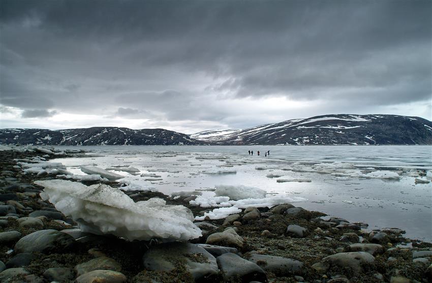
As a Resource Management Officer for Parks Canada, Brian Koonoo travels extensively to the northern tundra to compile information about the changing environment. Remaining abreast of weather conditions is a key challenge to working in this potentially hazardous region where temperatures and conditions can quickly change. Koonoo uses RADARSAT data to help identify the dangerous parts of the tundra and permafrost areas and what the best routes might be. RADARSAT data is an increasingly important part of that process, as climate change has made traditional knowledge of the Arctic icescape less reliable. Read Brian's full story.
RADARSAT satellites
What are they used for?
Parks Canada uses RADARSAT-2 data, and is gradually transitioning to RCM data, to fulfill its mandate related to the conservation of natural and cultural resources of Canadian heritage sites under its purview. EO data is used for tracking the state and health of our national parks.
RCM data allows Parks Canada to monitor changes in land use in and on the periphery of national parks. At the same time, RCM data is used to keep watch on the fragmentation of landscapes that may have an impact on the integrity of wildlife habitats and to track vegetation cover and related changes. This leads not only to preserved biodiversity, but also to better decision making in support of ecosystem conservation-related research, management and compliance programs.

Ocean noise from maritime traffic makes it difficult for maritime mammals, such as beluga whales, to communicate. (Credit: Yuan Yue)
Space-based solutions to help whales
Protecting the North Atlantic right whale
The North Atlantic right whale (NARW) is an endangered species. They can get entangled in fishing gear and get hit by vessels.
Under the smartWhales initiative, five companies are advancing innovative solutions, using satellite data, to help detect and monitor the presence of NARWs in Canadian waters and predict their movements.
Solutions such as these have the potential to help shape a better future for NARWs.
Reducing the effect of ship noise on marine life
Studies have shown that ocean noise from maritime traffic makes it increasingly challenging for maritime mammals, such as right whales, to communicate. In , the CSA funded a project by JASCO Applied Sciences aimed at developing an innovative solution for this global problem. JASCO proposed a space-based solution combining Satellite-Automatic Identification System (S-AIS) data with proven acoustic broadcast and ship noise models.
For navigation safety, ships of certain sizes and weights are required to be equipped with AIS, whose signals can be detected by satellites, including M3MSat and soon the RCM, providing near-real-time data on the vessels' locations. JASCO developed a modelling tool integrating data from S-AIS, along with meteorological and water depth data. The study, conducted in the area around the Saguenay–St. Lawrence Marine Park, a vital habitat for beluga whales, demonstrated the possibility of performing real-time management of marine traffic to reduce the effects of ship noise on marine life.
Classifying and conserving wetlands

Wetlands have been recognized as especially valuable areas and are the only ecosystem designated for conservation by an international convention, according to Water sources: wetlands from Environment and Climate Change Canada.
Submerged or saturated with water, wetlands cover about 14% of Canada's land area and are characterized by plants adapted to wet soil conditions. There are different types of wetlands, from fresh and salt water marshes to wooded swamps, bogs, peatlands and seasonally flooded forests. Wetlands have many benefits, including absorbing the impact of large waves or floods; filtering residues and toxic elements; supplying food and vital habitat for many species of wildlife; and providing us with sources of food, energy and building materials.
Considered wasteland in the past, many wetlands have been drained or filled in. Recently, however, the government has recognized their value and made efforts to protect them. In order to conserve and carefully use resources available in wetlands, it is necessary to map and classify them. The Canadian Wetland Inventory, established in 2002 by Ducks Unlimited Canada, Environment and Climate Change Canada (ECCC), the CSA and the North American Wetlands Conservation Council, relies on a combination of satellite imagery and aerial photography.
Peatlands is a unique class of wetlands. They have many valuable functions, such as storing carbon, providing habitat for several wildlife species, lessening the impact of floods and droughts, and collecting and purifying water. Canada holds close to 25% of the world's peatlands. When drained, peatlands turn into net sources of greenhouse gases (GHGs). In recent years, peatland management and the impact of climate change on them have become a concern. To sustainably manage and conserve peatlands, an up-to-date peatland inventory is necessary, enabling tracking of peatland loss and estimation of GHG emissions.
RADARSAT satellites
What are they used for?
For many years, optical satellites have been used to map wetlands. However, they can only acquire images in daylight and can be hindered by cloud cover and haze. Additionally, optical sensors cannot get through vegetation cover, which often makes it difficult to differentiate one wetland type from another. Due to those limitations, many remote sensing scientists have begun combining optical and radar satellite data to classify wetlands. Radar systems can penetrate vegetation cover to some degree as well as provide information on such conditions as soil moisture, helping classify different types of wetlands.
RADARSAT-2 data has been successfully used to help map wetlands. Recent research conducted by scientists at ECCC demonstrates the potential for RCM data to be used in combination with optical satellite imagery to classify peatlands. In the future, there is also potential to use the RCM for mapping seasonal changes in wetlands.
Mapping Canada's coasts and monitoring them for changes and pollution

The coast in Peggy's Cove, Nova Scotia.
Canada has the longest coastline in the world, measuring 243,042 km on three oceans – Atlantic, Arctic and Pacific. The coasts' unique biodiversity and resources contribute to Canada as a whole. Set between the ocean and the land, coastlines are continually changing as a result of climate change, natural processes and human activities.
Mapping the coasts and detecting changes in them is crucial for safe maritime navigation, coastal environmental protection, sustainable resource management, and coastal development and planning. Coastline changes may have a fundamental effect on the environment of the coastal zone. Government agencies, such as ECCC and the Department of Fisheries and Oceans (DFO), use satellite data to monitor coastal erosion, offshore pollution, urbanization and a resulting loss of natural habitat.

EO satellite data is used to detect oil pollution in Canadian waters.
RADARSAT satellites
What are they used for?
Since RADARSAT data is readily available in near real time, it is one of the best sources of information to use for coastal monitoring. DFO currently uses RADARSAT-2 data and is gradually transitioning to RCM data for research purposes and to support coastal mapping, improving safety in navigation of Canadian waters.
ECCC is planning to use RCM data to assess impacts of both climate change and human activities, particularly the construction of wharves and sediment removal, on coastlines.
Enabled by CSA funding in the early 2000s, the Integrated Satellite Tracking of Pollution (ISTOP) Program, operated by ECCC together with Transport Canada, uses RADARSAT-2 data and is transitioning to RCM data to detect and report on illegal and accidental oil pollution in Canadian waters. This is part of an ongoing effort to minimize or eliminate coastal water pollution, which adversely affects marine birds, mammals and the ecosystems in which they live.
Using RADARSAT-2 and RCM data, the Canadian Ice Service, part of ECCC, produces ice charts for clients such as the Canadian Coast Guard, which in turn distributes ice routing recommendations to mariners.
Arctic shoreline information on tides, coastal changes and access derived from satellite imagery is used by the environmental agencies as well as industry and northern community groups for on-site response and preparedness.
Our satellites at your service
- Wildfire burn scars mapped by satellites
- Can space technology help reduce chronic stress experienced by whales?
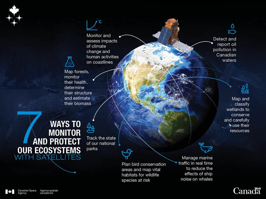
Text version 7 ways to monitor and protect our ecosystems with satellites
Credit: Canadian Space Agency
Explore further
- Agriculture in the satellite age
- Using satellites to protect and navigate Canada's waters
- Taking action on climate change
- Date modified: